Atm nearby صراف البلاد
Saudi Arabia
Atm nearby صراف البلاد
صراف البلاد
السعادة،، As Saadah, Riyadh 14258, Saudi Arabia
contacts phone
:
+966
Latitude:
24.6974164
, Longitude:
46.8551948
larger map & directions
read more
nearest Atm
69 m
مصرف الراجحي
طريق جاكرتا، حي السعادة، الرياض
Atm
read more
69 m
صراف الراجحي
طريق جاكرتا، حي السعادة، الرياض
Atm
read more
109 m
مصرف الراجحي
شارع جاكرتا، حي السعادة، الرياض
Atm
read more
145 m
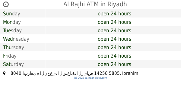
Al Rajhi ATM
8040 ابراهيم النخعي، السعادة، الرياض 14258 5805 Ibrahim An Nakhai, Riyadh
Atm
read more
165 m
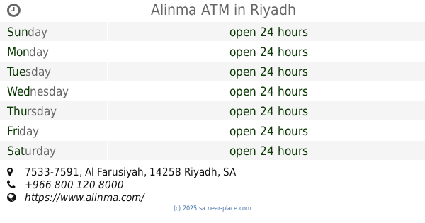
Alinma ATM
5717 Abi Suwaid, Riyadh
Atm
read more
250 m
قروش دالي الامتيازابوزيد
8338-8258 Ibrahim An Nakhai, Riyadh
Atm
read more
268 m
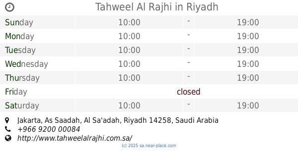
Tahweel Al Rajhi
Jakarta, Al Sa'adah, Riyadh
Atm
read more
338 m
Saadah Gasoline Station
Riyadh
Atm
read more
702 m
العربي
شارع الفروسية، حي السعادة، الرياض
Atm
read more
712 m
Alahli ATM
Al Farusiyah, Riyadh
Atm
read more
734 m
Share Amirsalman
Al Farusiyah, 7586-7562, Riyadh
Atm
read more
763 m
Alinma ATM
7533-7591 Al Farusiyah, Riyadh
Atm
read more
796 m
Al Rajhi ATM
Al Farusiyah, Riyadh
Atm
read more
810 m
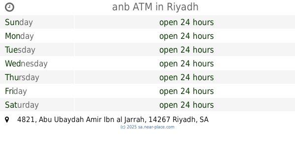
anb ATM
4821 Abu Ubaydah Amir Ibn al Jarrah, Riyadh
Atm
read more
985 m
صراف الاهلي
4533 Abu Ubaydah Amir Ibn al Jarrah, Riyadh
Atm
read more
988 m
الاهلي
4533 Abu Ubaydah Amir Ibn al Jarrah, 9053, Riyadh
Atm
read more
1.144 km
مصرف الراجحي
شارع الكواكب، حي السلي، الرياض
Atm
read more
1.155 km
صراف الراجي ش/العقبه
8083 Al Kawakib, Riyadh
Atm
read more
1.312 km
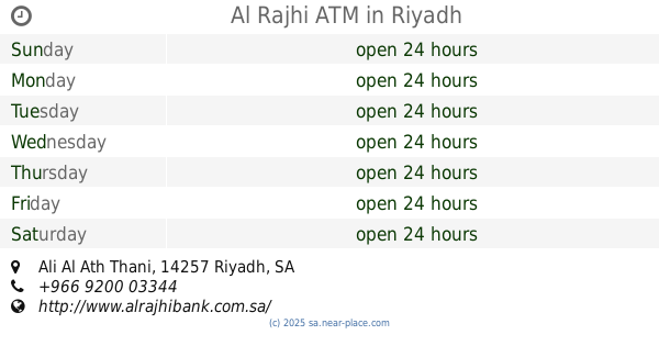
Al Rajhi ATM
Ali Al Ath Thani, Riyadh
Atm
read more
1.435 km
مصرف الراجحي
5042 Abu Ubaydah Amir Ibn al Jarrah, Riyadh
Atm
read more
1.57 km
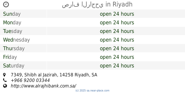
صراف الراجحي
7349 Shibh al Jazirah, Riyadh
Atm
read more
1.596 km
Alinma ATM
4860 Abu Ubaydah Amir Ibn al Jarrah, Riyadh
Atm
read more
1.596 km
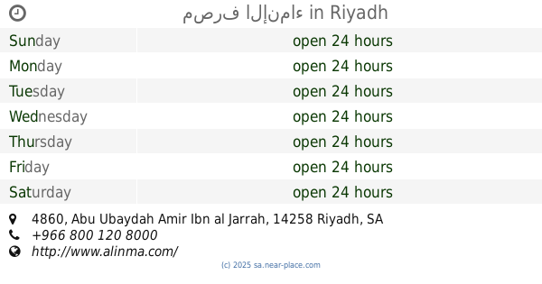
مصرف الإنماء
4860 Abu Ubaydah Amir Ibn al Jarrah, Riyadh
Atm
read more
1.613 km
Arab Bank ATMs
7136 Shibh al Jazirah, Riyadh
Atm
read more
1.676 km
صرافة البلاد
Riyadh
Atm
read more
📑
all categories
Accounting
Administrative area level 1
Airport
Amusement park
Aquarium
Art gallery
Atm
Bakery
Bank
Bar
Beauty salon
Bicycle store
Book store
Bowling alley
Bus station
Cafe
Campground
Car dealer
Car rental
Car repair
Car wash
Casino
Cemetery
Church
City hall
Clothing store
Colloquial area
Convenience store
Country
Courthouse
Dentist
Department store
Doctor
Electrician
Electronics store
Embassy
Finance
Fire station
Florist
Food
Funeral home
Furniture store
Gas station
General contractor
Grocery or supermarket
Gym
Hair care
Hardware store
Health
Hindu Temple
Home goods store
Hospital
Insurance agency
Intersection
Jewelry store
Laundry
Lawyer
Library
Light rail station
Liquor store
Local government office
Locality
Locksmith
Lodging
Meal delivery
Meal takeaway
Mosque
Movie rental
Movie theater
Moving company
Museum
Natural feature
Neighborhood
Night club
Painter
Park
Parking
Pet store
Pharmacy
Physiotherapist
Place of worship
Plumber
Point of interest
Police
Political
Post office
Premise
Real estate agency
Restaurant
Roofing contractor
Route
Rv park, camping
School
Shoe store
Shopping mall
Spa
Stadium
Storage
Store
Sublocality
Subpremise
Subway station
Supermarket
Taxi stand
Train station
Transit station
Travel agency
University
Veterinary care
Zoo
sublocality level 1
↑