Atm nearby صراف البنك الأهلي
Saudi Arabia
Atm nearby صراف البنك الأهلي
صراف البنك الأهلي
255, 62461, Khamis Mushait, SA Arabia Saudyjska
contacts phone
:
+966 12 627 9666
website:
www.alahli.com
Latitude:
18.3022138
, Longitude:
42.7386452
larger map & directions
read more
nearest Atm
37 m
صراف الأهلي
طريق الملك سعود، حي الشرفية، خميس مشيط
Atm
read more
93 m
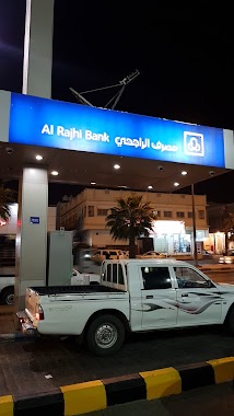
Al Rajhi ATM
King Saud, Khamis Mushait
Atm
read more
93 m
مصرف الراجحي
طريق الملك سعود، حي الشرفية، خميس مشيط
Atm
read more
129 m
بنك الرياض
طريق الملك سعود، حي الشرفية، خميس مشيط
Atm
read more
210 m
صراف ألي
Khamis Mushait
Atm
read more
405 m
العربي
حي الزهور، خميس مشيط
Atm
read more
461 m
العربي
حي العرق الجنوبي، خميس مشيط
Atm
read more
561 m
AlRaby atm
4883 King Fahd Road, Khamis Mushait
Atm
read more
657 m
صراف الانماء - الشرفية
5251 King Fahd Road, Khamis Mushait
Atm
read more
677 m
Al Rajhi ATM
255, Khamis Mushait
Atm
read more
715 m
ATM Ahli Bank
King Fahd Road, Khamis Mushait
Atm
read more
836 m
SABB
KSM Branch CDM, Khamis Mushait
Atm
read more
836 m
SABB
KSM Branch (2, Khamis Mushait
Atm
read more
853 m
AlAhli Bank ATM
8291, 4078, Khamis Mushait
Atm
read more
882 m
د/عبدالله معدي
7771, 5640, Khamis Mushait
Atm
read more
898 m
AL AHALI NCB . ATM
Khamis Mushait
Atm
read more
899 m
الأهلي
حي البلد، خميس مشيط
Atm
read more
927 m
Tahweel Al Rajhi
King Khaled, Dawar Al-Saah, Khamis Mushait
Atm
read more
1.027 km
Riyad ATM
شارع الملك فهد، خميس مشيط
Atm
read more
1.153 km
AlJazira Bank
Imam Muhammad Ibn Saud, Khamis Mushait
Atm
read more
1.156 km
Bank Bilad ATM
7555 South to Ahad Rufaiydah Northern to Khamis Mushayt, Khamis Mushait
Atm
read more
1.166 km
بنك البلاد
طريق الملك خالد، خميش مشيط
Atm
read more
1.238 km
صراف آلي الراجحي
بغداد Bagdad, 8161-, Khamis Mushait
Atm
read more
1.269 km
Al Rajhi Bank
2530 King Fahd Road, 7762, Khamis Mushait
Atm
read more
1.303 km
ATM Ahli Bank district honors
2621 King Fahd Road, Khamis Mushait
Atm
read more
📑
all categories
Accounting
Administrative area level 1
Airport
Amusement park
Aquarium
Art gallery
Atm
Bakery
Bank
Bar
Beauty salon
Bicycle store
Book store
Bowling alley
Bus station
Cafe
Campground
Car dealer
Car rental
Car repair
Car wash
Casino
Cemetery
Church
City hall
Clothing store
Colloquial area
Convenience store
Country
Courthouse
Dentist
Department store
Doctor
Electrician
Electronics store
Embassy
Finance
Fire station
Florist
Food
Funeral home
Furniture store
Gas station
General contractor
Grocery or supermarket
Gym
Hair care
Hardware store
Health
Hindu Temple
Home goods store
Hospital
Insurance agency
Intersection
Jewelry store
Laundry
Lawyer
Library
Light rail station
Liquor store
Local government office
Locality
Locksmith
Lodging
Meal delivery
Meal takeaway
Mosque
Movie rental
Movie theater
Moving company
Museum
Natural feature
Neighborhood
Night club
Painter
Park
Parking
Pet store
Pharmacy
Physiotherapist
Place of worship
Plumber
Point of interest
Police
Political
Post office
Premise
Real estate agency
Restaurant
Roofing contractor
Route
Rv park, camping
School
Shoe store
Shopping mall
Spa
Stadium
Storage
Store
Sublocality
Subpremise
Subway station
Supermarket
Taxi stand
Train station
Transit station
Travel agency
University
Veterinary care
Zoo
sublocality level 1
↑