Atm nearby صراف البنك العربي Arabi
Saudi Arabia
Atm nearby صراف البنك العربي Arabi
صراف البنك العربي Arabi
Qutybah Ibn Muslim Qutybah Ibn Muslim, Riyadh Saudi Arabia
contacts phone
:
+966
Latitude:
24.6051301
, Longitude:
46.7245833
read more
nearest Atm
303 m
صراف الرجحي
7791 Al Fariyan, Riyadh
Atm
read more
378 m
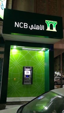
Al Ahli Bank
8254 Al Fariyan Al Yamamah Riyadh 12672 3750 Al Fariyan, Riyadh
Atm
read more
437 m
Al Rajhi
At Tif At Tif, Riyadh
Atm
read more
479 m
صراف الراجحي
شارع ابن خيثمة، حي المنفوحة، الرياض
Atm
read more
536 m
SABB
Bin Dayel Markets, Mini (Aswaq almahrjan, Riyadh
Atm
read more
730 m
صراف الي
الرياض
Atm
read more
736 m
صرافة الإنماء Alinma
Al Kharj
Atm
read more
741 m
صراف الانماء
شارع محمد بن عبدالرحمن، حي منفوحة، الرياض
Atm
read more
786 m
Bank Al Bilad ATM
Al Batha, Al Mansourah Bin Aiaf, Abana, Riyadh
Atm
read more
813 m
Riyad Bank
Halimah As Saadiyyah, Riyadh
Atm
read more
813 m
صراف بنك الرياض
Halimah As Saadiyyah, Riyadh
Atm
read more
839 m
بنك الرياض
شارع محمد بن عبدالرحمن، حي منفوحة، الرياض
Atm
read more
839 m
Riyad Bank
شارع محمد بن عبدالرحمن، حي منفوحة، الرياض
Atm
read more
854 m
صراف بنك
7835 Al Batha, Riyadh
Atm
read more
868 m
Al Rajhi ATM
Islamabad Street, Riyadh
Atm
read more
947 m
Alinma ATM
6904 Abdul Karim Ibn Muiqal, 3461, Riyadh
Atm
read more
951 m
Alinma ATM
Al Batha, Riyadh
Atm
read more
1.078 km
صراف البنك السعودي للاستثمار
Al Batha, Riyadh
Atm
read more
1.095 km
صراف الراجحي
شارع حليمة السعدية - حي المنفوحة الجديدة، الرياض
Atm
read more
1.117 km
SAIB ATM
6799 Al Fariyan, Riyadh
Atm
read more
1.117 km
صراف السعودي للاستثمار
6799 Al Fariyan, Riyadh
Atm
read more
1.133 km
Tahweel Al Rajhi
Manfouha Main, Manfouha, Riyadh
Atm
read more
1.14 km
ATM Bank Al Bilad
3348 Manfuhah, Riyadh
Atm
read more
1.164 km
NCB ATM
3372-3380 Manfuhah, Riyadh
Atm
read more
1.176 km
Al Rajhi ATM
2930 منفوحة، منفوحة الجديدة الرياض 12653 6737 Manfuhah, Riyadh
Atm
read more
📑
all categories
Accounting
Administrative area level 1
Airport
Amusement park
Aquarium
Art gallery
Atm
Bakery
Bank
Bar
Beauty salon
Bicycle store
Book store
Bowling alley
Bus station
Cafe
Campground
Car dealer
Car rental
Car repair
Car wash
Casino
Cemetery
Church
City hall
Clothing store
Colloquial area
Convenience store
Country
Courthouse
Dentist
Department store
Doctor
Electrician
Electronics store
Embassy
Finance
Fire station
Florist
Food
Funeral home
Furniture store
Gas station
General contractor
Grocery or supermarket
Gym
Hair care
Hardware store
Health
Hindu Temple
Home goods store
Hospital
Insurance agency
Intersection
Jewelry store
Laundry
Lawyer
Library
Light rail station
Liquor store
Local government office
Locality
Locksmith
Lodging
Meal delivery
Meal takeaway
Mosque
Movie rental
Movie theater
Moving company
Museum
Natural feature
Neighborhood
Night club
Painter
Park
Parking
Pet store
Pharmacy
Physiotherapist
Place of worship
Plumber
Point of interest
Police
Political
Post office
Premise
Real estate agency
Restaurant
Roofing contractor
Route
Rv park, camping
School
Shoe store
Shopping mall
Spa
Stadium
Storage
Store
Sublocality
Subpremise
Subway station
Supermarket
Taxi stand
Train station
Transit station
Travel agency
University
Veterinary care
Zoo
sublocality level 1
↑