Atm nearby صراف ساب
Coronavirus disease (COVID-19) Situation
confirmed cases
841469
deaths
9646
Saudi Arabia
Atm nearby صراف ساب
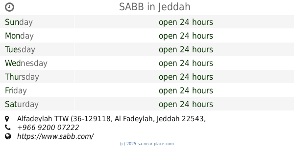
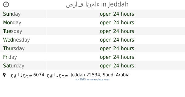
صراف ساب
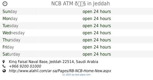
Al Fadeylah, Jeddah 22543, Saudi Arabia
contacts phone
:
+966
website:
www.sabb.com
Latitude:
21.307526
, Longitude:
39.2621474
larger map & directions
read more
nearest Atm
112 m
SABB
Alfadeylah TTW (36-129118, Jeddah
Atm
read more
197 m
صراف الرجحي
جدة
Atm
read more
443 m
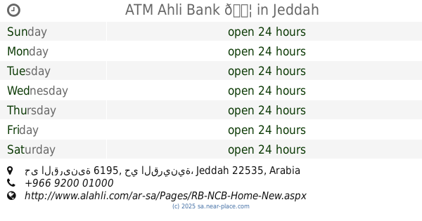
ATM Ahli Bank 🏦
5262, حي القرينية 6195, Jeddah
Atm
read more
1.881 km
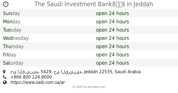
The Saudi Investment Bank🏧
8206, حي القرينية، 5429, Jeddah
Atm
read more
2.04 km
مصرف الراجحي
3569, حي القرينية, Jeddah
Atm
read more
2.046 km
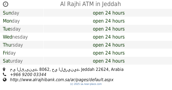
Al Rajhi ATM
3569, حي القرينية، 8062, Jeddah
Atm
read more
2.049 km
صراف الراجحي 1
3569, حي القرينية, Jeddah
Atm
read more
2.049 km
Al Rajhi ATM
3569, حي القرينية, Jeddah
Atm
read more
2.384 km
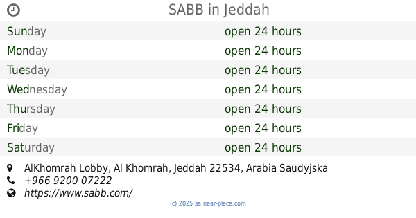
SABB
AlKhomrah Lobby, Jeddah
Atm
read more
2.395 km
صراف انماء
4708, حي الخمرة 6074, Jeddah
Atm
read more
2.51 km
Alinma ATM
Jeddah
Atm
read more
2.524 km
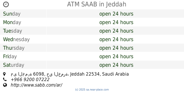
ATM SAAB
4406, حي الخمرة 6098, Jeddah
Atm
read more
3.378 km
صرافة البنك الاهلي
Jeddah
Atm
read more
3.541 km
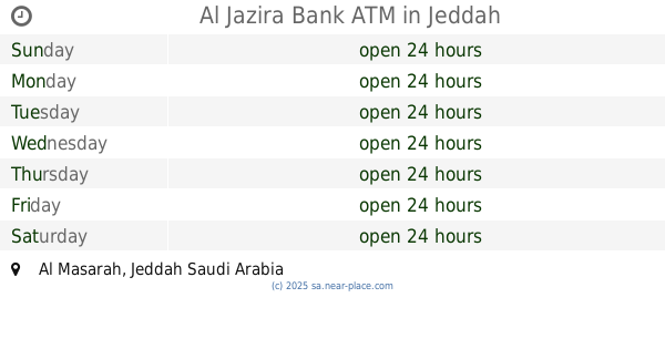
Al Jazira Bank ATM
Jeddah
Atm
read more
5.446 km
Alhamrani Universal - Warehouse
6986, Ad Dahiah District, Jeddah
Atm
read more
7.213 km
AL Riaydh Bank ATM
2204, Ad Dahiah District, Jeddah
Atm
read more
7.852 km
NCB ATM 🏧
Jeddah
Atm
read more
8.702 km
مصرف الانماء
الخمرة، جدة
Atm
read more
8.742 km
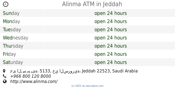
Alinma ATM
6453, حي السرورية، 5133, Jeddah
Atm
read more
9.223 km
Al Rajhi Bank 🏦
2470, Jeddah
Atm
read more
9.409 km
SABB
Altahlawi Lobby, Jeddah
Atm
read more
10.055 km
Al Rajhi ATM
4017, حي الهدى, Jeddah
Atm
read more
10.507 km
Al Rajhi ATM2592
4478, حي الاجاويد،, Jeddah
Atm
read more
10.524 km
صراف الهولندي
Jeddah
Atm
read more
10.575 km
ATM Ahli
Jeddah
Atm
read more
📑
all categories
Accounting
Administrative area level 1
Airport
Amusement park
Aquarium
Art gallery
Atm
Bakery
Bank
Bar
Beauty salon
Bicycle store
Book store
Bowling alley
Bus station
Cafe
Campground
Car dealer
Car rental
Car repair
Car wash
Casino
Cemetery
Church
City hall
Clothing store
Colloquial area
Convenience store
Country
Courthouse
Dentist
Department store
Doctor
Electrician
Electronics store
Embassy
Finance
Fire station
Florist
Food
Funeral home
Furniture store
Gas station
General contractor
Grocery or supermarket
Gym
Hair care
Hardware store
Health
Hindu Temple
Home goods store
Hospital
Insurance agency
Intersection
Jewelry store
Laundry
Lawyer
Library
Light rail station
Liquor store
Local government office
Locality
Locksmith
Lodging
Meal delivery
Meal takeaway
Mosque
Movie rental
Movie theater
Moving company
Museum
Natural feature
Neighborhood
Night club
Painter
Park
Parking
Pet store
Pharmacy
Physiotherapist
Place of worship
Plumber
Point of interest
Police
Political
Post office
Premise
Real estate agency
Restaurant
Roofing contractor
Route
Rv park, camping
School
Shoe store
Shopping mall
Spa
Stadium
Storage
Store
Sublocality
Subpremise
Subway station
Supermarket
Taxi stand
Train station
Transit station
Travel agency
University
Veterinary care
Zoo
sublocality level 1
↑