Atm nearby Tahweel Al Rajhi
Saudi Arabia
Atm nearby Tahweel Al Rajhi
Tahweel Al Rajhi
mmarmar, Alnazim, Riyadh Saudi Arabia
contacts phone
:
+966
Latitude:
24.813457
, Longitude:
46.882396
read more
nearest Atm
76 m
صراف بنك العربي
2719 Al Marmar, Riyadh
Atm
read more
147 m
صراف الراجحي🏧
2582 المرمر، النظيم، الرياض 14814 7521 Al Marmar, Riyadh
Atm
read more
159 m
ATM Alrajeha🏧
2560 Al Marmar, Riyadh
Atm
read more
220 m
Riyad ATM
2471 Al Marmar, Riyadh
Atm
read more
556 m
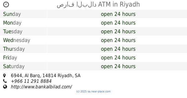
صراف البلاد ATM
6944 Al Barq, Riyadh
Atm
read more
567 m
ساب
شارع المرمر، حي النظيم، الرياض
Atm
read more
613 m
صراف الرياض
2991 Rifaah Ibn Aws, Riyadh
Atm
read more
613 m
Riyad Bank
2991 Rifaah Ibn Aws, Riyadh
Atm
read more
631 m
Al Rajhi Bank ATM
Assaf Ibn Mahya, Riyadh
Atm
read more
648 m
Al Barazi
Unnamed Road, Riyadh
Atm
read more
686 m
Al jazira ATM
2442-2464 المحيط, Riyadh
Atm
read more
697 m
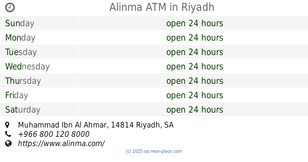
Alinma ATM
Muhammad Ibn Al Ahmar, Riyadh
Atm
read more
711 m
البنك الاول ATM
Riyadh
Atm
read more
753 m
Bank Albilad ATM
Rifaah Ibn Aws, Riyadh
Atm
read more
803 m
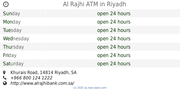
Al Rajhi ATM
Khurais Rd, Riyadh
Atm
read more
803 m
Al Rajhi ATM
Khurais Road, Riyadh
Atm
read more
840 m
Bank Albilad ATM
Al-Enazi Room, Abana, Riyadh
Atm
read more
858 m
SABB
Bayariq altamyez super market (37-269339, Riyadh
Atm
read more
880 m
SABB
Al Torath Riyadh
Atm
read more
881 m
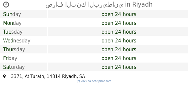
صراف البنك البريطاني
3371 At Turath, Riyadh
Atm
read more
911 m
Riyad ATM
3008 At Turath, Riyadh
Atm
read more
915 m
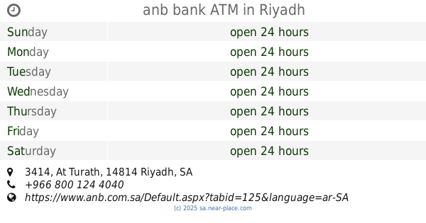
anb bank ATM
3414 At Turath, Riyadh
Atm
read more
979 m
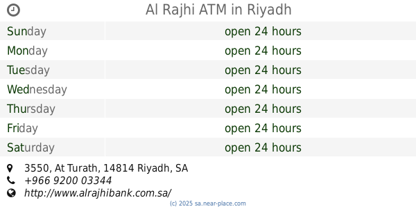
Al Rajhi ATM
3550 At Turath, Riyadh
Atm
read more
1.03 km
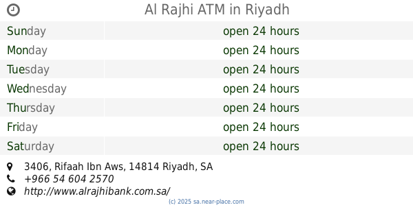
Al Rajhi ATM
3406 Rifaah Ibn Aws, Riyadh
Atm
read more
1.144 km
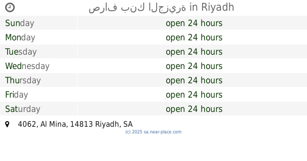
صراف بنك الجزيرة
4062 Al Mina, Riyadh
Atm
read more
📑
all categories
Accounting
Administrative area level 1
Airport
Amusement park
Aquarium
Art gallery
Atm
Bakery
Bank
Bar
Beauty salon
Bicycle store
Book store
Bowling alley
Bus station
Cafe
Campground
Car dealer
Car rental
Car repair
Car wash
Casino
Cemetery
Church
City hall
Clothing store
Colloquial area
Convenience store
Country
Courthouse
Dentist
Department store
Doctor
Electrician
Electronics store
Embassy
Finance
Fire station
Florist
Food
Funeral home
Furniture store
Gas station
General contractor
Grocery or supermarket
Gym
Hair care
Hardware store
Health
Hindu Temple
Home goods store
Hospital
Insurance agency
Intersection
Jewelry store
Laundry
Lawyer
Library
Light rail station
Liquor store
Local government office
Locality
Locksmith
Lodging
Meal delivery
Meal takeaway
Mosque
Movie rental
Movie theater
Moving company
Museum
Natural feature
Neighborhood
Night club
Painter
Park
Parking
Pet store
Pharmacy
Physiotherapist
Place of worship
Plumber
Point of interest
Police
Political
Post office
Premise
Real estate agency
Restaurant
Roofing contractor
Route
Rv park, camping
School
Shoe store
Shopping mall
Spa
Stadium
Storage
Store
Sublocality
Subpremise
Subway station
Supermarket
Taxi stand
Train station
Transit station
Travel agency
University
Veterinary care
Zoo
sublocality level 1
↑