Bakery nearby مخبز الرحمة للخبز العربي
Saudi Arabia
Bakery nearby مخبز الرحمة للخبز العربي
مخبز الرحمة للخبز العربي
Halat Mahish, Al Qatif 32652, Saudi Arabia
contacts phone
:
+966
Latitude:
26.5375406
, Longitude:
49.9995944
larger map & directions
read more
nearest Bakery
1.053 km
مخبز السلطان
7616, 2805, Al Qatif
Bakery
read more
1.545 km
تنور الخويلدية الحديث
شارع الملك بن سراج, Al Qatif
Bakery
read more
1.681 km
Al-Eid Bakeries
6796, 2596, Al Qatif
Bakery
read more
1.719 km
مخبز نسيم الشام
Al Qatif
Bakery
read more
1.774 km
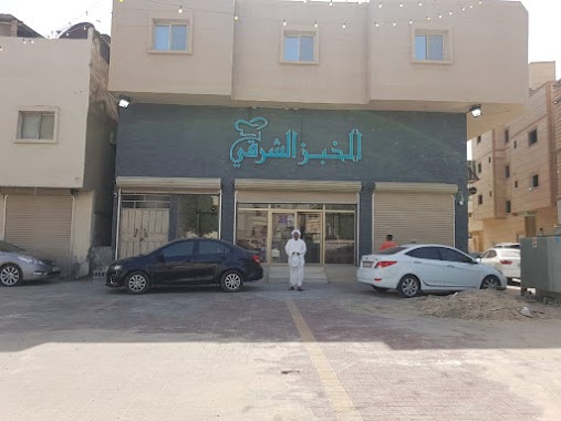
مخبز الخبز الشرقي
Umm Al Jazm, Al Qatif
Bakery
read more
1.783 km
مخبز حسن عباس آل ناصر
2857, Al Qatif
Bakery
read more
1.851 km
مخبز و حلويات عالم الخبازين
Unnamed Road, Anak
Bakery
read more
1.903 km
Al-Eid Bakery
شارع المحيط, Anak
Bakery
read more
1.975 km
Abu Saud Bakeries and Sweets
King Faisal Ibn Abdulaziz Street, Al Qatif
Bakery
read more
2.078 km
بيت الدونات
8880 Al Quds Street, منطقة المستودعات، 3229, Al Qatif
Bakery
read more
2.157 km
Qassqous Sweets & Bakeries
8607 Al Quds Street, Al Qatif
Bakery
read more
2.194 km
Alyahya Bakery
Al Qatif
Bakery
read more
2.209 km
Cake House
8421 شارع القدس، المجيدية، القطيف 32632
Bakery
read more
2.213 km
Cady Sweets
Al Quds, Al Qatif
Bakery
read more
2.217 km
مخبز الغدير
Al Qatif
Bakery
read more
2.269 km
Isfahani Bakery
2422 Al Khalifah Omar Street, Al Qatif
Bakery
read more
2.274 km
مخبز العافيه
9 Street, Al Qatif
Bakery
read more
2.281 km
Al-Bustan Bakery
Al Qatif
Bakery
read more
2.346 km
Harat Rahhal Bakery
King Abdulaziz Road, Al Qatif
Bakery
read more
2.354 km
Tarout Loaf Bakeries & Pastry
Zain Alabideen Street, Al-Malahah
Bakery
read more
2.397 km
Al-Eid Bakery
Al Quds Street, Al Qatif
Bakery
read more
2.426 km
Ragheef Alqatif Bakery
Badr Street, Al Qatif
Bakery
read more
2.544 km
Sweets & Bakeries Rami
7634 King Abdulaziz Road, 2732, Al Qatif
Bakery
read more
2.562 km
Pastry break Qatif
7652 King Abdulaziz Road, 2729, Al Qatif
Bakery
read more
2.605 km
Sweets & Bakeries Rami
7303 Al Quds Street, Al Qatif
Bakery
read more
📑
all categories
Accounting
Administrative area level 1
Airport
Amusement park
Aquarium
Art gallery
Atm
Bakery
Bank
Bar
Beauty salon
Bicycle store
Book store
Bowling alley
Bus station
Cafe
Campground
Car dealer
Car rental
Car repair
Car wash
Casino
Cemetery
Church
City hall
Clothing store
Colloquial area
Convenience store
Country
Courthouse
Dentist
Department store
Doctor
Electrician
Electronics store
Embassy
Finance
Fire station
Florist
Food
Funeral home
Furniture store
Gas station
General contractor
Grocery or supermarket
Gym
Hair care
Hardware store
Health
Hindu Temple
Home goods store
Hospital
Insurance agency
Intersection
Jewelry store
Laundry
Lawyer
Library
Light rail station
Liquor store
Local government office
Locality
Locksmith
Lodging
Meal delivery
Meal takeaway
Mosque
Movie rental
Movie theater
Moving company
Museum
Natural feature
Neighborhood
Night club
Painter
Park
Parking
Pet store
Pharmacy
Physiotherapist
Place of worship
Plumber
Point of interest
Police
Political
Post office
Premise
Real estate agency
Restaurant
Roofing contractor
Route
Rv park, camping
School
Shoe store
Shopping mall
Spa
Stadium
Storage
Store
Sublocality
Subpremise
Subway station
Supermarket
Taxi stand
Train station
Transit station
Travel agency
University
Veterinary care
Zoo
sublocality level 1
↑