Bakery nearby Sweets & Bakeries happens at
Saudi Arabia
Bakery nearby Sweets & Bakeries happens at
Sweets & Bakeries happens at
47322, Saudi Arabia
contacts phone
:
+966
Latitude:
28.4591232
, Longitude:
36.5570769
larger map & directions
read more
nearest Bakery
440 m
درر الريان
حي الريان، تبوك
Bakery
read more
1.689 km
Bakery resort of Tmis and beans
Tabuk
Bakery
read more
2.365 km
فطائر لاره
8104, Tabuk
Bakery
read more
2.458 km
مخابز الرحاب
Tabuk
Bakery
read more
3.032 km
مخبز وحلويات وريف المروج
3251, Tabuk
Bakery
read more
3.057 km
فطائر أبو هلال
3251, Tabuk
Bakery
read more
3.065 km
Helal promoter
Tabuk
Bakery
read more
3.066 km
فطائر أبو هلال
Tabuk
Bakery
read more
3.097 km
Fahad Kaharvai
Unnamed Road, Tabuk
Bakery
read more
3.593 km
مخبز التماس
شارع مروج الامير، تبوك
Bakery
read more
4.604 km
مخبز بهجة وسرور للخبز
Tabuk
Bakery
read more
4.967 km
مخبز تميس اليوم
الملك فيصل، القادسية، تبوك
Bakery
read more
5.158 km
مخبز تميس
8301 Abi Bakr As Siddiq, Tabuk
Bakery
read more
5.62 km
مخبز شراك الشمال
Tabuk
Bakery
read more
5.644 km
مخبز تميس
ممدوح بن عبد العزيز، الورود، تبوك
Bakery
read more
5.737 km
مخبز محمد سليمان عيد البلوي
شارع الامير ممدوح، حي الورود، تبوك
Bakery
read more
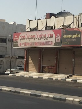
5.976 km
مخبز وحلويات هداج
3884 Prince Mamduh Ibn Abdul Aziz, Tabuk
Bakery
read more
6.015 km
مخابز ركائز تبوك
Tabuk
Bakery
read more
6.033 km
مخبز تميس صالح البلوي
Tabuk
Bakery
read more
6.036 km
مخبز تميس رمز القمة
Tabuk
Bakery
read more
6.095 km
مخبز المشروح الأردني
Tabuk
Bakery
read more
6.119 km
بسمة ذوق للحلويات
7516 Khalid Al Sidayri, Tabuk
Bakery
read more
6.208 km
Bakery loaf festival
3909 طريق الملك سعود، تبوك
Bakery
read more
6.243 km
مؤسسة سالم أحمد المصعبي للشراك والقرصان
ممدوح بن عبدالعزيز، الورود، تبوك
Bakery
read more
6.317 km
Hot dish
4176 طريق الملك سعود، المهرجان تبوك 47913 7189 King Saud Road, Tabuk
Bakery
read more
📑
all categories
Accounting
Administrative area level 1
Airport
Amusement park
Aquarium
Art gallery
Atm
Bakery
Bank
Bar
Beauty salon
Bicycle store
Book store
Bowling alley
Bus station
Cafe
Campground
Car dealer
Car rental
Car repair
Car wash
Casino
Cemetery
Church
City hall
Clothing store
Colloquial area
Convenience store
Country
Courthouse
Dentist
Department store
Doctor
Electrician
Electronics store
Embassy
Finance
Fire station
Florist
Food
Funeral home
Furniture store
Gas station
General contractor
Grocery or supermarket
Gym
Hair care
Hardware store
Health
Hindu Temple
Home goods store
Hospital
Insurance agency
Intersection
Jewelry store
Laundry
Lawyer
Library
Light rail station
Liquor store
Local government office
Locality
Locksmith
Lodging
Meal delivery
Meal takeaway
Mosque
Movie rental
Movie theater
Moving company
Museum
Natural feature
Neighborhood
Night club
Painter
Park
Parking
Pet store
Pharmacy
Physiotherapist
Place of worship
Plumber
Point of interest
Police
Political
Post office
Premise
Real estate agency
Restaurant
Roofing contractor
Route
Rv park, camping
School
Shoe store
Shopping mall
Spa
Stadium
Storage
Store
Sublocality
Subpremise
Subway station
Supermarket
Taxi stand
Train station
Transit station
Travel agency
University
Veterinary care
Zoo
sublocality level 1
↑