Bank nearby Credit and Savings Bank
Saudi Arabia
Bank nearby Credit and Savings Bank
Credit and Savings Bank
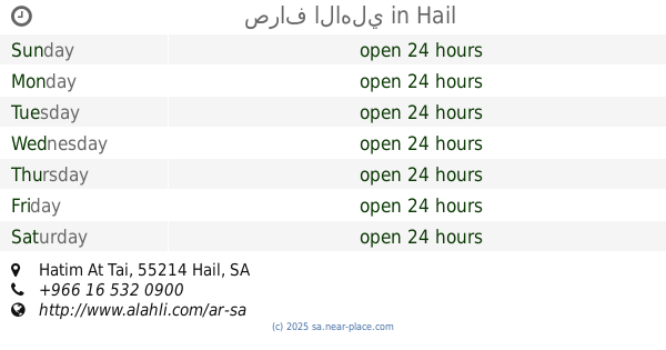
6711 حاتم الطائي، حائل Saudi Arabia
contacts phone
:
+966
Latitude:
27.4749174
, Longitude:
41.7059503
read more
nearest Bank
10 m
بنك التنمية الاجتماعية
6737 Hatim At Tai, Hail
Bank
read more
1.279 km
ENJAZ HAIL AL SENAYA
11411 King Abdulaziz Road, Hail
Bank
read more
1.296 km
NCB
King Abdulaziz Road, Hail
Bank
read more
1.587 km
Al Rajhi Bank
King Abdulaziz Road, Hail
Bank
read more
1.617 km
صالة تمويل السيارات مصرف الراجحي
8635 طريق الملك عبدالعزيز،, 3832، السعودية, Hail
Bank
read more
1.627 km
بنك الراجحي
8635 King Abdulaziz Rd, Al Samra Hail 55422 3832 King Abdulaziz Road, Hail
Bank
read more
2.054 km
SABB
Salam Mall, King Saud Street, AL kamashayiah, Hail
Bank
read more
2.295 km
Bank AlJazira
King Saud Road, Hail
Bank
read more
2.331 km
Riyad Bank
400, Hail
Bank
read more
2.626 km
Riyad Bank
Hail
Bank
read more
2.798 km
صرافة الجزيرة
Hail
Bank
read more
2.813 km
مكتب تورق للتقسيط
Hail
Bank
read more
2.855 km
Bank Albilad
8108 طريق الملك سعود، المطار، حائل 55421 5135 King Saud Road, Hail
Bank
read more
2.855 km
بنك البلاد - فرع حائل - رجال - سيدات
8108 طريق الملك سعود، المطار، حائل 55421 5135 King Saud Road, Hail
Bank
read more
2.938 km
Arabic National Bank
Hail
Bank
read more
2.938 km
Arab Bank
Hail
Bank
read more
2.975 km
Alinma Bank
King Abdulaziz Road, Hail
Bank
read more
2.99 km
Banque Saudi Fransi
Hail
Bank
read more
3.034 km
Samba Bank
Hail
Bank
read more
3.607 km
Al Rajhi Bank
Al Amir Sultan Ibn Abdul Aziz, Hail
Bank
read more
4.063 km
The Saudi Investment Bank
Al Imam Faisal Ibn Turki, Hail
Bank
read more
4.181 km
بنك الراحجي
8045 طريق الملك عبدالعزيز، الزبارة حائل 55425 2248 King Abdulaziz Road, Hail
Bank
read more
4.192 km
مصرف الراجحي فرع السيدات
8045 طريق الملك عبدالعزيز، الزبارة، حائل 55425 2248 طريق الملك عبدالعزيز،, Hail
Bank
read more
4.204 km
Al Rajhi Bank
8045 King Abdulaziz Road, Hail
Bank
read more
4.382 km
صراف الاهلي
Hatim At Tai, Hail
Bank
read more
📑
all categories
Accounting
Administrative area level 1
Airport
Amusement park
Aquarium
Art gallery
Atm
Bakery
Bank
Bar
Beauty salon
Bicycle store
Book store
Bowling alley
Bus station
Cafe
Campground
Car dealer
Car rental
Car repair
Car wash
Casino
Cemetery
Church
City hall
Clothing store
Colloquial area
Convenience store
Country
Courthouse
Dentist
Department store
Doctor
Electrician
Electronics store
Embassy
Finance
Fire station
Florist
Food
Funeral home
Furniture store
Gas station
General contractor
Grocery or supermarket
Gym
Hair care
Hardware store
Health
Hindu Temple
Home goods store
Hospital
Insurance agency
Intersection
Jewelry store
Laundry
Lawyer
Library
Light rail station
Liquor store
Local government office
Locality
Locksmith
Lodging
Meal delivery
Meal takeaway
Mosque
Movie rental
Movie theater
Moving company
Museum
Natural feature
Neighborhood
Night club
Painter
Park
Parking
Pet store
Pharmacy
Physiotherapist
Place of worship
Plumber
Point of interest
Police
Political
Post office
Premise
Real estate agency
Restaurant
Roofing contractor
Route
Rv park, camping
School
Shoe store
Shopping mall
Spa
Stadium
Storage
Store
Sublocality
Subpremise
Subway station
Supermarket
Taxi stand
Train station
Transit station
Travel agency
University
Veterinary care
Zoo
sublocality level 1
↑