Cafe nearby AlHarkan’s 🏡
Saudi Arabia
Cafe nearby AlHarkan’s 🏡
AlHarkan’s 🏡
Irqah, Riyadh 12546, Saudi Arabia
contacts phone
:
+966
Latitude:
24.6844066
, Longitude:
46.5607043
larger map & directions
read more
nearest Cafe
1.575 km
تفاصيل
Alsail Alkabeer Road, Riyadh
Cafe
read more
2.189 km
dipndip
Prince Mashal Ibn Abdulaziz Rd., Irqah, Riyadh
Cafe
read more
2.189 km
dipndip
Prince Mashal Ibn Abdulaziz Rd., Irqah، الرياض
Cafe
read more
2.208 km
Starbucks
Riyadh
Cafe
read more
2.241 km
Costa Coffee
Riyadh
Cafe
read more
2.277 km
قهوه المساء
الرياض
Cafe
read more
2.278 km
Almasaa Cafe
Riyadh
Cafe
read more
2.824 km
Cofe7
Manea Al Mreidi Manea Al Mreidi, Riyadh
Cafe
read more
3.52 km
كوز القهوة
6956 Mirad, Riyadh
Cafe
read more
3.698 km
رومانتك كافيه
2785 الطائف، الرياض
Cafe
read more
3.719 km
القهوه الرومنسية
شارع الطائف - حي ظهرة لبن، الرياض
Cafe
read more
3.725 km
مقهى جلسة السمو
نابلس Nablus, 4843-, Riyadh
Cafe
read more
3.734 km
مقهى جلسة الكرامة
4843 Nablus, 4817-, Riyadh
Cafe
read more
3.768 km
ستايل كافية
4882 Taif، Riyadh
Cafe
read more
3.773 km
ستايل كافية
Riyadh
Cafe
read more
3.886 km
مقهى اخر قطرة
ظهرة لبن،, Riyadh
Cafe
read more
3.904 km
مقهى اخر قطرة - Last Drop Cafe
ظهرة لبن،, Riyadh
Cafe
read more
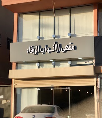
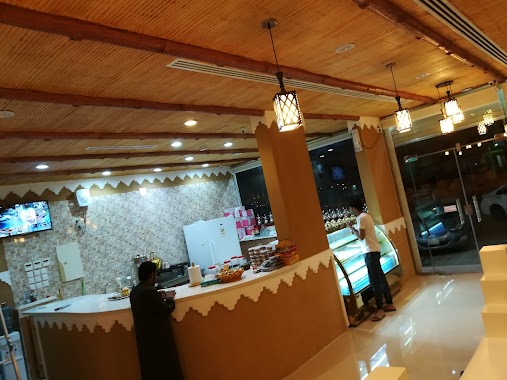
3.976 km
مقهى الاكواب الزرقاء
Riyadh
Cafe
read more
3.997 km
قهوة مكين
Dhahrat Laban, Riyadh
Cafe
read more
4.061 km
Mango Juice
الأمير مشعل بن عبدالعزيز Prince Mashal Ibn Abdulaziz, Riyadh
Cafe
read more
4.177 km
Richard's Coffee
Unnamed Road, Riyadh
Cafe
read more
4.179 km
كوفي شوب للعائلات
Riyadh
Cafe
read more
4.192 km
Rip Diet
Wadi Hanifah, Riyadh
Cafe
read more
4.248 km
Cafe assets Chadelya
شارع الطائف Taif Street, Riyadh
Cafe
read more
4.263 km
قهوه عربية
9263 Taiba Street, Riyadh
Cafe
read more
📑
all categories
Accounting
Administrative area level 1
Airport
Amusement park
Aquarium
Art gallery
Atm
Bakery
Bank
Bar
Beauty salon
Bicycle store
Book store
Bowling alley
Bus station
Cafe
Campground
Car dealer
Car rental
Car repair
Car wash
Casino
Cemetery
Church
City hall
Clothing store
Colloquial area
Convenience store
Country
Courthouse
Dentist
Department store
Doctor
Electrician
Electronics store
Embassy
Finance
Fire station
Florist
Food
Funeral home
Furniture store
Gas station
General contractor
Grocery or supermarket
Gym
Hair care
Hardware store
Health
Hindu Temple
Home goods store
Hospital
Insurance agency
Intersection
Jewelry store
Laundry
Lawyer
Library
Light rail station
Liquor store
Local government office
Locality
Locksmith
Lodging
Meal delivery
Meal takeaway
Mosque
Movie rental
Movie theater
Moving company
Museum
Natural feature
Neighborhood
Night club
Painter
Park
Parking
Pet store
Pharmacy
Physiotherapist
Place of worship
Plumber
Point of interest
Police
Political
Post office
Premise
Real estate agency
Restaurant
Roofing contractor
Route
Rv park, camping
School
Shoe store
Shopping mall
Spa
Stadium
Storage
Store
Sublocality
Subpremise
Subway station
Supermarket
Taxi stand
Train station
Transit station
Travel agency
University
Veterinary care
Zoo
sublocality level 1
↑