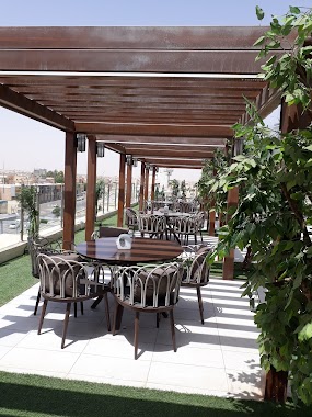
Cafe nearby القهوة العالمية
Saudi Arabia
Cafe nearby القهوة العالمية
القهوة العالمية
شارع المشاغل, 52382, Buraydah, SA Saudi Arabia
contacts phone
:
+966
Latitude:
26.3641069
, Longitude:
43.9559728
larger map & directions
read more
nearest Cafe
37 m
Universal Coffee House
Al Mashaghil Street, As Safra، بريدة
Cafe
read more
480 m
Juices Mayssam
طريق الأمير سلطان بن عبدالعزيز Prince Sultan Ibn Abdulaziz Road, Buraydah
Cafe
read more
488 m
كاريوكا CARIOCA
بريدة
Cafe
read more
521 m
Crips - كربس
مقابل النخيل بلازا، (الصفراء شارع التخصصي (طريق م عبدالله، بريدة
Cafe
read more
606 m
Rest Coffee
Abu Bakr As Siddiq Road, Buraydah
Cafe
read more
648 m
الزيدان 10 كافيه
طريق أبو بكر الصديق، حي الصفراء، بريدة
Cafe
read more
670 m
Godiva
Buraydah
Cafe
read more
674 m
Nai cafe
Abu Bakr As Siddiq Road, Buraydah
Cafe
read more
698 m
Canto Specialty Coffee
Buraydah
Cafe
read more
702 m
ماما روتي كافيه
مول ش الملك عبد الله, Buraydah
Cafe
read more
712 m
دلتي للقهوة العربية
2523, 8250, Buraydah
Cafe
read more
719 m
مقهى مكتب الدعوة بالصفراء
6992 3062, Buraydah
Cafe
read more
746 m
فن.جن.كيف
Buraydah
Cafe
read more
790 m
ديوانية ابو خالد وام خالد
بريدة
Cafe
read more
875 m
Dunkin' Donuts
King Abdulaziz Road, Buraydah
Cafe
read more
934 m
Kofi Schaars hotel
6770, Buraydah
Cafe
read more
1.009 km
Arabica Star
Abu Bakr As Siddiq Road, Buraydah
Cafe
read more
1.014 km
Coffee Cup
Buraydah
Cafe
read more
1.014 km
Starbucks
Buraydah
Cafe
read more
1.014 km
ستار بكس
Buraydah
Cafe
read more
1.022 km
Gunes Cafe
6679 King Abdulaziz Rd As Safra Buraydah 52382 2850 King Abdulaziz Road, Buraydah
Cafe
read more
1.074 km
Vostra Gelato
Buraydah
Cafe
read more
1.074 km
فوسترا جيلاتو كافيه
Buraydah
Cafe
read more
1.108 km
Lion Coffee
King Abdulaziz Road, Buraydah
Cafe
read more
1.124 km
Mangia coffee roasters
7104 Al Amir Faisal Ibn Bandar Ibn Abdul Aziz, Buraydah
Cafe
read more
📑
all categories
Accounting
Administrative area level 1
Airport
Amusement park
Aquarium
Art gallery
Atm
Bakery
Bank
Bar
Beauty salon
Bicycle store
Book store
Bowling alley
Bus station
Cafe
Campground
Car dealer
Car rental
Car repair
Car wash
Casino
Cemetery
Church
City hall
Clothing store
Colloquial area
Convenience store
Country
Courthouse
Dentist
Department store
Doctor
Electrician
Electronics store
Embassy
Finance
Fire station
Florist
Food
Funeral home
Furniture store
Gas station
General contractor
Grocery or supermarket
Gym
Hair care
Hardware store
Health
Hindu Temple
Home goods store
Hospital
Insurance agency
Intersection
Jewelry store
Laundry
Lawyer
Library
Light rail station
Liquor store
Local government office
Locality
Locksmith
Lodging
Meal delivery
Meal takeaway
Mosque
Movie rental
Movie theater
Moving company
Museum
Natural feature
Neighborhood
Night club
Painter
Park
Parking
Pet store
Pharmacy
Physiotherapist
Place of worship
Plumber
Point of interest
Police
Political
Post office
Premise
Real estate agency
Restaurant
Roofing contractor
Route
Rv park, camping
School
Shoe store
Shopping mall
Spa
Stadium
Storage
Store
Sublocality
Subpremise
Subway station
Supermarket
Taxi stand
Train station
Transit station
Travel agency
University
Veterinary care
Zoo
sublocality level 1
↑