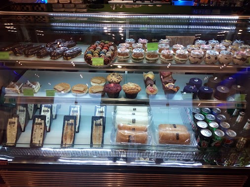
Cafe nearby دانكن دونت
Coronavirus disease (COVID-19) Situation
confirmed cases
841469
deaths
9646
Saudi Arabia
Cafe nearby دانكن دونت
دانكن دونت
7889, الطريق الدائري الشمالي الفرعي, التعاون، الرياض, SA Saudi Arabia
contacts phone
:
+966
Latitude:
24.7783066
, Longitude:
46.6896348
larger map & directions
read more
nearest Cafe
288 m
Coffee Boxes
طريق ابي بكر الصديق الفرعي, التعاون، الرياض
Cafe
read more
315 m
WPS STARBUCKS
7647 ابي بكر الصديق الفرعي،, 2139, Riyadh
Cafe
read more
388 m
Dunkin' Donuts
طريق ابي بكر الصديق الفرعي، التعاون،, Riyadh
Cafe
read more
473 m
Pixel Cafe
Riyadh
Cafe
read more
489 m
Veto فيتو كافيه
4500 Northern Ring Branch Road, Riyadh
Cafe
read more
541 m
Jwan Co Office
2823 الطريق الدائري الشمالي الفرعي، التعاون، الرياض
Cafe
read more
548 m
Jwan Co Office
2823 Northern Ring Branch Road, Riyadh
Cafe
read more
571 m
Coffee Address
Abi Bakr As Siddiq Branch Road, Riyadh
Cafe
read more
746 m
اربيك كافية
Riyadh
Cafe
read more
753 m
Arabica Cafe
Abi Bakr As Siddiq Branch Road, Riyadh
Cafe
read more
785 m
Dunkin Donuts
King Abdul Aziz Branch Road, Riyadh
Cafe
read more
798 m
Cioccolat Italiani
Al Ahmadi, Riyadh
Cafe
read more
881 m
Clémence Kofi
Riyadh
Cafe
read more
897 m
Coffee Qube
Riyadh
Cafe
read more
920 m
Java Cafe
Northern Ring Branch Road, Riyadh
Cafe
read more
927 m
قهوتنا
الحسين بن علي، التعاون،, Riyadh
Cafe
read more
931 m
ملحق السعادة
6776 Smnan, Riyadh
Cafe
read more
979 m
عصائر التمييز
Al Bahar Al Ahmar Street, Riyadh
Cafe
read more
1.01 km
Camel Step Coffee Roasters
طريق ابي بكر الصديق الفرعي، التعاون، الرياض
Cafe
read more
1.011 km
Camel Step Coffee Roasters
Abi Bakr As Siddiq Road, Riyadh
Cafe
read more
1.019 km
Simit Susam
Abi Bakr As Siddiq Rd, At Taawun، الرياض
Cafe
read more
1.031 km
Puzzle Cafe
6893 Abi Muhammad Al Janabi, Riyadh
Cafe
read more
1.049 km
مقهى قديمك نديمك
Al Bahar Al Ahmar Street, Riyadh
Cafe
read more
1.063 km
accent laini hai
7082 Wadi Abu Arab, Riyadh 13313
Cafe
read more
1.081 km
منالك كافيه manalook cafe
Riyadh
Cafe
read more
📑
all categories
Accounting
Administrative area level 1
Airport
Amusement park
Aquarium
Art gallery
Atm
Bakery
Bank
Bar
Beauty salon
Bicycle store
Book store
Bowling alley
Bus station
Cafe
Campground
Car dealer
Car rental
Car repair
Car wash
Casino
Cemetery
Church
City hall
Clothing store
Colloquial area
Convenience store
Country
Courthouse
Dentist
Department store
Doctor
Electrician
Electronics store
Embassy
Finance
Fire station
Florist
Food
Funeral home
Furniture store
Gas station
General contractor
Grocery or supermarket
Gym
Hair care
Hardware store
Health
Hindu Temple
Home goods store
Hospital
Insurance agency
Intersection
Jewelry store
Laundry
Lawyer
Library
Light rail station
Liquor store
Local government office
Locality
Locksmith
Lodging
Meal delivery
Meal takeaway
Mosque
Movie rental
Movie theater
Moving company
Museum
Natural feature
Neighborhood
Night club
Painter
Park
Parking
Pet store
Pharmacy
Physiotherapist
Place of worship
Plumber
Point of interest
Police
Political
Post office
Premise
Real estate agency
Restaurant
Roofing contractor
Route
Rv park, camping
School
Shoe store
Shopping mall
Spa
Stadium
Storage
Store
Sublocality
Subpremise
Subway station
Supermarket
Taxi stand
Train station
Transit station
Travel agency
University
Veterinary care
Zoo
sublocality level 1
↑