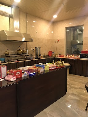
Cafe nearby Istraha
Saudi Arabia
Cafe nearby Istraha
Istraha
Al Manar, Dammam 32274, Saudi Arabia
contacts phone
:
+966
Latitude:
26.386074
, Longitude:
50.0392116
larger map & directions
read more
nearest Cafe
51 m
استراحة الدروازة
Al Manar, Dammam
Cafe
read more
68 m
استراحة الحبايب
Unnamed Road, Dammam
Cafe
read more
928 m
ديوانية دلة الحارة
Amer Ibn Umaiah Street, Dammam
Cafe
read more
1.008 km
Expresso Cafe
3642 طريق الملك فهد بن عبد العزيز, 6995, Dammam
Cafe
read more
1.07 km
عصاير الجسر
عصاير الجسر
Cafe
read more
1.099 km
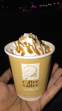
Coffee Valley
4136 King Fahd Rd، الدمام
Cafe
read more
1.17 km
Diwaniya Naif Arab coffee
4264 طريق الملك فهد بن عبد العزيز, 7323, Dammam
Cafe
read more
1.173 km
Fatimah Beauty Salon
8465 26 ا، المنار الدمام 32274
Cafe
read more
1.192 km
Dunkin' Donuts - دانكن دونتس
6741 Abu Bakr Alsiddiq St، الدمام
Cafe
read more
1.199 km
Smoothie Factory
Abu Bakr Alsiddiq Street, Dammam
Cafe
read more
1.201 km
Smoothie Factory
Abu Bakr Alsiddiq St، الدمام
Cafe
read more
1.222 km
ستار بكس كافيه
شارع أبوبكر صديق، حي الفيصلية، الدمام
Cafe
read more
1.223 km
Starbucks coffee shop
Dammam
Cafe
read more
1.225 km
STARBUCKS
شارع أبوبكر صديق، حي الفيصلية، الدمام
Cafe
read more
1.265 km
Cafe and Restaurant Deka
Imam Mohammed Bin Saud Street, Dammam
Cafe
read more
1.39 km
Al Fanar Coffee
Abu Bakr Alsiddiq Street, Dammam
Cafe
read more
1.402 km
وقت القهوة
12b Imam Mohammed Bin Saud Street, Dammam
Cafe
read more
1.434 km
ديبينغو شوكوليت بار
طريق أبو عبيدة الجراح،، الدمام
Cafe
read more
1.44 km
حلويات تمرة
Dammam
Cafe
read more
1.463 km
Road Cafe Co
7415 Abu Ubaidah Amir Ibn Al Jarah, Al Manar, Dammam 32274
Cafe
read more
1.515 km
Dalin Sweets حلويات دالين
Dammam
Cafe
read more
1.516 km
صاله النجوم للبلياردو كوفي شوب وديونيه النجوم
Dammam
Cafe
read more
1.518 km
ORCHID CAFE
Abu Bakr Alsiddiq Street, Dammam
Cafe
read more
1.567 km
The Coffee Lab
5، الدمام
Cafe
read more
1.567 km
The Coffee Lab
الفيصلية، الدمام
Cafe
read more
📑
all categories
Accounting
Administrative area level 1
Airport
Amusement park
Aquarium
Art gallery
Atm
Bakery
Bank
Bar
Beauty salon
Bicycle store
Book store
Bowling alley
Bus station
Cafe
Campground
Car dealer
Car rental
Car repair
Car wash
Casino
Cemetery
Church
City hall
Clothing store
Colloquial area
Convenience store
Country
Courthouse
Dentist
Department store
Doctor
Electrician
Electronics store
Embassy
Finance
Fire station
Florist
Food
Funeral home
Furniture store
Gas station
General contractor
Grocery or supermarket
Gym
Hair care
Hardware store
Health
Hindu Temple
Home goods store
Hospital
Insurance agency
Intersection
Jewelry store
Laundry
Lawyer
Library
Light rail station
Liquor store
Local government office
Locality
Locksmith
Lodging
Meal delivery
Meal takeaway
Mosque
Movie rental
Movie theater
Moving company
Museum
Natural feature
Neighborhood
Night club
Painter
Park
Parking
Pet store
Pharmacy
Physiotherapist
Place of worship
Plumber
Point of interest
Police
Political
Post office
Premise
Real estate agency
Restaurant
Roofing contractor
Route
Rv park, camping
School
Shoe store
Shopping mall
Spa
Stadium
Storage
Store
Sublocality
Subpremise
Subway station
Supermarket
Taxi stand
Train station
Transit station
Travel agency
University
Veterinary care
Zoo
sublocality level 1
↑