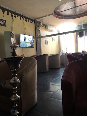
Cafe nearby مقهى جده
Coronavirus disease (COVID-19) Situation
confirmed cases
841469
deaths
9646
Saudi Arabia
Cafe nearby مقهى جده
مقهى جده
Al Bawadi, Jeddah 23443, Saudi-Arabien
contacts phone
:
+966
Latitude:
21.5817141
, Longitude:
39.1664871
larger map & directions
read more
nearest Cafe
46 m
كوفيانا
Jeddah
Cafe
read more
46 m
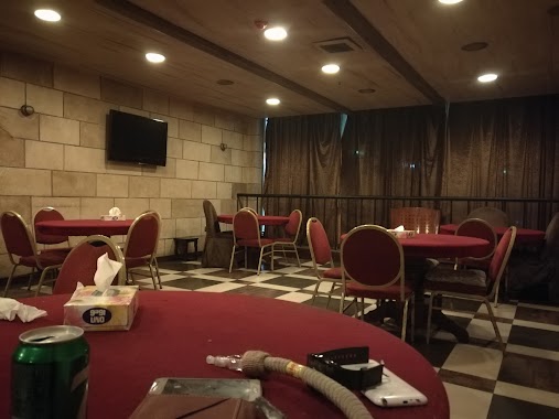
The Glory Lounge
Jeddah
Cafe
read more
51 m
مقهى عالهوارة
Jeddah
Cafe
read more
56 m
عالهوارة كافيه
Jeddah
Cafe
read more
59 m
Crystal Caffe
Jeddah
Cafe
read more
66 m
ديوان الوادي
Jeddah
Cafe
read more
81 m
مقهى تراس السعادة
2736 Salih As Saadi, Al Bawadi District, Jeddah
Cafe
read more
86 m
Laguna Cafe-Sari Road, Behind STC Sari Bransh.
2736 Salih As Saadi, Al Bawadi District,, Jeddah
Cafe
read more
95 m
لاقونا
2736 6280 صالح السعدي، حي البوادي،، جدة
Cafe
read more
99 m
Lacona Café مقهى لاقونا
2736 صالح السعدي، جدة
Cafe
read more
106 m
لاقوناكافيه
جدة
Cafe
read more
112 m
Fllah Cafe
Sari, Jeddah
Cafe
read more
113 m
كافيه الحدث
جدة Sari, Jeddah
Cafe
read more
114 m
محمصة بن داليا
2239 Sari, حي الفيصلية،, Jeddah
Cafe
read more
116 m
مقهى الخدث
Sari, Jeddah
Cafe
read more
316 m
Imtiyazat Al Riyada Est.
Unnamed Road, Jeddah
Cafe
read more
376 m
Le Croissant Shop
3036 Al Badawi Al Mulatham, Al Bawadi District, Jeddah
Cafe
read more
387 m
Le Croissant Shop
3036 Al Badawi Al Mulatham, Jeddah
Cafe
read more
463 m
كنوز القهوة للتجارة
Jeddah
Cafe
read more
482 m
كافيتالي
Sari, Jeddah
Cafe
read more
483 m
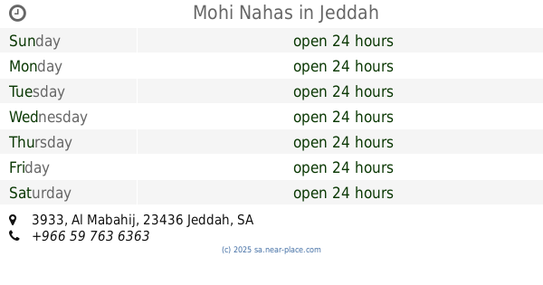
Mohi Nahas
3933 Al Mabahij, As Salamah District, Jeddah
Cafe
read more
494 m
Santos
Rayhanat Al Jazirah, Jeddah
Cafe
read more
500 m
CAZ Cafe
2237 Rayhanat Al Jazirah, Al Faisaliyah District, Jeddah 23442 8371 Rayhanat Al Jazirah, Jeddah
Cafe
read more
503 m
Kawkab Cafe
Rayhanat Al Jazirah, Jeddah
Cafe
read more
503 m
كاز كافيه Gaz Coffe
Rayhanat Al Jazirah, Jeddah
Cafe
read more
📑
all categories
Accounting
Administrative area level 1
Airport
Amusement park
Aquarium
Art gallery
Atm
Bakery
Bank
Bar
Beauty salon
Bicycle store
Book store
Bowling alley
Bus station
Cafe
Campground
Car dealer
Car rental
Car repair
Car wash
Casino
Cemetery
Church
City hall
Clothing store
Colloquial area
Convenience store
Country
Courthouse
Dentist
Department store
Doctor
Electrician
Electronics store
Embassy
Finance
Fire station
Florist
Food
Funeral home
Furniture store
Gas station
General contractor
Grocery or supermarket
Gym
Hair care
Hardware store
Health
Hindu Temple
Home goods store
Hospital
Insurance agency
Intersection
Jewelry store
Laundry
Lawyer
Library
Light rail station
Liquor store
Local government office
Locality
Locksmith
Lodging
Meal delivery
Meal takeaway
Mosque
Movie rental
Movie theater
Moving company
Museum
Natural feature
Neighborhood
Night club
Painter
Park
Parking
Pet store
Pharmacy
Physiotherapist
Place of worship
Plumber
Point of interest
Police
Political
Post office
Premise
Real estate agency
Restaurant
Roofing contractor
Route
Rv park, camping
School
Shoe store
Shopping mall
Spa
Stadium
Storage
Store
Sublocality
Subpremise
Subway station
Supermarket
Taxi stand
Train station
Transit station
Travel agency
University
Veterinary care
Zoo
sublocality level 1
↑