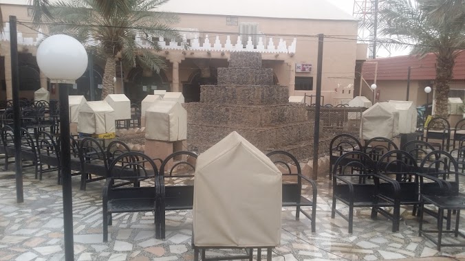
Cafe nearby مقهى ليل سمار
Saudi Arabia
Cafe nearby مقهى ليل سمار
مقهى ليل سمار
Unnamed Road, Riyadh Saudi Arabia
contacts phone
:
+966
Latitude:
24.605775
, Longitude:
46.777099
read more
nearest Cafe
20 m
Shish cafe
3210 Al Kharj Road, 6585, Riyadh
Cafe
read more
27 m
Coffee Alatekaya
3200 Al Kharj Road, Riyadh
Cafe
read more
28 m
مقهى الشياب
Al Kharj Road, Riyadh
Cafe
read more
331 m
Arabica Cafe
Al Kharj Road, Riyadh
Cafe
read more
1.172 km
Fawwal Bahmidan- Ethnic Arabian Cuisine
2635 An Nasr Road, 8334, Riyadh
Cafe
read more
1.533 km
مقهى برنس
العزيزية،, Riyadh
Cafe
read more
1.637 km
Arabica Cafe
الطريق الدائري الجنوبي الفرعي، المنصورة،, Riyadh
Cafe
read more
1.637 km
Arabica Cafe
Riyadh
Cafe
read more
1.771 km
ععبدالله
7660 ابي الفرج الحربي، العزيزية الرياض 14513
Cafe
read more
1.974 km
Perfect Time Cafe
محمد بن شعيل, المنصورة، الرياض
Cafe
read more
2.013 km
لمى ايسكريم
3054 Sufyan Ibn Awf, Riyadh
Cafe
read more
2.013 km
لمى ايسكريم علي الصاج
3054 Sufyan Ibn Awf، Riyadh
Cafe
read more
2.034 km
القهوة الداكنة
3983 Al Kharj Road, Riyadh
Cafe
read more
2.046 km
تاج القهوة
Al Kharj Road, Riyadh
Cafe
read more
2.058 km
كشك عبير
طريق الدائري الجنوبي، حي العزيزية، الرياض
Cafe
read more
2.154 km
Awan evening of billiards lounge
Sufyan Ibn Awf, Riyadh
Cafe
read more
2.167 km
Our Cafe
7059 Al Gharara, Riyadh
Cafe
read more
2.202 km
Abu Haitham Cafe
Riyadh
Cafe
read more
2.213 km
Second Coffee القهوة الثانية
Al Kharj Road, Riyadh
Cafe
read more
2.214 km
Second Coffee
Riyadh
Cafe
read more
2.224 km
Second Coffee
طريق الخرج، حي المنصورة، الرياض
Cafe
read more
2.225 km
القهوة الثانية
طريق الخرج، حي المنصورة، الرياض
Cafe
read more
2.236 km
Forum mono Samaani
3783, Riyadh
Cafe
read more
2.249 km
Lailat Alkaif Cafe
3849 مخرج 20، شارع محمد بن شعيل، المنصورة، الرياض
Cafe
read more
2.249 km
ليلة الكيف كافية
3849 مخرج 20، شارع محمد بن شعيل، المنصورة، الرياض
Cafe
read more
📑
all categories
Accounting
Administrative area level 1
Airport
Amusement park
Aquarium
Art gallery
Atm
Bakery
Bank
Bar
Beauty salon
Bicycle store
Book store
Bowling alley
Bus station
Cafe
Campground
Car dealer
Car rental
Car repair
Car wash
Casino
Cemetery
Church
City hall
Clothing store
Colloquial area
Convenience store
Country
Courthouse
Dentist
Department store
Doctor
Electrician
Electronics store
Embassy
Finance
Fire station
Florist
Food
Funeral home
Furniture store
Gas station
General contractor
Grocery or supermarket
Gym
Hair care
Hardware store
Health
Hindu Temple
Home goods store
Hospital
Insurance agency
Intersection
Jewelry store
Laundry
Lawyer
Library
Light rail station
Liquor store
Local government office
Locality
Locksmith
Lodging
Meal delivery
Meal takeaway
Mosque
Movie rental
Movie theater
Moving company
Museum
Natural feature
Neighborhood
Night club
Painter
Park
Parking
Pet store
Pharmacy
Physiotherapist
Place of worship
Plumber
Point of interest
Police
Political
Post office
Premise
Real estate agency
Restaurant
Roofing contractor
Route
Rv park, camping
School
Shoe store
Shopping mall
Spa
Stadium
Storage
Store
Sublocality
Subpremise
Subway station
Supermarket
Taxi stand
Train station
Transit station
Travel agency
University
Veterinary care
Zoo
sublocality level 1
↑