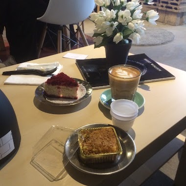
Cafe nearby مساعد سعود الحربي
Coronavirus disease (COVID-19) Situation
confirmed cases
841469
deaths
9646
Saudi Arabia
Cafe nearby مساعد سعود الحربي
مساعد سعود الحربي
4145, Hail 55422 Arabia Saudita
contacts phone
:
+966
Latitude:
27.4757643
, Longitude:
41.7126639
read more
nearest Cafe
1.669 km
cooffee cup كوب القهوة
حائل
Cafe
read more
1.669 km
coffee cup كوب القهوة
حائل
Cafe
read more
2.211 km
ماماروتي
8989, Hail
Cafe
read more
2.376 km
مقهى فلكلور النسائي
حائل
Cafe
read more
2.973 km
محمصة البن الفاخر
Al Amir Sultan Ibn Abdul Aziz, Hail
Cafe
read more
3.001 km
Coffee Club
Hail
Cafe
read more
3.036 km
Barncafe بارن كافيه
Al Jameen district, AlJameen aljanobi street, Hail, Al Jameen district, Hail
Cafe
read more
3.069 km
Crips & Cinnamon Roll
4864, Hail
Cafe
read more
3.113 km
Dunkin' Donuts
4841 King Fahd Ibn Abdul Aziz Rd, An Naqrah, Hail 55431 8304 King Fahd Ibn Abdul Aziz Road, Hail
Cafe
read more
3.329 km
Vanilla chocolla
Hail
Cafe
read more
3.339 km
فانيلا شوكولا ـvanillachocola
4504, Al Matar, Hail 55421 8018
Cafe
read more
3.373 km
Chocolate Sarayi
4480, Hail
Cafe
read more
3.395 km
Chocolate Sarayi
جراند مول بوابة 1 .. النقرة،
Cafe
read more
3.45 km
باباروتي
حائل
Cafe
read more
3.469 km
dipndip
Hail
Cafe
read more
3.484 km
مقهى كوب الفقاعات
Hail
Cafe
read more
3.49 km
Bubbli Cup
Hail
Cafe
read more
3.542 km
Krispy Kreme
An Naqrah, Grand Mall, 1st floor, Hail
Cafe
read more
3.593 km
ديب اند ريتش
الجامعيين،, Hail
Cafe
read more
3.604 km
shay khanah
Hail
Cafe
read more
3.61 km
Njj
Hail
Cafe
read more
3.671 km
Choc Crepe
Hail
Cafe
read more
3.702 km
Arabica Time Cafe
Hail
Cafe
read more
3.712 km
Krispy Kreme Doughnuts
4416 طريق الملك فهد بن عبدالعزيز، النقرة، حائل 55431 8755 King Fahd Ibn Abdul Aziz Road, Hail
Cafe
read more
3.801 km
Black Drop Coffee Shop
3838, Hail
Cafe
read more
📑
all categories
Accounting
Administrative area level 1
Airport
Amusement park
Aquarium
Art gallery
Atm
Bakery
Bank
Bar
Beauty salon
Bicycle store
Book store
Bowling alley
Bus station
Cafe
Campground
Car dealer
Car rental
Car repair
Car wash
Casino
Cemetery
Church
City hall
Clothing store
Colloquial area
Convenience store
Country
Courthouse
Dentist
Department store
Doctor
Electrician
Electronics store
Embassy
Finance
Fire station
Florist
Food
Funeral home
Furniture store
Gas station
General contractor
Grocery or supermarket
Gym
Hair care
Hardware store
Health
Hindu Temple
Home goods store
Hospital
Insurance agency
Intersection
Jewelry store
Laundry
Lawyer
Library
Light rail station
Liquor store
Local government office
Locality
Locksmith
Lodging
Meal delivery
Meal takeaway
Mosque
Movie rental
Movie theater
Moving company
Museum
Natural feature
Neighborhood
Night club
Painter
Park
Parking
Pet store
Pharmacy
Physiotherapist
Place of worship
Plumber
Point of interest
Police
Political
Post office
Premise
Real estate agency
Restaurant
Roofing contractor
Route
Rv park, camping
School
Shoe store
Shopping mall
Spa
Stadium
Storage
Store
Sublocality
Subpremise
Subway station
Supermarket
Taxi stand
Train station
Transit station
Travel agency
University
Veterinary care
Zoo
sublocality level 1
↑