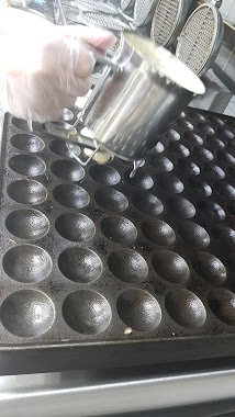
Cafe nearby مزيان
Saudi Arabia
Cafe nearby مزيان
مزيان
Jeddah 22451, Saudi Arabia
contacts phone
:
+966
Latitude:
21.4158494
, Longitude:
39.3359675
larger map & directions
read more
nearest Cafe
6 m
ميكاتو
Jeddah
Cafe
read more
30 m
Rabat, Moroccan tea
8889 طريق المطار, Taif
Cafe
read more
64 m
Bon Cafe
Jeddah
Cafe
read more
94 m
Marrakesh - Moroccan tea
3881, حي الشفا،, Jeddah
Cafe
read more
95 m
Santos Cofe
Jeddah
Cafe
read more
146 m
Arabic coffee
3863, حي الشفا, Jeddah
Cafe
read more
147 m
Moroccan Taste
Jeddah
Cafe
read more
189 m
Sultan Moroccan tea
5، جدة
Cafe
read more
264 m
بارنيز
Jeddah
Cafe
read more
277 m
Barncafe بارن كافيه
JEDDAH MAKKAH HIGHWAY INSIDE ALMIZAN STATION, Jeddah, BALANCE STATION, محطة الميزان, فرع الميزان, Jeddah
Cafe
read more
515 m
شاهي عبد الرحمن
Jeddah
Cafe
read more
920 m
كويك كافية
طريق مكة جدة السريع،, Jeddah
Cafe
read more
2.026 km
مؤسسة
Jeddah
Cafe
read more
2.028 km
لوسيندا كافية
Makkah - Jeddah Highway, محطة الرحيلي, Jeddah
Cafe
read more
2.144 km
مقهى الراحة
4661, حي الاجاويد،, Jeddah
Cafe
read more
2.157 km
قهوة الراحه
4661, حي الاجاويد 7180, Jeddah
Cafe
read more
2.194 km
عمار باعبود
Unnamed Road, Jeddah
Cafe
read more
2.22 km
ركن المعسلات
3660 طريق مكة جدة السريع، حي الفضل جدة 22362 6083 طريق مكة جدة السريع حي الفضل Jeddah Saudi Arabia 22362
Cafe
read more
2.24 km
السنارة
4495, حي الاجاويد، 7107, Jeddah
Cafe
read more
2.246 km
Bon Cafe
8889 طريق المطار, Taif
Cafe
read more
2.328 km
استراحة موسى بن ساري
Jeddah
Cafe
read more
2.329 km
كازينو الجدعاني
Jeddah
Cafe
read more
2.339 km
ستار كافية
Makkah - Jeddah Highway, Jeddah
Cafe
read more
2.445 km
كرك و وافل
4289 Makkah - Jeddah Hwy, Al Ajaweed District Jeddah 22441 7352 Makkah - Jeddah Highway, Jeddah
Cafe
read more
2.462 km
كويك كافية فرع الرحيلي
خط جدة مكة السريع،, Jeddah
Cafe
read more
📑
all categories
Accounting
Administrative area level 1
Airport
Amusement park
Aquarium
Art gallery
Atm
Bakery
Bank
Bar
Beauty salon
Bicycle store
Book store
Bowling alley
Bus station
Cafe
Campground
Car dealer
Car rental
Car repair
Car wash
Casino
Cemetery
Church
City hall
Clothing store
Colloquial area
Convenience store
Country
Courthouse
Dentist
Department store
Doctor
Electrician
Electronics store
Embassy
Finance
Fire station
Florist
Food
Funeral home
Furniture store
Gas station
General contractor
Grocery or supermarket
Gym
Hair care
Hardware store
Health
Hindu Temple
Home goods store
Hospital
Insurance agency
Intersection
Jewelry store
Laundry
Lawyer
Library
Light rail station
Liquor store
Local government office
Locality
Locksmith
Lodging
Meal delivery
Meal takeaway
Mosque
Movie rental
Movie theater
Moving company
Museum
Natural feature
Neighborhood
Night club
Painter
Park
Parking
Pet store
Pharmacy
Physiotherapist
Place of worship
Plumber
Point of interest
Police
Political
Post office
Premise
Real estate agency
Restaurant
Roofing contractor
Route
Rv park, camping
School
Shoe store
Shopping mall
Spa
Stadium
Storage
Store
Sublocality
Subpremise
Subway station
Supermarket
Taxi stand
Train station
Transit station
Travel agency
University
Veterinary care
Zoo
sublocality level 1
↑