Clothing store nearby Arabian Oud
Saudi Arabia
Clothing store nearby Arabian Oud
Arabian Oud
6929, طريق الملك عبدالعزيز, 73311, Ar Ar, SA Saudi Arabia
contacts phone
:
+966
Latitude:
30.9699645
, Longitude:
41.0156271
larger map & directions
read more
nearest Clothing store
87 m
Oud Elite
7013 الشارقة, المساعدية، 3205،, Arar
Clothing store
read more
161 m
Almriol Alhur
شارع الشارقة, Arar
Clothing store
read more
825 m
N.CITY.ARAR
Arar
Clothing store
read more
825 m
ان سيتي
Arar
Clothing store
read more
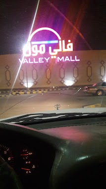
884 m
Gingersnaps
King Khaled Road, فالي مول, Arar
Clothing store
read more
888 m
nichii
King Khaled Road, Arar
Clothing store
read more
889 m
Shana
شارع أم القوين, فالي مول, Arar
Clothing store
read more
919 m
جنيد للعطور
Arar
Clothing store
read more
919 m
غناتي للعطور والبخوو والهدايا
Arar
Clothing store
read more
934 m
قصر العناية للزي الموحد
طريق الملك فيصل, Arar
Clothing store
read more
934 m
عبد الصمد القرشي
King Khaled Road, Arar
Clothing store
read more
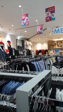
936 m
رد تاغ
VALLEY MALL, BETWEEN KING SAUD RD AND KING KHALED RD, Arar
Clothing store
read more
936 m
REDTAG
VALLEY MALL, BETWEEN KING SAUD RD AND KING KHALED RD, Arar
Clothing store
read more
971 m
TWENTY4
Arar
Clothing store
read more
1.021 km
Daffah Store - معرض الدفه
King Abdulaziz Road, Arar
Clothing store
read more
1.022 km
الدفه
Arar
Clothing store
read more
1.034 km
Elite Oud
King Saud Road, Arar
Clothing store
read more
1.045 km
Deraah for Perfume
7937 الواحة, Arar
Clothing store
read more
1.09 km
Max
King Saud Road, Arar
Clothing store
read more
1.226 km
H&M
Al Gawhara, Sakaka Highway, Arar
Clothing store
read more
1.262 km
Centerpoint
Salahuldin Alayouby Street, Arar
Clothing store
read more
1.274 km
البلاد للملابس
Arar
Clothing store
read more
1.276 km
Alhazem Center
Arar
Clothing store
read more
1.291 km
Hazaz
شارع الرافعي, Arar
Clothing store
read more
1.333 km
عرعر
طريق الملك فيصل،, Arar
Clothing store
read more
📑
all categories
Accounting
Administrative area level 1
Airport
Amusement park
Aquarium
Art gallery
Atm
Bakery
Bank
Bar
Beauty salon
Bicycle store
Book store
Bowling alley
Bus station
Cafe
Campground
Car dealer
Car rental
Car repair
Car wash
Casino
Cemetery
Church
City hall
Clothing store
Colloquial area
Convenience store
Country
Courthouse
Dentist
Department store
Doctor
Electrician
Electronics store
Embassy
Finance
Fire station
Florist
Food
Funeral home
Furniture store
Gas station
General contractor
Grocery or supermarket
Gym
Hair care
Hardware store
Health
Hindu Temple
Home goods store
Hospital
Insurance agency
Intersection
Jewelry store
Laundry
Lawyer
Library
Light rail station
Liquor store
Local government office
Locality
Locksmith
Lodging
Meal delivery
Meal takeaway
Mosque
Movie rental
Movie theater
Moving company
Museum
Natural feature
Neighborhood
Night club
Painter
Park
Parking
Pet store
Pharmacy
Physiotherapist
Place of worship
Plumber
Point of interest
Police
Political
Post office
Premise
Real estate agency
Restaurant
Roofing contractor
Route
Rv park, camping
School
Shoe store
Shopping mall
Spa
Stadium
Storage
Store
Sublocality
Subpremise
Subway station
Supermarket
Taxi stand
Train station
Transit station
Travel agency
University
Veterinary care
Zoo
sublocality level 1
↑