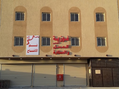
Doctor nearby saudi council for health specialities
Saudi Arabia
Doctor nearby saudi council for health specialities
saudi council for health specialities
3177 Prince Mohammad Bin Nasser Road, Jazan Saudi Arabia
contacts phone
:
+966
Latitude:
16.9235841
, Longitude:
42.5546746
read more
nearest Doctor
4 m
Treatment of Dermatology Center
Jazan
Doctor
read more
694 m
تابع الشئون الصحيه
6808, Jazan
Doctor
read more
1.64 km
Jezan Main Ex
Scheme 5, Jazan
Doctor
read more
1.808 km
ياسر عقدي
الروضة, Jazan
Doctor
read more
2.917 km
مركز اللياقة الطبية بجازان
Ar Rawdah, Jazan
Doctor
read more
3.569 km
البيت
شارع إبن هشام،, Jazan
Doctor
read more
5.461 km
ام وسيم لمختلف انواع التدليك (العلاج الشعبي)
7836 جازان 82733
Doctor
read more
8.603 km
مركز الامير محمد بن ناصر للخدمات المساندة للتربية الخاصة
Jazan
Doctor
read more
14.699 km
مستوصف الواصلي
3419, Jazan
Doctor
read more
18.934 km
مستوصف الخشابية
Al Khashabiyah
Doctor
read more
27.052 km
مركز حياتي اسناني
Sabya
Doctor
read more
28.427 km
Your Health Center for treatment
King Fahd Road, Abu Arish
Doctor
read more
28.474 km
فطيطه
Al Husayni
Doctor
read more
31.921 km
الشيخ / محمد ابوشرحة
ضمد
Doctor
read more
141.974 km
مركز الهلال الاحمر باحد رفيدة
Ahad Rafidah
Doctor
read more
143.709 km
عيادة الشيخ ابو وحيد
8011, Ahad Rafidah
Doctor
read more
144.046 km
Alfaifi for herbal remedy
2088, Abha
Doctor
read more
144.385 km
مختبرات ألفا الطبية
Abha
Doctor
read more
144.549 km
Kuzmolayn Clinics Medicine and Surgery and Orthodontic
4818, Abha
Doctor
read more
145.083 km
عيادة فوزية القيسي
6796, Abha
Doctor
read more
145.084 km
منزل محمد موسى مضواح
index, http://maps.address.gov.sa/m, Abha
Doctor
read more
145.101 km
معالجه بالعسل والاعشاب فوزيه القيسي
6807, Abha
Doctor
read more
145.465 km
عيادة صناع الريادة البيطرية
6227، طريق الملك عبدالعزيز، الشرفية،، أبها، 62542
Doctor
read more
145.865 km
مركز اسعاف ابها 1 وادارة التدريب
Abha
Doctor
read more
149.49 km
Saad Abdullah Al Daheina
4369, Abha
Doctor
read more
📑
all categories
Accounting
Administrative area level 1
Airport
Amusement park
Aquarium
Art gallery
Atm
Bakery
Bank
Bar
Beauty salon
Bicycle store
Book store
Bowling alley
Bus station
Cafe
Campground
Car dealer
Car rental
Car repair
Car wash
Casino
Cemetery
Church
City hall
Clothing store
Colloquial area
Convenience store
Country
Courthouse
Dentist
Department store
Doctor
Electrician
Electronics store
Embassy
Finance
Fire station
Florist
Food
Funeral home
Furniture store
Gas station
General contractor
Grocery or supermarket
Gym
Hair care
Hardware store
Health
Hindu Temple
Home goods store
Hospital
Insurance agency
Intersection
Jewelry store
Laundry
Lawyer
Library
Light rail station
Liquor store
Local government office
Locality
Locksmith
Lodging
Meal delivery
Meal takeaway
Mosque
Movie rental
Movie theater
Moving company
Museum
Natural feature
Neighborhood
Night club
Painter
Park
Parking
Pet store
Pharmacy
Physiotherapist
Place of worship
Plumber
Point of interest
Police
Political
Post office
Premise
Real estate agency
Restaurant
Roofing contractor
Route
Rv park, camping
School
Shoe store
Shopping mall
Spa
Stadium
Storage
Store
Sublocality
Subpremise
Subway station
Supermarket
Taxi stand
Train station
Transit station
Travel agency
University
Veterinary care
Zoo
sublocality level 1
↑