Food nearby Alghamdi Farm Equipment
Saudi Arabia
Food nearby Alghamdi Farm Equipment
Alghamdi Farm Equipment
3387, King Abdul Aziz Road, 82721, Jazan, SA Saudi Arabia
contacts phone
:
+966
Latitude:
16.8902569
, Longitude:
42.5595481
larger map & directions
read more
nearest Food
378 m
Creativity joy celebrations
Al Mutalla Street, Jazan
Food
read more
428 m
Grocery shop بقاله
Jazan
Food
read more
550 m
البشاير للمناسبات
Jazan
Food
read more
652 m
سيد العصير
3425 Airport Road, Jazan
Food
read more
863 m
Farghali Juice
Prince Sultan Road, Jazan
Food
read more
917 m
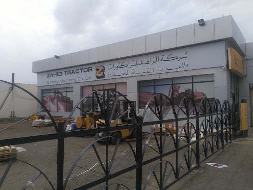
شركة الزاهد للتراكتورات والمعدات الثقيلة جازان
3075 King Abdul Aziz Road, Jazan
Food
read more
1.324 km
جنة العصيرات
6767, Jazan
Food
read more
1.464 km
Laser beam
Jazan
Food
read more
1.466 km
مقهى رشات الكيك
Jazan
Food
read more
1.504 km
ACES Jazan Arab Company For Lab & Soil
Jazan
Food
read more
1.659 km
Mashawi Mido
King Faisal, Jazan
Food
read more
1.839 km
Alarabi Restaurant
King Fahd Road, Jazan
Food
read more
1.966 km
Fish Market jazan
Jazan
Food
read more
2.001 km
Potato Tuesday
Airport Road, Jazan
Food
read more
2.049 km
المزاز
7489-7649 King Fahd Road, Jazan
Food
read more
2.382 km
Almuhaidib
طريق الأمير فيصل بن فهد, Jazan
Food
read more
2.408 km
سقنتشر signature
Jazan
Food
read more
2.424 km
Signature Juice
Jazan
Food
read more
2.426 km
Signature Juice
Ash Shati, Jazan
Food
read more
2.431 km
Kaif Juices
طريق الأمير فيصل بن فهد, Jazan
Food
read more
2.438 km
الكنفاني الاصلي
Corniche Road, Jazan
Food
read more
2.462 km
بسبوستي الذهبية
Jazan
Food
read more
2.586 km
Alafandi Restaurant
Jazan
Food
read more
4.373 km
عصائر افكادو باسكن
3230 شارع الأمير محمد بن عبد العزيز, Jazan
Food
read more
7.776 km
Ash Shariah
King Abdul Aziz Road, Jazan
Food
read more
📑
all categories
Accounting
Administrative area level 1
Airport
Amusement park
Aquarium
Art gallery
Atm
Bakery
Bank
Bar
Beauty salon
Bicycle store
Book store
Bowling alley
Bus station
Cafe
Campground
Car dealer
Car rental
Car repair
Car wash
Casino
Cemetery
Church
City hall
Clothing store
Colloquial area
Convenience store
Country
Courthouse
Dentist
Department store
Doctor
Electrician
Electronics store
Embassy
Finance
Fire station
Florist
Food
Funeral home
Furniture store
Gas station
General contractor
Grocery or supermarket
Gym
Hair care
Hardware store
Health
Hindu Temple
Home goods store
Hospital
Insurance agency
Intersection
Jewelry store
Laundry
Lawyer
Library
Light rail station
Liquor store
Local government office
Locality
Locksmith
Lodging
Meal delivery
Meal takeaway
Mosque
Movie rental
Movie theater
Moving company
Museum
Natural feature
Neighborhood
Night club
Painter
Park
Parking
Pet store
Pharmacy
Physiotherapist
Place of worship
Plumber
Point of interest
Police
Political
Post office
Premise
Real estate agency
Restaurant
Roofing contractor
Route
Rv park, camping
School
Shoe store
Shopping mall
Spa
Stadium
Storage
Store
Sublocality
Subpremise
Subway station
Supermarket
Taxi stand
Train station
Transit station
Travel agency
University
Veterinary care
Zoo
sublocality level 1
↑