Gas station nearby محطة الوفاء
Saudi Arabia
Gas station nearby محطة الوفاء
محطة الوفاء
King Fahd Road, Jeddah Saudi Arabia
contacts phone
:
+966
Latitude:
21.6193685
, Longitude:
39.1661938
read more
nearest Gas station
22 m
الوفاء لبطاقات الشحن
3510 عين ابن فهير، حي النزهة Ayn Ibn Fahir, Jeddah
Gas station
read more
115 m
Station 2 Petruyam
King Fahd Road, Jeddah
Gas station
read more
447 m
Petrol station
King Fahd Road, Jeddah
Gas station
read more
447 m
محطة المطار
King Fahd Road, Jeddah
Gas station
read more
592 m
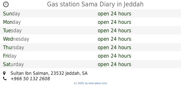
Gas station Sama Diary
Sultan Ibn Salman, Jeddah
Gas station
read more
603 m
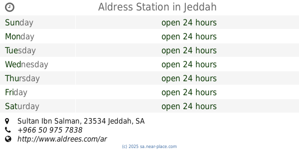
Aldress Station
Sultan Ibn Salman, Jeddah
Gas station
read more
630 m
عالم الإطارات لخدمة السيارات بنشر و زيت
4113 سلطان بن سلمان، حي النزهة جدة 23534
Gas station
read more
694 m
Petromin
Hira Street, Jeddah
Gas station
read more
702 m
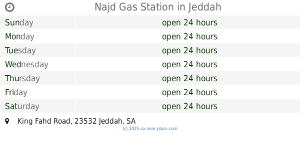
Najd Gas Station
King Fahd Road, Jeddah
Gas station
read more
840 m
ورشة المتخصصون إشراف المعلم عماد
3540 الحيدري، حي الربوة جدة 23533
Gas station
read more
855 m
محطه المعموره
Jeddah
Gas station
read more
864 m
NAFT Station
Jeddah
Gas station
read more
1.116 km
Petrol Fuel
Jeddah
Gas station
read more
1.116 km
محطة وقود بيت محمد أبو فارس
Jeddah
Gas station
read more
1.149 km
NAFT Gas Station
Yaqub Ibn Salih, Jeddah
Gas station
read more
1.155 km
حسين المطيري
Jeddah
Gas station
read more
1.165 km
salama car
6717 المكرونة, An Nuzhah District, 4644, Jeddah
Gas station
read more
1.189 km
كهربائي وتكييف سيارات
شارع المكرونة، النزهة، شارع المكرونة، جدةمحطة نفط،, Jeddah
Gas station
read more
1.207 km
Airport petrol station
Jeddah
Gas station
read more
1.207 km
محطة المطار
Jeddah
Gas station
read more
1.273 km
Jlati island Alhsna
7783 King Fahd Road, حي النزهة،, Jeddah
Gas station
read more
1.344 km
محطة الجزيرة
4321 الحيدري, حي الربوة, Jeddah
Gas station
read more
1.382 km
محطة بنزين
2829 Umar Abu Zarah, حي النزهة, Jeddah
Gas station
read more
1.382 km
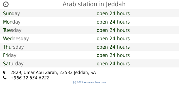
محطة العرب
2829 Umar Abu Zarah, حي النزهة, Jeddah
Gas station
read more
1.383 km
Arab station
2829 Umar Abu Zarah, حي النزهة, Jeddah
Gas station
read more
📑
all categories
Accounting
Administrative area level 1
Airport
Amusement park
Aquarium
Art gallery
Atm
Bakery
Bank
Bar
Beauty salon
Bicycle store
Book store
Bowling alley
Bus station
Cafe
Campground
Car dealer
Car rental
Car repair
Car wash
Casino
Cemetery
Church
City hall
Clothing store
Colloquial area
Convenience store
Country
Courthouse
Dentist
Department store
Doctor
Electrician
Electronics store
Embassy
Finance
Fire station
Florist
Food
Funeral home
Furniture store
Gas station
General contractor
Grocery or supermarket
Gym
Hair care
Hardware store
Health
Hindu Temple
Home goods store
Hospital
Insurance agency
Intersection
Jewelry store
Laundry
Lawyer
Library
Light rail station
Liquor store
Local government office
Locality
Locksmith
Lodging
Meal delivery
Meal takeaway
Mosque
Movie rental
Movie theater
Moving company
Museum
Natural feature
Neighborhood
Night club
Painter
Park
Parking
Pet store
Pharmacy
Physiotherapist
Place of worship
Plumber
Point of interest
Police
Political
Post office
Premise
Real estate agency
Restaurant
Roofing contractor
Route
Rv park, camping
School
Shoe store
Shopping mall
Spa
Stadium
Storage
Store
Sublocality
Subpremise
Subway station
Supermarket
Taxi stand
Train station
Transit station
Travel agency
University
Veterinary care
Zoo
sublocality level 1
↑