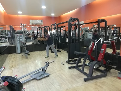
Gym nearby Football Stadium Alogiaan
Saudi Arabia
Gym nearby Football Stadium Alogiaan
Football Stadium Alogiaan
3011, An Nasiriyyah, Buraydah 52335 6408, Saudi Arabia
contacts phone
:
+966
Latitude:
26.2770935
, Longitude:
43.9893296
larger map & directions
read more
nearest Gym
2.276 km
ملاعب المها
Al Khudayra, 7186-6702, Buraydah
Gym
read more
4.32 km
ملعب البستان
Buraydah
Gym
read more
4.401 km
الملتقى الرياضي لكرة الطائرة
البساتين،, Buraydah
Gym
read more
4.942 km
الملعب الهولندي فرع الروابي
8205 الروابي بريدة 52328
Gym
read more
5.417 km
Relax the Body
7401, 3336, Buraydah
Gym
read more
6.514 km
نادي بلاتينيوم للياقة وكمال الاجسام والمساج والحمام المغربي
Prince Faisal Ibn Mishaal Ibn Saud Road, Buraydah
Gym
read more
6.541 km
نادي بلاتينيوم
Buraydah
Gym
read more
6.544 km
بلاتنيوم جيم
4762، القويع، بريدة 52358
Gym
read more
6.547 km
نادي بلاتينيوم الرياضي
6420 طريق الأمير فيصل بن مشعل بن سعود، 4779, Buraydah
Gym
read more
6.564 km
صالة عبد الملك صالح الثواب الرياضية
طريق الأمير فيصل بن مشعل، بريدة
Gym
read more
6.674 km
أبو خالد الخالدي
2520, 7738, Buraydah
Gym
read more
6.798 km
الصالة الرياضية
Buraydah
Gym
read more
6.947 km
اسطبل البرادي
Buraydah
Gym
read more
7.505 km
ملعب الجالية
بريدة
Gym
read more
7.552 km
Smart Body
شارع التغيرة، غرب مجمع المحاكم، القصيم، بريدة
Gym
read more
7.671 km
وقت اللياقة
الطريق الدائري الداخلي - الضلع الشرقي، النقع الغربية،, Buraydah
Gym
read more
7.761 km
Fitness Here Gym
2243 At Taghirah, Buraydah
Gym
read more
7.803 km
صالة كل الرياضة
6113 At Tarafiyyah Road, Buraydah
Gym
read more
8.467 km
Sand courts
2593, Buraydah
Gym
read more
8.862 km
معلب الديربي
بريدة
Gym
read more
8.946 km
استراحة الاخوة
At Tarafiyyah Road, القصيم بريدة, Buraydah
Gym
read more
9.163 km
مسبح البركه ببريده
المليدا، بريده مخطط البركه بالقرب من، بريدة
Gym
read more
9.634 km
منتزه السليم المريدسيه
2098, Buraydah
Gym
read more
9.657 km
شاليه كيو Q
3671, 8137, Buraydah
Gym
read more
9.758 km
مشغل فن الأزياء
طريق الأمير سلطان بن عبدالعزيز، بريدة
Gym
read more
📑
all categories
Accounting
Administrative area level 1
Airport
Amusement park
Aquarium
Art gallery
Atm
Bakery
Bank
Bar
Beauty salon
Bicycle store
Book store
Bowling alley
Bus station
Cafe
Campground
Car dealer
Car rental
Car repair
Car wash
Casino
Cemetery
Church
City hall
Clothing store
Colloquial area
Convenience store
Country
Courthouse
Dentist
Department store
Doctor
Electrician
Electronics store
Embassy
Finance
Fire station
Florist
Food
Funeral home
Furniture store
Gas station
General contractor
Grocery or supermarket
Gym
Hair care
Hardware store
Health
Hindu Temple
Home goods store
Hospital
Insurance agency
Intersection
Jewelry store
Laundry
Lawyer
Library
Light rail station
Liquor store
Local government office
Locality
Locksmith
Lodging
Meal delivery
Meal takeaway
Mosque
Movie rental
Movie theater
Moving company
Museum
Natural feature
Neighborhood
Night club
Painter
Park
Parking
Pet store
Pharmacy
Physiotherapist
Place of worship
Plumber
Point of interest
Police
Political
Post office
Premise
Real estate agency
Restaurant
Roofing contractor
Route
Rv park, camping
School
Shoe store
Shopping mall
Spa
Stadium
Storage
Store
Sublocality
Subpremise
Subway station
Supermarket
Taxi stand
Train station
Transit station
Travel agency
University
Veterinary care
Zoo
sublocality level 1
↑