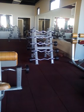
Gym nearby ملاعب المواهب الصناعية
Saudi Arabia
Gym nearby ملاعب المواهب الصناعية
ملاعب المواهب الصناعية
منطقة الزراعية, Tabuk 47318, Saudi Arabia
contacts phone
:
+966
Latitude:
28.4389175
, Longitude:
36.6164778
larger map & directions
read more
nearest Gym
1.384 km
صالة بلو بكس ( للبلياردو و البلايستيشن و كافية )
2272 طريق الامير فهد بن سلطان، منطقة الزراعية تبوك 47318
Gym
read more
1.395 km
مركز الابطال الرياضي
تبوك طريق
Gym
read more
3.298 km
شالية ١
Tabuk
Gym
read more
3.472 km
ملاعب حديقة الامراء بتبوك
Tabuk
Gym
read more
3.507 km
Princec Garden Stadium
3187 Cultivated Area Tabuk 47317
Gym
read more
3.589 km
Your Time Fitness Sports Center
Al Khawarazmi, Al Muruj، تبوك
Gym
read more
3.723 km
Academy of Sport City
4661, Tabuk
Gym
read more
4.133 km
صالون دار الاسترخاء
شارع ابى بكر الصديق، تبوك
Gym
read more
4.22 km
Prince Fahd bin Sultan Sports Center
3862, Tabuk
Gym
read more
4.359 km
Playgrounds elite football
4455, منطقة الزراعية،, Tabuk
Gym
read more
4.611 km
القرية المائية
15, Tabuk
Gym
read more
4.747 km
Al Salheen Gym, Tabuk
Tabuk
Gym
read more
4.834 km
نادي الوطني السعودي–
7646, Tabuk
Gym
read more
5.154 km
دارين سنتر النسائي
6917 تبوك 47315
Gym
read more
5.174 km
مركز دارين الرياضي للسيدات
6917, Tabuk
Gym
read more
5.287 km
ملعب برشلونة
2241, منطقة الزراعية, Tabuk
Gym
read more
5.319 km
Badawi Sports Center
Prince Fahad Ibn Sultan, Tabuk
Gym
read more
5.327 km
Dar al-Yazid Sports
Prince Mamduh Ibn Abdul Aziz, Tabuk
Gym
read more
5.382 km
صالون ركن الاسترخاء للمساج والحمام المغربى وتجهيز العرسان
Abi Bakr As Siddiq, Tabuk
Gym
read more
5.512 km
Hamdan Toys Center
8259 طريق الملك عبدالله بن عبدالعزيز, المروج ب, Tabuk
Gym
read more
5.548 km
مركز فتاة الشمال
تبوك
Gym
read more
5.63 km
body masters
3411, Tabuk
Gym
read more
5.758 km
نادي فتنس تايم تبوك
Tabuk
Gym
read more
5.763 km
وقت اللياقة للرجال
Tabuk
Gym
read more
5.888 km
وقت اللياقة النسائي
Tabuk
Gym
read more
📑
all categories
Accounting
Administrative area level 1
Airport
Amusement park
Aquarium
Art gallery
Atm
Bakery
Bank
Bar
Beauty salon
Bicycle store
Book store
Bowling alley
Bus station
Cafe
Campground
Car dealer
Car rental
Car repair
Car wash
Casino
Cemetery
Church
City hall
Clothing store
Colloquial area
Convenience store
Country
Courthouse
Dentist
Department store
Doctor
Electrician
Electronics store
Embassy
Finance
Fire station
Florist
Food
Funeral home
Furniture store
Gas station
General contractor
Grocery or supermarket
Gym
Hair care
Hardware store
Health
Hindu Temple
Home goods store
Hospital
Insurance agency
Intersection
Jewelry store
Laundry
Lawyer
Library
Light rail station
Liquor store
Local government office
Locality
Locksmith
Lodging
Meal delivery
Meal takeaway
Mosque
Movie rental
Movie theater
Moving company
Museum
Natural feature
Neighborhood
Night club
Painter
Park
Parking
Pet store
Pharmacy
Physiotherapist
Place of worship
Plumber
Point of interest
Police
Political
Post office
Premise
Real estate agency
Restaurant
Roofing contractor
Route
Rv park, camping
School
Shoe store
Shopping mall
Spa
Stadium
Storage
Store
Sublocality
Subpremise
Subway station
Supermarket
Taxi stand
Train station
Transit station
Travel agency
University
Veterinary care
Zoo
sublocality level 1
↑