Health nearby Bab makkah polyclinic
Saudi Arabia
Health nearby Bab makkah polyclinic
Bab makkah polyclinic
Mawqif Makkah, As Sabeel, جدة, SA Saudi Arabia
contacts phone
:
+966 12 644 3344
Latitude:
21.4835417
, Longitude:
39.1979533
larger map & directions
read more
nearest Health
165 m
HIBA ASIA POLYCLINIC-2 BABMAKKAH
Al Kawakib As Sairah, Jeddah
Health
read more
526 m
Faisal clinic 1
Tulaytila, Jeddah
Health
read more
613 m
صيدلية المجتمع الحديثه 8
6688 زقاق النفيس, Al Balad District, 3696,, Jeddah
Health
read more
618 m
Ibtasamet
Jeddah
Health
read more
707 m
مستوصف حي السبيل الطبي
Saudi Arabia
Health
read more
778 m
Al Fateh Clinics
Old Makkah Road, Jeddah
Health
read more
864 m
مكز صحي
Jeddah
Health
read more
869 m
United pharmacy
7205 Old Makkah Road, Jeddah
Health
read more
893 m
صيدلية الجمل
7205 Old Makkah Road, Jeddah
Health
read more
897 m
فرع خيام السنيدي في جدة أو وكيلهم
6710 اليمن، Al Balad District, Jeddah 22236 3414
Health
read more
1.065 km
العمارية وادي الضحيه
Jeddah
Health
read more
1.076 km
الشركه السعودية للتوريدات ( باناجه )
7427 Old Makkah Road, Al Ammariyah District, Jeddah
Health
read more
1.12 km
Jamjoom Medicine Store
طريق مكة القديم, Jeddah
Health
read more
1.138 km
Tamer
Jeddah
Health
read more
1.314 km
Alwasfa Alhaditha 2
Jeddah
Health
read more
1.496 km
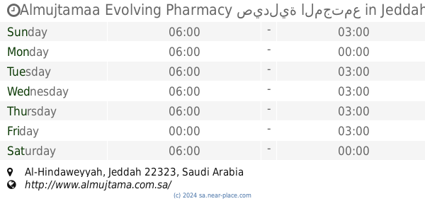
Almujtamaa Evolving Pharmacy صيدلية المجتمع
Jeddah
Health
read more
1.512 km
Ammar Pharmacy
6704 King Abdul Aziz, Jeddah
Health
read more
1.554 km
New Family Polyclinic
Abha, Jeddah
Health
read more
1.572 km
مستوصف التسامح النزلة
2663 Ahmad Tabarah, حي النزلة اليمانية،, Jeddah
Health
read more
1.704 km
DXN
Jeddah
Health
read more
1.773 km
شركة مجمع ربيع المملكة الطبي
Jeddah
Health
read more
1.845 km
صيدلية البترجي شارع المدارس
5090 البسيطين, Al Baghdadiyah Ash Sharqiyah District, Jeddah
Health
read more
1.875 km
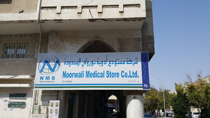
Drugstore Noreli Company Limited
Al Dhahab, Jeddah
Health
read more
1.986 km
صيدلية اسيا
Jeddah
Health
read more
2.003 km
Al Hijaz Pharmacy
Jeddah
Health
read more
📑
all categories
Accounting
Administrative area level 1
Airport
Amusement park
Aquarium
Art gallery
Atm
Bakery
Bank
Bar
Beauty salon
Bicycle store
Book store
Bowling alley
Bus station
Cafe
Campground
Car dealer
Car rental
Car repair
Car wash
Casino
Cemetery
Church
City hall
Clothing store
Colloquial area
Convenience store
Country
Courthouse
Dentist
Department store
Doctor
Electrician
Electronics store
Embassy
Finance
Fire station
Florist
Food
Funeral home
Furniture store
Gas station
General contractor
Grocery or supermarket
Gym
Hair care
Hardware store
Health
Hindu Temple
Home goods store
Hospital
Insurance agency
Intersection
Jewelry store
Laundry
Lawyer
Library
Light rail station
Liquor store
Local government office
Locality
Locksmith
Lodging
Meal delivery
Meal takeaway
Mosque
Movie rental
Movie theater
Moving company
Museum
Natural feature
Neighborhood
Night club
Painter
Park
Parking
Pet store
Pharmacy
Physiotherapist
Place of worship
Plumber
Point of interest
Police
Political
Post office
Premise
Real estate agency
Restaurant
Roofing contractor
Route
Rv park, camping
School
Shoe store
Shopping mall
Spa
Stadium
Storage
Store
Sublocality
Subpremise
Subway station
Supermarket
Taxi stand
Train station
Transit station
Travel agency
University
Veterinary care
Zoo
sublocality level 1
↑