Health nearby Nahdi
Saudi Arabia
Health nearby Nahdi
Nahdi
King Abdul Aziz Sub-Road, Coral, Pour، الرياض Saudi Arabia
contacts phone
:
+966
Latitude:
24.593139
, Longitude:
46.757971
read more
nearest Health
266 m
صيدلية اريج السقاف رقم 2 Pharmacy
Shabab, 6405, 6559, Riyadh
Health
read more
270 m
صيدلية اريج السقاف رقم 2 Pharmacy
Shabab, Riyadh
Health
read more
1.496 km
عيادة نحو النجاح للحجامة
الطريق الدائري الجنوبي - المنصورة مخرج 19 أمام الهرم بلازا, Riyadh
Health
read more
1.519 km
عيادة نحو النجاح للحجامة
الطريق الدائري الجنوبي - المنصورة، الرياض
Health
read more
1.547 km
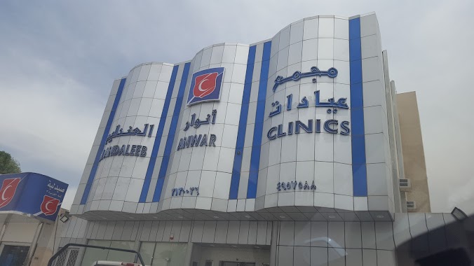
مجمع عيادات أنوار العندليب الطبية
7341 Al Aziziah Road, Riyadh
Health
read more
1.692 km
صيدلية السقاف الطبية رقم 2
An Nasr Road, Riyadh
Health
read more
1.831 km
Al Saggaf Pharmacy no. 26
Mohammad Rashid Rida, 7870-7846, Riyadh
Health
read more
1.893 km
مجمع العزيزية الطبي الأهلي
العزيزية،, Riyadh
Health
read more
1.903 km
Aziziyah Medical Clinic
Abdullah Ibn Muhammad At Tilmisani, Riyadh
Health
read more
2.002 km
مركز الرعاية الصحية الأولية حي المنصورة
الرياض
Health
read more
2.018 km
Dora complex medical clinics for Mar
7741 Mohammad Rashid Rida, Riyadh
Health
read more
2.021 km
مركز صحي المنصورة
Shabab, Riyadh
Health
read more
2.31 km
مؤسسة أصل الرعاية لمرضى السكري والضغط وذوي الإحتياجات الخاصة
معن بن زائدة، حي العزيزية، الرياض
Health
read more
2.394 km
صيدلية علي عبدالله النهدي
7433 Mohammad Rashid Rida, 4270, Riyadh
Health
read more
2.432 km
منارة الأندلس
Riyadh
Health
read more
2.489 km
Ruff Medical Complex
Mansur Ibn Al Mutamir, Riyadh
Health
read more
2.609 km
صيدليه السقاف الطبيه رقم 20
Maan Bin Zaida Street, Riyadh
Health
read more
2.911 km
Warehouse Saudi Center Pharmaceutical Company
4320, Riyadh
Health
read more
2.996 km
مركز إسعاف الخالدية
6805 Al Khalifah Al Mamun, Riyadh
Health
read more
2.996 km
هيئة الهلال الأحمر السعودي
6794 Ibn Muhadhab, Riyadh
Health
read more
3.103 km
مركز إسعاف الدار البيضاء
4258 طريق فتح مكة, Riyadh
Health
read more
3.126 km
مؤسسة بدرالمملكة للخدمات التجارية
مستوصف منفوحة الاهلي, Riyadh
Health
read more
3.136 km
صيدلية تفاصيل الدواء (1)
Arafat Branch Road, Riyadh
Health
read more
3.15 km
مستوصف حكومي
2772 Tahir Ibn Muhammad, Riyadh
Health
read more
3.151 km
مركز صحي منفوحة القديمة
رويضات، منفوحة، الرياض
Health
read more
📑
all categories
Accounting
Administrative area level 1
Airport
Amusement park
Aquarium
Art gallery
Atm
Bakery
Bank
Bar
Beauty salon
Bicycle store
Book store
Bowling alley
Bus station
Cafe
Campground
Car dealer
Car rental
Car repair
Car wash
Casino
Cemetery
Church
City hall
Clothing store
Colloquial area
Convenience store
Country
Courthouse
Dentist
Department store
Doctor
Electrician
Electronics store
Embassy
Finance
Fire station
Florist
Food
Funeral home
Furniture store
Gas station
General contractor
Grocery or supermarket
Gym
Hair care
Hardware store
Health
Hindu Temple
Home goods store
Hospital
Insurance agency
Intersection
Jewelry store
Laundry
Lawyer
Library
Light rail station
Liquor store
Local government office
Locality
Locksmith
Lodging
Meal delivery
Meal takeaway
Mosque
Movie rental
Movie theater
Moving company
Museum
Natural feature
Neighborhood
Night club
Painter
Park
Parking
Pet store
Pharmacy
Physiotherapist
Place of worship
Plumber
Point of interest
Police
Political
Post office
Premise
Real estate agency
Restaurant
Roofing contractor
Route
Rv park, camping
School
Shoe store
Shopping mall
Spa
Stadium
Storage
Store
Sublocality
Subpremise
Subway station
Supermarket
Taxi stand
Train station
Transit station
Travel agency
University
Veterinary care
Zoo
sublocality level 1
↑