Health nearby شركة محمد عبدالرحيم ياسين وشركاه للخدمات الطبية
Saudi Arabia
Health nearby شركة محمد عبدالرحيم ياسين وشركاه للخدمات الطبية
شركة محمد عبدالرحيم ياسين وشركاه للخدمات الطبية
حي النخيل، جدة Arabia Saudyjska
contacts phone
:
+966
Latitude:
21.539277
, Longitude:
39.2582927
read more
nearest Health
69 m
United Pharmaceutical Company
سليمان ال الشيخ, Jeddah
Health
read more
185 m
Dawhet AsSham Drug Store
سليمان ال الشيخ, Jeddah
Health
read more
205 m
شركة الأمين للتجهيزات الطبية والعلمية
3925, An Nakhil District, Jeddah
Health
read more
416 m
Sitco Pharma Warehouse
سليمان ال الشيخ, Jeddah
Health
read more
532 m
شركة مخزن الأدوية العربي السعودي
Jeddah
Health
read more
660 m
مستودع شركة دوحة الشام الطبية
8400, حي النخيل،, Jeddah
Health
read more
1.02 km
Arabian Health Care Supplay Company(AHCSC) Ware Houseالشركة العربية للوازم الطبية العليان
3365, An Nakhil District 8262, Jeddah
Health
read more
1.166 km
United Pharmacy Group Warehouse
2605, An Nakhil District, Jeddah
Health
read more
1.216 km
Tamimi DRUGSTORE
7850, An Nakhil District, 4452,, Jeddah
Health
read more
1.662 km
مستودع صيدلية المجتمع الحديثة
7990, An Nakhil District, 2709,, Jeddah
Health
read more
2.14 km
Pharmacy Eshraqa
8818 Abdul Karim Al Qashiri, Bani Malik District, Jeddah 23235
Health
read more
2.251 km
Medical clinic
ابراهيم بن محمد التميمي, Jeddah
Health
read more
2.483 km
Nahdi Warehouse
Jeddah
Health
read more
2.878 km
شركة الدواء للخدمات الطبية
3678 King Abdullah Road, حي النخيل, Jeddah
Health
read more
2.92 km
Nahdy Pharmacy
الواحة, Jeddah
Health
read more
3.041 km
صيدية المجتمع
Jeddah
Health
read more
3.135 km
مركز صحي حي النسيم
إياس بن اوس إياس بن اوس, Jeddah
Health
read more
3.195 km
Qoizh ambulance center
Abdulah Ibn Abi Ayash, Jeddah
Health
read more
3.208 km
JPFCM
3092, Bani Malik District, Jeddah
Health
read more
3.274 km
Lumiere Skin Clinic
6586 Abi Dharr Alghifari St, Jeddah
Health
read more
3.334 km
Medical clinic Zafer
King Abdullah Road, Jeddah
Health
read more
3.336 km
مجمع الظافر الطبي العام
Abdul Rahman Azzam, Jeddah
Health
read more
3.479 km
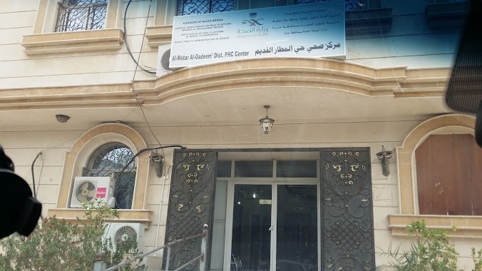
Health Center Old Airport مركز صحي حي المطار القديم
إياس بن اوس, Jeddah
Health
read more
3.482 km
Al-Rehab Public Health Center
4553 البحرين, AR Rihab District, Jeddah
Health
read more
3.619 km
New Afaq Pharmacy
7076 Um Almuminin Sawdah, An Nasim District,, Jeddah
Health
read more
📑
all categories
Accounting
Administrative area level 1
Airport
Amusement park
Aquarium
Art gallery
Atm
Bakery
Bank
Bar
Beauty salon
Bicycle store
Book store
Bowling alley
Bus station
Cafe
Campground
Car dealer
Car rental
Car repair
Car wash
Casino
Cemetery
Church
City hall
Clothing store
Colloquial area
Convenience store
Country
Courthouse
Dentist
Department store
Doctor
Electrician
Electronics store
Embassy
Finance
Fire station
Florist
Food
Funeral home
Furniture store
Gas station
General contractor
Grocery or supermarket
Gym
Hair care
Hardware store
Health
Hindu Temple
Home goods store
Hospital
Insurance agency
Intersection
Jewelry store
Laundry
Lawyer
Library
Light rail station
Liquor store
Local government office
Locality
Locksmith
Lodging
Meal delivery
Meal takeaway
Mosque
Movie rental
Movie theater
Moving company
Museum
Natural feature
Neighborhood
Night club
Painter
Park
Parking
Pet store
Pharmacy
Physiotherapist
Place of worship
Plumber
Point of interest
Police
Political
Post office
Premise
Real estate agency
Restaurant
Roofing contractor
Route
Rv park, camping
School
Shoe store
Shopping mall
Spa
Stadium
Storage
Store
Sublocality
Subpremise
Subway station
Supermarket
Taxi stand
Train station
Transit station
Travel agency
University
Veterinary care
Zoo
sublocality level 1
↑