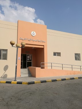
Health nearby Women's Health Care Center
Saudi Arabia
Health nearby Women's Health Care Center
Women's Health Care Center
Zain Alabideen Street, 32466, Anak, SA Saudi Arabia
contacts phone
:
+966 55 518 4775
Latitude:
26.5162849
, Longitude:
49.9963175
larger map & directions
read more
nearest Health
142 m
جمال العيون للنظارات
2904 Al Imam Zayn Al Abidin, 6102, Anak
Health
read more
321 m
مستوصف الجش
6108, Anak
Health
read more
328 m
Aljesh PHC
Anak
Health
read more
715 m
Dispensary Association Umm Al-Hamam Charity
Anak
Health
read more
1.081 km
Red Crescent Authority
شارع الحزام, Anak
Health
read more
2.164 km
Red crescent
Al Qatif
Health
read more
2.187 km
مركز اسعاف القطيف ٢
Al Qatif
Health
read more
2.264 km
مركز الهلال الأحمر
7834, Al Qatif
Health
read more
2.326 km
صيدليه المرعى
7463 King Abdulaziz Road, Anak
Health
read more
2.369 km
Red Crescent - Qatif 2
7834, 4206, Al Qatif
Health
read more
2.412 km
ابوعيشة السوداني
Unnamed Road, Anak
Health
read more
2.606 km
Hillat Mahaish PHC
Al Qatif
Health
read more
2.989 km
Jarudia PHC
Badr Street, Al Qatif
Health
read more
3.06 km
Out patient clinics in qatif central hospital
3139, Al Qatif
Health
read more
3.106 km
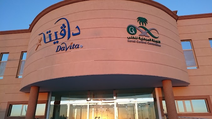
Dawita Qatif Central Hospital dialysis center in Qatif
Al Qatif
Health
read more
3.114 km
مركز غسيل الكلى بمستشفى القطيف المركزي
القطيف المركزي, Al Qatif
Health
read more
3.187 km
مستوصف عنك الطبي
Anak
Health
read more
3.395 km
مؤسسة حجر العين التجارية
Al Qatif
Health
read more
3.468 km
Integration Physical Therapy Center
Al Qatif
Health
read more
3.521 km
ATCo Medical Qatif KSA
3836, Warehouse Area,, Al Qatif
Health
read more
3.526 km
مستودع المهنا
3836, Warehouse Area,, Al Qatif
Health
read more
3.598 km
الرعاية الصحية
Al Qatif
Health
read more
3.604 km
Shwiakah PHC
King Abdulaziz Road, Al Qatif
Health
read more
3.658 km
مستشار قانوني محمد ابراهيم البنا
شارع سلمان الفارسي Salman Alfarisi Street, Anak
Health
read more
3.664 km
مركز اسعاف عنك الهلال الاحمر
3521 Al Qismah Street, Anak
Health
read more
📑
all categories
Accounting
Administrative area level 1
Airport
Amusement park
Aquarium
Art gallery
Atm
Bakery
Bank
Bar
Beauty salon
Bicycle store
Book store
Bowling alley
Bus station
Cafe
Campground
Car dealer
Car rental
Car repair
Car wash
Casino
Cemetery
Church
City hall
Clothing store
Colloquial area
Convenience store
Country
Courthouse
Dentist
Department store
Doctor
Electrician
Electronics store
Embassy
Finance
Fire station
Florist
Food
Funeral home
Furniture store
Gas station
General contractor
Grocery or supermarket
Gym
Hair care
Hardware store
Health
Hindu Temple
Home goods store
Hospital
Insurance agency
Intersection
Jewelry store
Laundry
Lawyer
Library
Light rail station
Liquor store
Local government office
Locality
Locksmith
Lodging
Meal delivery
Meal takeaway
Mosque
Movie rental
Movie theater
Moving company
Museum
Natural feature
Neighborhood
Night club
Painter
Park
Parking
Pet store
Pharmacy
Physiotherapist
Place of worship
Plumber
Point of interest
Police
Political
Post office
Premise
Real estate agency
Restaurant
Roofing contractor
Route
Rv park, camping
School
Shoe store
Shopping mall
Spa
Stadium
Storage
Store
Sublocality
Subpremise
Subway station
Supermarket
Taxi stand
Train station
Transit station
Travel agency
University
Veterinary care
Zoo
sublocality level 1
↑