Hospital nearby 21st Evacuation Hospital
Saudi Arabia
Hospital nearby 21st Evacuation Hospital
21st Evacuation Hospital
Dhahran Saudi Arabia
contacts phone
:
+966
Latitude:
26.2378194
, Longitude:
50.1262325
read more
nearest Hospital
2.698 km
مستشفى صقر السلام بالقاعده
قاعدة الملك عبدالعزيز الجوية،, Dhahran
Hospital
read more
4.67 km
المبنى الرئيسي
Al Khobar
Hospital
read more
4.766 km
Governmental Khobar Hospital
Al Khobar
Hospital
read more
4.768 km
Alkhobar Central Hospital
Al Khobar
Hospital
read more
5.285 km
King Khalid Medical City
Cooperative Council Road, Dhahran
Hospital
read more
5.7 km
King AbdhulAziz Airbase Armed Force Hospital
Dhahran
Hospital
read more
5.743 km
Airbase Hospital
Dhahran
Hospital
read more
6.355 km
مخطط٤٣ حرف الف
3361, Al Khobar
Hospital
read more
7.031 km
مركز صحي الخزامى بالخبر
9 B Street, 6 34719, Al Khobar
Hospital
read more
7.384 km
Silver Crescent Clinic
21st Street, Al Khobar
Hospital
read more
7.518 km
Silver Cresent Pharmacy
Tabuk Street, Al Khobar
Hospital
read more
7.56 km
kingsalman military hospital
Tabuk Street, Al Khobar
Hospital
read more
7.734 km
Horizon Medical Solutions
11th St 11th Street, Al Khobar
Hospital
read more
7.872 km
امير الزقزوق
Al Khobar
Hospital
read more
7.889 km
The Medical Center
Medical Center Drive, Dhahran
Hospital
read more
7.89 km
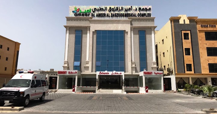
Dr.Ameer Al Zagzoog Medical Complex
Al Khobar
Hospital
read more
7.89 km
KFUPM Medical Center
Medical Center Drive, Dhahran
Hospital
read more
7.921 km
رعاية الأورام - ارامكو
Dhahran
Hospital
read more
7.927 km
JHAH Risk Mgmt
Modular 5816 7965, Dhahran
Hospital
read more
7.939 km
Cancer Care Centre, JHAH
8027, Dhahran
Hospital
read more
7.94 km
Hospital Aramco
8027, Dhahran
Hospital
read more
7.944 km
مركز رعاية الدم
8027, Dhahran
Hospital
read more
7.945 km
JHAH Day Surgery عمليات اليوم الواحد
Dhahran
Hospital
read more
7.95 km
Clinic of Community Counseling
5140, Dhahran
Hospital
read more
7.956 km
Abdul Wahid Al Omari clinic
23 Street, Al Khobar
Hospital
read more
📑
all categories
Accounting
Administrative area level 1
Airport
Amusement park
Aquarium
Art gallery
Atm
Bakery
Bank
Bar
Beauty salon
Bicycle store
Book store
Bowling alley
Bus station
Cafe
Campground
Car dealer
Car rental
Car repair
Car wash
Casino
Cemetery
Church
City hall
Clothing store
Colloquial area
Convenience store
Country
Courthouse
Dentist
Department store
Doctor
Electrician
Electronics store
Embassy
Finance
Fire station
Florist
Food
Funeral home
Furniture store
Gas station
General contractor
Grocery or supermarket
Gym
Hair care
Hardware store
Health
Hindu Temple
Home goods store
Hospital
Insurance agency
Intersection
Jewelry store
Laundry
Lawyer
Library
Light rail station
Liquor store
Local government office
Locality
Locksmith
Lodging
Meal delivery
Meal takeaway
Mosque
Movie rental
Movie theater
Moving company
Museum
Natural feature
Neighborhood
Night club
Painter
Park
Parking
Pet store
Pharmacy
Physiotherapist
Place of worship
Plumber
Point of interest
Police
Political
Post office
Premise
Real estate agency
Restaurant
Roofing contractor
Route
Rv park, camping
School
Shoe store
Shopping mall
Spa
Stadium
Storage
Store
Sublocality
Subpremise
Subway station
Supermarket
Taxi stand
Train station
Transit station
Travel agency
University
Veterinary care
Zoo
sublocality level 1
↑