Lodging nearby Alfursan Hotel
Saudi Arabia
Lodging nearby Alfursan Hotel
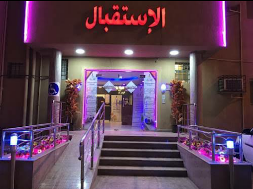
Alfursan Hotel
Jazan Arabia Saudyjska
contacts phone
:
+966
Latitude:
16.8992746
, Longitude:
42.5683683
read more
nearest Lodging
106 m
Park Jizan 2
4768 Airport Road, Jazan
Lodging
read more
152 m
فندق سما 1
6692, Jazan
Lodging
read more
182 m
Al Eairy Furnished Apartments Jizan 3
Airport Road, Jazan
Lodging
read more
191 m
فندق سما جيزان
141 B Street, Jazan
Lodging
read more
223 m
Alnaseria 4 Hotel
Airport Road, Jazan
Lodging
read more
277 m
Life Jazan Hotel Apartments
Airport Road, Jazan
Lodging
read more
397 m
Naseem Jizan Furnished Residential Units
4267-4414 Airport Road, Jazan
Lodging
read more
398 m
Rawdhat Jazan Hotel
Airport Road, Jazan
Lodging
read more
472 m
Salam Jazan Hotel
Airport Road, Jazan
Lodging
read more
476 m
Durrat Jazan Hotel
Airport Road, Jazan
Lodging
read more
500 m
Alhinawi Hotel
4267 Airport Road, 4414, Jazan
Lodging
read more
640 m
Adnan Hotelu
شارع الأمير أحمد بن عبد العزيز, Jazan
Lodging
read more
660 m
Alsalam Hotel
Airport Road, Jazan
Lodging
read more
733 m
فندق حياة نوماس
شارع 28 أ،, Jazan
Lodging
read more
740 m
Qasr Palace Hotel
Jazan
Lodging
read more
813 m
Baisaan residential units
شارع 24 أ, Jazan
Lodging
read more
966 m
Rooz Alsalemya Hotel
Prince Sultan Bin Abdul Aziz, Jazan
Lodging
read more
1.009 km
قصر الروضة للاحتفالات الكبرى
شارع الأمير طلال بن عبد العزيز, Jazan
Lodging
read more
1.036 km
ہوٹل جزان
Prince Sultan Road, Jazan
Lodging
read more
1.044 km
Pink Flowe
7587, Jazan
Lodging
read more
1.054 km
Alqasr Palace Hotel
طريق الامير سلطان بن عبد العزيز, Jazan
Lodging
read more
1.055 km
زهرة المنار2 للوحدات السكنية المفروشة
شارع 11 ب،, Jazan
Lodging
read more
1.111 km
Beauty Rayan Hotel 2
Prince Sultan Bin Abdul Aziz, Jazan
Lodging
read more
1.231 km
Aseel Hotel
Jazan
Lodging
read more
1.238 km
اركان الندى
المطار، السويس،
Lodging
read more
📑
all categories
Accounting
Administrative area level 1
Airport
Amusement park
Aquarium
Art gallery
Atm
Bakery
Bank
Bar
Beauty salon
Bicycle store
Book store
Bowling alley
Bus station
Cafe
Campground
Car dealer
Car rental
Car repair
Car wash
Casino
Cemetery
Church
City hall
Clothing store
Colloquial area
Convenience store
Country
Courthouse
Dentist
Department store
Doctor
Electrician
Electronics store
Embassy
Finance
Fire station
Florist
Food
Funeral home
Furniture store
Gas station
General contractor
Grocery or supermarket
Gym
Hair care
Hardware store
Health
Hindu Temple
Home goods store
Hospital
Insurance agency
Intersection
Jewelry store
Laundry
Lawyer
Library
Light rail station
Liquor store
Local government office
Locality
Locksmith
Lodging
Meal delivery
Meal takeaway
Mosque
Movie rental
Movie theater
Moving company
Museum
Natural feature
Neighborhood
Night club
Painter
Park
Parking
Pet store
Pharmacy
Physiotherapist
Place of worship
Plumber
Point of interest
Police
Political
Post office
Premise
Real estate agency
Restaurant
Roofing contractor
Route
Rv park, camping
School
Shoe store
Shopping mall
Spa
Stadium
Storage
Store
Sublocality
Subpremise
Subway station
Supermarket
Taxi stand
Train station
Transit station
Travel agency
University
Veterinary care
Zoo
sublocality level 1
↑