Lodging nearby Arabs compartment housing units
Saudi Arabia
Lodging nearby Arabs compartment housing units
Arabs compartment housing units
Sharorah 68342, Saudi Arabia
contacts phone
:
+966 17 532 3535
Latitude:
17.4926892
, Longitude:
47.1017355
larger map & directions
read more
nearest Lodging
189 m
Ranz sharourah
Sharorah
Lodging
read more
203 m
فندق رينز إن شرورة
Sharorah
Lodging
read more
313 m
Sahara Hotel - iniquities
6222, Sharorah
Lodging
read more
470 m
Qasr Al Howaizy Apartments
شارع الثلاثين حي الفهد خلف حديد الفوزان القديم مقابل خلاط بن معيقل, Sharorah
Lodging
read more
674 m
الربوة لغرف العزاب المفروشه
الفهد،, Sharorah
Lodging
read more
739 m
Shawamekh Towers
شارع الملك عبدالعزيز,مقابل مطعم الكندي , مخطط أ، شرورة
Lodging
read more
740 m
الشامخة للوحدات السكنية
الفهد،, Sharorah
Lodging
read more
775 m
Gulf Plaza
8344, Sharorah
Lodging
read more
832 m
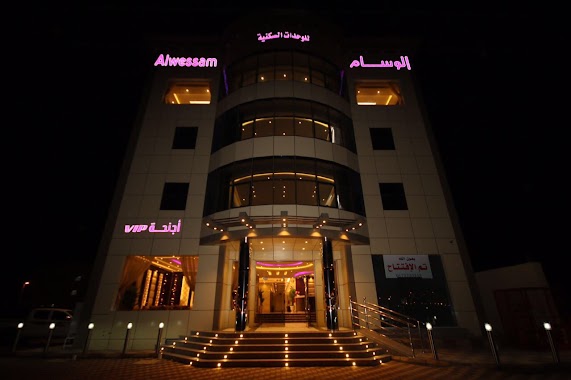
فندق الوسام
6342, Sharorah
Lodging
read more
833 m
Dary Furnished Apartments
Sharorah
Lodging
read more
833 m
الوسام للوحدات السكنية
Sharorah
Lodging
read more
972 m
AL - HAMMAMI HOTEL
شارع الملك عبدالله، الفهد، شرورة
Lodging
read more
972 m
فندق الهمامي
الفهد، شرورة
Lodging
read more
988 m
Al Hayat Plaza
7363, Sharorah
Lodging
read more
990 m
فندق بيونهه
شرورة
Lodging
read more
992 m
مجمع البركة للعزاب
Unnamed Road, Sharorah
Lodging
read more
1.007 km
مجمع البركه للعزاب
7585، السوق، شرورة 68372
Lodging
read more
1.089 km
قصر بينونة للوحدات السكنية /مساعد الصمصوم الحارثي
7029, 2375،, Sharorah
Lodging
read more
1.091 km
Baynonah Hotel
7029, Sharorah
Lodging
read more
1.136 km
فندق المحمل
3316, Sharorah
Lodging
read more
1.193 km
فندق اجا
Sharorah
Lodging
read more
1.25 km
High House Hotel
6481, Sharorah
Lodging
read more
1.252 km
High House Apartment
6246, 2575, Sharorah
Lodging
read more
1.34 km
فندق ياهلا
6890, 3218, Sharorah
Lodging
read more
1.415 km
Welfare Title
7410, Sharorah
Lodging
read more
📑
all categories
Accounting
Administrative area level 1
Airport
Amusement park
Aquarium
Art gallery
Atm
Bakery
Bank
Bar
Beauty salon
Bicycle store
Book store
Bowling alley
Bus station
Cafe
Campground
Car dealer
Car rental
Car repair
Car wash
Casino
Cemetery
Church
City hall
Clothing store
Colloquial area
Convenience store
Country
Courthouse
Dentist
Department store
Doctor
Electrician
Electronics store
Embassy
Finance
Fire station
Florist
Food
Funeral home
Furniture store
Gas station
General contractor
Grocery or supermarket
Gym
Hair care
Hardware store
Health
Hindu Temple
Home goods store
Hospital
Insurance agency
Intersection
Jewelry store
Laundry
Lawyer
Library
Light rail station
Liquor store
Local government office
Locality
Locksmith
Lodging
Meal delivery
Meal takeaway
Mosque
Movie rental
Movie theater
Moving company
Museum
Natural feature
Neighborhood
Night club
Painter
Park
Parking
Pet store
Pharmacy
Physiotherapist
Place of worship
Plumber
Point of interest
Police
Political
Post office
Premise
Real estate agency
Restaurant
Roofing contractor
Route
Rv park, camping
School
Shoe store
Shopping mall
Spa
Stadium
Storage
Store
Sublocality
Subpremise
Subway station
Supermarket
Taxi stand
Train station
Transit station
Travel agency
University
Veterinary care
Zoo
sublocality level 1
↑