Lodging nearby أزاهير للشقق الفندقية
Saudi Arabia
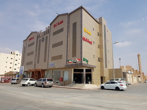
Lodging nearby أزاهير للشقق الفندقية
أزاهير للشقق الفندقية
King Khalid Road, 52387, Buraydah, SA Saudi Arabia
contacts phone
:
+966 55 748 1715
Latitude:
26.3911425
, Longitude:
43.951776
larger map & directions
read more
nearest Lodging
12 m
اجنحة ازاهير الفندقية
طريق الملك خالد،، بريدة
Lodging
read more
83 m
Elaf Aparthotel
King Khalid Road القصيم - بريده - طريق الملك خالد, Buraydah
Lodging
read more
259 m
نجمة الافق
8187, الجامعيين 3370, Buraydah
Lodging
read more
311 m
حياة الأفق للوحدات السكنية المفروشة
طريق الملك خالد، الأفق، بريدة
Lodging
read more
328 m
حياة الافق
King Khalid Road, Buraydah
Lodging
read more
356 m
حياة الأفق للوحدات السكنية المفروشة
8123, Buraydah
Lodging
read more
532 m
فضة تالا للوحدات السكنية
شارع الورود، حي الأفق، بريدة
Lodging
read more
549 m
شقق عزاب
طريق الملك خالد، الورود، بريدة
Lodging
read more
549 m
شقق عزاب
King Khalid Road, Buraydah
Lodging
read more
593 m
دار بلقيس وحدات سكنية
7901, الجامعيين 3506, Buraydah
Lodging
read more
619 m
ARJWAN Hotel
2932, Buraydah
Lodging
read more
625 m
Orjwan Hotel
2932, Buraydah
Lodging
read more
657 m
ارجوان للشقق الفندقية
Buraydah
Lodging
read more
732 m
Buraidah Hotel
King Khalid Road, Buraydah
Lodging
read more
737 m
Yen Nights Hotel Suites
King Khalid Road, Buraydah
Lodging
read more
760 m
Alebreez Palace
Buraydah
Lodging
read more
873 m
استراحة تالين للمناسبات
Buraydah
Lodging
read more
880 m
Al Apreez Palace 2 ApartHotel
القصيم - بريدة - الاوفك, Buraydah
Lodging
read more
988 m
فلل البستاتين
Unnamed Road, Buraydah
Lodging
read more
1.032 km
بيت الشيخ سعود علي السعودالصقري
الأفق، بريدة
Lodging
read more
1.089 km
Juicy Palace Hotel Suites
4051 طريق علي بن أبي طالب، الاخضر، بريدة 52385 7618 Ali Ibn Abi Talib Road, Buraydah
Lodging
read more
1.216 km
Student House
Buraydah
Lodging
read more
1.254 km
شقق روز بريده
طريق أبو بكر الصديق،، بريدة
Lodging
read more
1.304 km
Masia Hamra Hotel
9412, Buraydah
Lodging
read more
1.379 km
شقق الاسكان
طريق أبو بكر الصديق،، بريدة
Lodging
read more
📑
all categories
Accounting
Administrative area level 1
Airport
Amusement park
Aquarium
Art gallery
Atm
Bakery
Bank
Bar
Beauty salon
Bicycle store
Book store
Bowling alley
Bus station
Cafe
Campground
Car dealer
Car rental
Car repair
Car wash
Casino
Cemetery
Church
City hall
Clothing store
Colloquial area
Convenience store
Country
Courthouse
Dentist
Department store
Doctor
Electrician
Electronics store
Embassy
Finance
Fire station
Florist
Food
Funeral home
Furniture store
Gas station
General contractor
Grocery or supermarket
Gym
Hair care
Hardware store
Health
Hindu Temple
Home goods store
Hospital
Insurance agency
Intersection
Jewelry store
Laundry
Lawyer
Library
Light rail station
Liquor store
Local government office
Locality
Locksmith
Lodging
Meal delivery
Meal takeaway
Mosque
Movie rental
Movie theater
Moving company
Museum
Natural feature
Neighborhood
Night club
Painter
Park
Parking
Pet store
Pharmacy
Physiotherapist
Place of worship
Plumber
Point of interest
Police
Political
Post office
Premise
Real estate agency
Restaurant
Roofing contractor
Route
Rv park, camping
School
Shoe store
Shopping mall
Spa
Stadium
Storage
Store
Sublocality
Subpremise
Subway station
Supermarket
Taxi stand
Train station
Transit station
Travel agency
University
Veterinary care
Zoo
sublocality level 1
↑