Lodging nearby فندق الطائفين
Saudi Arabia
Lodging nearby فندق الطائفين
فندق الطائفين
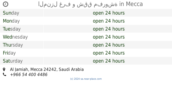
7215, طريق الطائف, 24242, Makkah, SA Saudi Arabia
contacts phone
:
+966
Latitude:
21.393687
, Longitude:
39.8706254
larger map & directions
read more
nearest Lodging
94 m
Al Rehab Al Makkiah Hotel
7108 At Taif Road, Mecca
Lodging
read more
94 m
Al Rehab Al Makkiah
7108 At Taif Road, Mecca
Lodging
read more
132 m
Hotel Junubi Azizia Masjid Hariri
3209 Ash Shaikh Abdullah Ibn Hamid, Mecca
Lodging
read more
136 m
Almizr Furnished Apartments
Mecca
Lodging
read more
140 m
شقق الرباط
الجامعة، مكة
Lodging
read more
159 m
فندق الياسر
3423 Ash Shaikh Abdullah Ibn Hamid, Mecca
Lodging
read more
169 m
برج العتيبي السكني التجاري
شارع عبد الله خياط, Mecca
Lodging
read more
186 m
فندق سلمان باقديم
Mecca
Lodging
read more
194 m
Lunar Hotel
7073 طريق الطائف, Mecca
Lodging
read more
211 m
عزاء الدحيه
Mecca
Lodging
read more
218 m
Tarik Hotel
Mecca
Lodging
read more
219 m
Roba Hijaz hotel فندق ربا الحجاز
شارع البر, 3440, Mecca
Lodging
read more
246 m
Aseel Tower Hotel
Ash Shaikh Abdullah Ibn Hamid, Mecca
Lodging
read more
255 m
Al Borj Al Aseel Hotel
The North Azizya Dst., Mecca
Lodging
read more
271 m
Charminar Hotal Makkah
شارع البر, Mecca
Lodging
read more
280 m
عمارة وقف الصائغ
3350 الايمان، الجامعة، مكة 24242 7492،
Lodging
read more
287 m
Alrsaal Hotel
7446, Mecca
Lodging
read more
298 m
Rawabi Al Azhar Hotel
7300, Mecca
Lodging
read more
305 m
Ghazzawi Hotel
3326 الايمان، الجامعة، مكة 24242 7506 Al Iman, Mecca
Lodging
read more
310 m
فندق منارة المشاعر جديد
Mecca
Lodging
read more
325 m
المنزل غرف و شقق مفروشة
Mecca
Lodging
read more
333 m
فندق منارة المشاعر
Mecca
Lodging
read more
334 m
فندق رفاف الحياة
شارع عبدالله خياط، حي العزيزية، مكة
Lodging
read more
335 m
فندق الحميدى
3574 الايمان، الجامعة مكة 24242
Lodging
read more
343 m
فندق رفاف الحياة
شارع الدعوة, Mecca
Lodging
read more
📑
all categories
Accounting
Administrative area level 1
Airport
Amusement park
Aquarium
Art gallery
Atm
Bakery
Bank
Bar
Beauty salon
Bicycle store
Book store
Bowling alley
Bus station
Cafe
Campground
Car dealer
Car rental
Car repair
Car wash
Casino
Cemetery
Church
City hall
Clothing store
Colloquial area
Convenience store
Country
Courthouse
Dentist
Department store
Doctor
Electrician
Electronics store
Embassy
Finance
Fire station
Florist
Food
Funeral home
Furniture store
Gas station
General contractor
Grocery or supermarket
Gym
Hair care
Hardware store
Health
Hindu Temple
Home goods store
Hospital
Insurance agency
Intersection
Jewelry store
Laundry
Lawyer
Library
Light rail station
Liquor store
Local government office
Locality
Locksmith
Lodging
Meal delivery
Meal takeaway
Mosque
Movie rental
Movie theater
Moving company
Museum
Natural feature
Neighborhood
Night club
Painter
Park
Parking
Pet store
Pharmacy
Physiotherapist
Place of worship
Plumber
Point of interest
Police
Political
Post office
Premise
Real estate agency
Restaurant
Roofing contractor
Route
Rv park, camping
School
Shoe store
Shopping mall
Spa
Stadium
Storage
Store
Sublocality
Subpremise
Subway station
Supermarket
Taxi stand
Train station
Transit station
Travel agency
University
Veterinary care
Zoo
sublocality level 1
↑