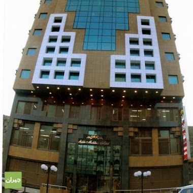
Lodging nearby فندق مواكب اجياد
Saudi Arabia
Lodging nearby فندق مواكب اجياد
فندق مواكب اجياد
8608, اجياد, 24233, Makkah, SA Saudi Arabia
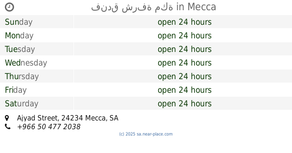
contacts phone
:
+966
Latitude:
21.4088358
, Longitude:
39.8292395
larger map & directions
read more
nearest Lodging
4 m
فندق الفصول أجياد
Mecca
Lodging
read more
5 m
Ibrahem Al Omaier Hotel
Ajyad Street, Mecca
Lodging
read more
31 m
Dar Sadn Hotel
8608 Ajyad, Mecca
Lodging
read more
41 m
فندق البركة مودة
Mecca
Lodging
read more
45 m
فندق جراند درانف
Ajyad Street, Mecca
Lodging
read more
46 m
Rawdat Al Bait Hotel
Ajyad Street, Mecca
Lodging
read more
56 m
Zümrüt
Mecca
Lodging
read more
63 m
Samah Tower برج السماح
Mecca
Lodging
read more
70 m
nokhba hotel 1
Ajyad Street, Mecca
Lodging
read more
73 m
فندق النخبة 1
8821 Ajyad Street, Ar Rawabi, Mecca 24234 2404 Ajyad Street, Mecca
Lodging
read more
88 m
فندق إبراهيم محمد الأوامير
طريق الصلواتي، الروابي،, Mecca
Lodging
read more
90 m
فندق إبراهيم الأومير
شارع أجياد، مكة المكرمة،
Lodging
read more
93 m
فندق عالية اجياد
8648 اجياد، الروابي، مكة 24233
Lodging
read more
94 m
Mona Ajyad Hotel Mecca
Ajyad Street, Mecca
Lodging
read more
96 m
Aleyat Ajyad Hotel
Ajyad Street, Mecca
Lodging
read more
105 m
Al Nokhbah 2 Hotel
8486 Ajyad Street, Ar Rawabi Makkah 24233 4207 Ajyad Street, Mecca
Lodging
read more
109 m
Nirsian Golden Hotel Ajyad
Ajyad, Reea Al Bakh street, Mecca
Lodging
read more
111 m
Proceeds hotel Bakhsh
2533, Mecca
Lodging
read more
116 m
فندق شرفة مكة
Ajyad Street, Mecca
Lodging
read more
121 m
روابي أجياد
Mecca
Lodging
read more
126 m
سليمان خياط
Ajyad Street, Mecca
Lodging
read more
129 m
6 pilgrims
طلعة ريع بخش, Mecca
Lodging
read more
133 m
فندق رفادة 3
Mecca
Lodging
read more
138 m
برج الحميد - 3
8767، الروابي، مكة 24234
Lodging
read more
139 m
Batoul Suite
Ajyad Street Reea Bakhsh, Mecca
Lodging
read more
📑
all categories
Accounting
Administrative area level 1
Airport
Amusement park
Aquarium
Art gallery
Atm
Bakery
Bank
Bar
Beauty salon
Bicycle store
Book store
Bowling alley
Bus station
Cafe
Campground
Car dealer
Car rental
Car repair
Car wash
Casino
Cemetery
Church
City hall
Clothing store
Colloquial area
Convenience store
Country
Courthouse
Dentist
Department store
Doctor
Electrician
Electronics store
Embassy
Finance
Fire station
Florist
Food
Funeral home
Furniture store
Gas station
General contractor
Grocery or supermarket
Gym
Hair care
Hardware store
Health
Hindu Temple
Home goods store
Hospital
Insurance agency
Intersection
Jewelry store
Laundry
Lawyer
Library
Light rail station
Liquor store
Local government office
Locality
Locksmith
Lodging
Meal delivery
Meal takeaway
Mosque
Movie rental
Movie theater
Moving company
Museum
Natural feature
Neighborhood
Night club
Painter
Park
Parking
Pet store
Pharmacy
Physiotherapist
Place of worship
Plumber
Point of interest
Police
Political
Post office
Premise
Real estate agency
Restaurant
Roofing contractor
Route
Rv park, camping
School
Shoe store
Shopping mall
Spa
Stadium
Storage
Store
Sublocality
Subpremise
Subway station
Supermarket
Taxi stand
Train station
Transit station
Travel agency
University
Veterinary care
Zoo
sublocality level 1
↑