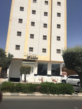
Lodging nearby Hail Hotel
Saudi Arabia
Lodging nearby Hail Hotel
Hail Hotel
Al Amir Miqrin Ibn Abdul Aziz, 55428, Hail, SA Saudi Arabia
contacts phone
:
+966
Latitude:
27.518781
, Longitude:
41.701733
larger map & directions
read more
nearest Lodging
178 m
فندق البنفسج
8667 عثمان بن عفان, 2468, Hail
Lodging
read more
178 m
شقق ركاز للوحدات السكنية
8667 عثمان بن عفان, Hail
Lodging
read more
408 m
bfiya sahari
Unnamed Road, Hail
Lodging
read more
477 m
Rose Apartments in Hail
8676, Hail
Lodging
read more
547 m
Aleairy No.2
Muhammad Al Abdullah Ar Rashid, Hail
Lodging
read more
591 m
Ayar Hotel Apartments
70, Hail
Lodging
read more
619 m
Aleairy No.3
Muhammad Al Abdullah Ar Rashid, Hail
Lodging
read more
689 m
شقق سور برزان
3053, Hail
Lodging
read more
763 m
تاج لبده للشقق الفندقيه
3288 Muhammad Al Abdullah Ar Rashid, Hail
Lodging
read more
811 m
بيت حائل
5638, Hail
Lodging
read more
822 m
بزاخة للشقق المفروشة
Al Amir Miqrin Ibn Abdul Aziz, Hail
Lodging
read more
841 m
Bazakha Aparthotel
Alzearah district -Prince muqren Ibn Abdulaziz Road, Hail
Lodging
read more
858 m
Lahorei Hotel Hail
5567 Uqdah Road, Hail
Lodging
read more
870 m
Rest Inn Suites
King Abdulaziz Road, Hail
Lodging
read more
880 m
Rest Inn Suites - Hail
alzabarre
Lodging
read more
893 m
Rest Inn Hotel
Hail
Lodging
read more
921 m
AL MAZAQ BROAST
Unnamed Road, Hail
Lodging
read more
924 m
منتجع الماردية ٢
Hail
Lodging
read more
924 m
منتجع الماردية (٢) بلبده
Hail
Lodging
read more
1.01 km
Round Hotel Suites
AlMahatta Dist. Ibn Khaldoun St., Hail
Lodging
read more
1.055 km
Lamah Hotel Suites
5356 Uqdah Rd, Al Mahattah Hail 55424 7483 Uqdah Road, Hail
Lodging
read more
1.063 km
Moghaidh Furnished Apartments
3648 الملك فيصل, Hail
Lodging
read more
1.082 km
الرواسي للأجنحة الفندقية
7068 الكويت, Hail
Lodging
read more
1.135 km
Al Rawasi
Hail
Lodging
read more
1.183 km
Dar Arkaan Hail
5414 King Faisal Road, Hail
Lodging
read more
📑
all categories
Accounting
Administrative area level 1
Airport
Amusement park
Aquarium
Art gallery
Atm
Bakery
Bank
Bar
Beauty salon
Bicycle store
Book store
Bowling alley
Bus station
Cafe
Campground
Car dealer
Car rental
Car repair
Car wash
Casino
Cemetery
Church
City hall
Clothing store
Colloquial area
Convenience store
Country
Courthouse
Dentist
Department store
Doctor
Electrician
Electronics store
Embassy
Finance
Fire station
Florist
Food
Funeral home
Furniture store
Gas station
General contractor
Grocery or supermarket
Gym
Hair care
Hardware store
Health
Hindu Temple
Home goods store
Hospital
Insurance agency
Intersection
Jewelry store
Laundry
Lawyer
Library
Light rail station
Liquor store
Local government office
Locality
Locksmith
Lodging
Meal delivery
Meal takeaway
Mosque
Movie rental
Movie theater
Moving company
Museum
Natural feature
Neighborhood
Night club
Painter
Park
Parking
Pet store
Pharmacy
Physiotherapist
Place of worship
Plumber
Point of interest
Police
Political
Post office
Premise
Real estate agency
Restaurant
Roofing contractor
Route
Rv park, camping
School
Shoe store
Shopping mall
Spa
Stadium
Storage
Store
Sublocality
Subpremise
Subway station
Supermarket
Taxi stand
Train station
Transit station
Travel agency
University
Veterinary care
Zoo
sublocality level 1
↑