Lodging nearby HH Furnished Residential Units
Saudi Arabia
Lodging nearby HH Furnished Residential Units
HH Furnished Residential Units
Al-Sanabel, Jeddah 22444, Saudi Arabia
contacts phone
:
+966 56 315 4339
Latitude:
21.3885005
, Longitude:
39.2764127
larger map & directions
read more
nearest Lodging
170 m
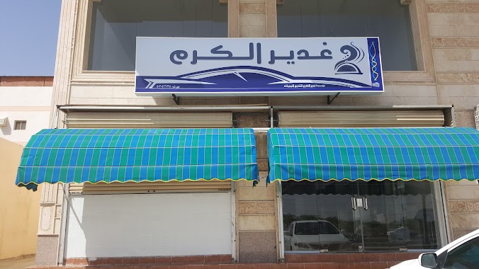
مؤسسة غدير الكرم
2470, 8020, Jeddah
Lodging
read more
231 m
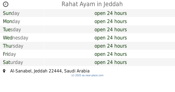
Rahat Ayam
Jeddah
Lodging
read more
285 m
المرجان للشقق الفندقية
الشارع العام، السنابل، جدة
Lodging
read more
867 m
خالد ال شعبان
Unnamed Road, Jeddah
Lodging
read more
898 m
عمارة ميسر الحداد
Jeddah
Lodging
read more
1.368 km
بيت فيصل مطلق
Jeddah
Lodging
read more
1.431 km
Hisham’s House
Jeddah
Lodging
read more
1.549 km
الريف للوحدات الفندقية AL-REEF HOTEL UNITS
Jeddah
Lodging
read more
1.567 km
Rawasi 2
Jeddah
Lodging
read more
1.613 km
سنابل حنا
Unnamed Road, Jeddah
Lodging
read more
1.91 km
هوم سويت للوحدات السكنيه
3699, 7671, Jeddah
Lodging
read more
2.018 km
مطعم فارس
6615 حي الهدى، جدة 22443
Lodging
read more
2.132 km
عقار غرم الله الزهراني
3524 Al Ajaweed District Jeddah 22443
Lodging
read more
2.147 km
نسيم الفجر للوحدات السكنية
Unnamed Road, Jeddah
Lodging
read more
2.224 km
Furnished Apartments home Wreaths
7593, حي الاجاويد،, Jeddah
Lodging
read more
2.231 km
Adel Furnished Apartments
Jeddah
Lodging
read more
2.298 km
الدوسي ياسين
Jeddah
Lodging
read more
2.339 km
Aleairy No.6
Jeddah
Lodging
read more
2.351 km
دانة الأجاويد للوحدات السكنية المفروشة
3576, حي الاجاويد،, Jeddah
Lodging
read more
2.414 km
Buqami Resort
Jeddah
Lodging
read more
2.416 km
عمارة أبو ريان الزهراني
Jeddah
Lodging
read more
2.432 km
قصر نزوى للشقق المفروشه
3067, Jeddah
Lodging
read more
2.47 km
Aslam
2996, Jeddah
Lodging
read more
2.508 km
مسرع ال نجمة
Jeddah
Lodging
read more
2.816 km
Alfiya
Jeddah
Lodging
read more
📑
all categories
Accounting
Administrative area level 1
Airport
Amusement park
Aquarium
Art gallery
Atm
Bakery
Bank
Bar
Beauty salon
Bicycle store
Book store
Bowling alley
Bus station
Cafe
Campground
Car dealer
Car rental
Car repair
Car wash
Casino
Cemetery
Church
City hall
Clothing store
Colloquial area
Convenience store
Country
Courthouse
Dentist
Department store
Doctor
Electrician
Electronics store
Embassy
Finance
Fire station
Florist
Food
Funeral home
Furniture store
Gas station
General contractor
Grocery or supermarket
Gym
Hair care
Hardware store
Health
Hindu Temple
Home goods store
Hospital
Insurance agency
Intersection
Jewelry store
Laundry
Lawyer
Library
Light rail station
Liquor store
Local government office
Locality
Locksmith
Lodging
Meal delivery
Meal takeaway
Mosque
Movie rental
Movie theater
Moving company
Museum
Natural feature
Neighborhood
Night club
Painter
Park
Parking
Pet store
Pharmacy
Physiotherapist
Place of worship
Plumber
Point of interest
Police
Political
Post office
Premise
Real estate agency
Restaurant
Roofing contractor
Route
Rv park, camping
School
Shoe store
Shopping mall
Spa
Stadium
Storage
Store
Sublocality
Subpremise
Subway station
Supermarket
Taxi stand
Train station
Transit station
Travel agency
University
Veterinary care
Zoo
sublocality level 1
↑