Lodging nearby Hotel Al Hateem International
Saudi Arabia
Lodging nearby Hotel Al Hateem International
Hotel Al Hateem International
Ash Shubaikah, Mecca 24231, Saudi Arabia
contacts phone
:
+966
Latitude:
21.4177184
, Longitude:
39.8190758
larger map & directions
read more
nearest Lodging
150 m
Syed Plaza
6582 Ash Shubaikah Mecca 24231 3500
Lodging
read more
191 m
Jawhrat Al Nowyr Hotel
3743, Mecca
Lodging
read more
200 m
فندق بنجلاديشي
3723, 6619, Mecca
Lodging
read more
228 m
Crown plaza, raddison blue, holiday inn , four points - jabel omer
Mecca
Lodging
read more
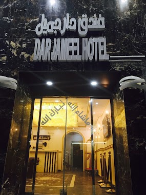
255 m
DAR JAMEEL HOTEL
6507, Mecca
Lodging
read more
261 m
Salem Hazza Burkati Misfalah Hotel Darul Qazi
6518, Mecca
Lodging
read more
265 m
rushad al toba
3761, Ash Shubaikah, Mecca 24231 6544
Lodging
read more
275 m
Arjaan Al Salam Hotel
King Faisal Road , Al Adl District, Mecca
Lodging
read more
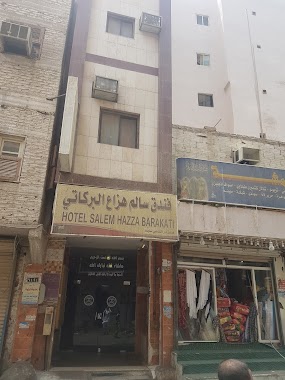
275 m
hotel salem hazza burkati misfalah
6507, Mecca
Lodging
read more
275 m
Nasamat Al Rayyan Concorde Hotel - Makkah
Mecca
Lodging
read more
294 m
Majority repentance Hotel
3767, Mecca
Lodging
read more
294 m
Rushad Touba Hotel Makkah Mukarama
3767, Mecca
Lodging
read more
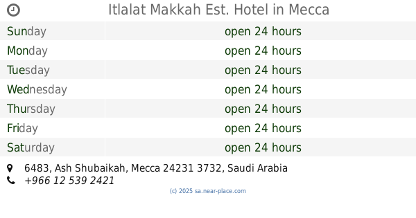
295 m
Itlalat Makkah Est. Hotel
6483, Mecca
Lodging
read more
296 m
Dahleh majority Hotel
3770, 6515, Mecca
Lodging
read more
297 m
Etlale Macca Hotel
Lodging
read more
304 m
فندق جميل بوقري
6483, Mecca
Lodging
read more
306 m
فندق لمار
Mecca
Lodging
read more
308 m
Al zahir hotal
Ibrahim Al Khalil, Mecca
Lodging
read more
314 m
فندق ضيافة السليم
مكة
Lodging
read more
333 m
Deyafa Saleem Hotel
3610, Mecca
Lodging
read more
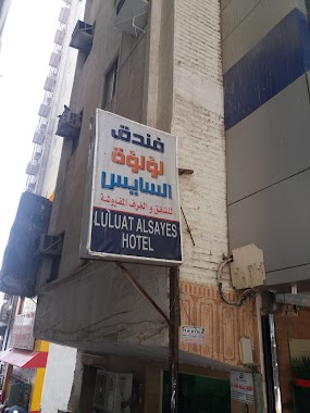
338 m
فندق لولوة السايس
3891، الشبيكة، مكة 24231
Lodging
read more
340 m
Lulu Al Sayes
3891, Mecca
Lodging
read more
340 m
Flower Muna Hotel
3880, Mecca
Lodging
read more
342 m
كونراد مكة الباب الرئيس
مكة
Lodging
read more
347 m
Dar Al-Riyad
6688 Ibrahim Al Khalil, Mecca
Lodging
read more
📑
all categories
Accounting
Administrative area level 1
Airport
Amusement park
Aquarium
Art gallery
Atm
Bakery
Bank
Bar
Beauty salon
Bicycle store
Book store
Bowling alley
Bus station
Cafe
Campground
Car dealer
Car rental
Car repair
Car wash
Casino
Cemetery
Church
City hall
Clothing store
Colloquial area
Convenience store
Country
Courthouse
Dentist
Department store
Doctor
Electrician
Electronics store
Embassy
Finance
Fire station
Florist
Food
Funeral home
Furniture store
Gas station
General contractor
Grocery or supermarket
Gym
Hair care
Hardware store
Health
Hindu Temple
Home goods store
Hospital
Insurance agency
Intersection
Jewelry store
Laundry
Lawyer
Library
Light rail station
Liquor store
Local government office
Locality
Locksmith
Lodging
Meal delivery
Meal takeaway
Mosque
Movie rental
Movie theater
Moving company
Museum
Natural feature
Neighborhood
Night club
Painter
Park
Parking
Pet store
Pharmacy
Physiotherapist
Place of worship
Plumber
Point of interest
Police
Political
Post office
Premise
Real estate agency
Restaurant
Roofing contractor
Route
Rv park, camping
School
Shoe store
Shopping mall
Spa
Stadium
Storage
Store
Sublocality
Subpremise
Subway station
Supermarket
Taxi stand
Train station
Transit station
Travel agency
University
Veterinary care
Zoo
sublocality level 1
↑