Lodging nearby Johratul Faz Hotel Mecca
Saudi Arabia
Lodging nearby Johratul Faz Hotel Mecca
Johratul Faz Hotel Mecca
6234, Al Hijrah, 24231, Mecca, SA Saudi Arabia
contacts phone
:
+966 58 059 4053
Latitude:
21.4133234
, Longitude:
39.8230449
larger map & directions
read more
nearest Lodging
15 m
Hotel maather
Mecca
Lodging
read more
15 m
Fajar Badi 1 Hotel
Al Hijrah, 6229-6613, Mecca
Lodging
read more
16 m
Manar-al-Eman
6229-6613 الهجرة،, Mecca
Lodging
read more
18 m
Golden Areej
Al Hijrah, Mecca
Lodging
read more
18 m
Manar Al Khair
Mecca
Lodging
read more
19 m
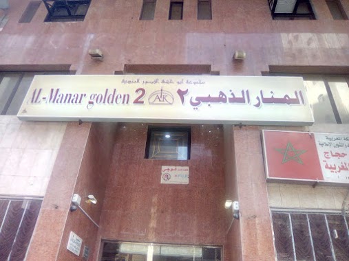
Al Manar Gold (al Zahbi)
Mecca
Lodging
read more
20 m
Attawfeegh Hotel
6222 Al Hijrah, Mecca
Lodging
read more
21 m
الفجر البديع
3952, Mecca
Lodging
read more
26 m
Al fajr al badea 1
Lodging
read more
27 m
Fajer Al Badee 1
6234, Mecca
Lodging
read more
33 m
Qahir Al Sahara Hotel
6194 Al Hijrah, Al Hajlah, Mecca 24231 3947 Al Hijrah, Mecca
Lodging
read more
34 m
Hotel Mekah
6229 Al Hijrah
Lodging
read more
34 m
الفجر البديع 1
3952, Mecca
Lodging
read more
35 m
Hotel Dayar al Bushra 2
6209, Mecca
Lodging
read more
37 m
Rahab Al Bayan Hotel
6206 Al Hijrah, Mecca
Lodging
read more
40 m
Jouhara Al Ferdos Al Touba Hotel
6186 Al Hijrah, Mecca
Lodging
read more
41 m
Golden Manar 2
Al Birkah Tunnel, Mecca
Lodging
read more
44 m
فندق جوهرة الفردوس
3998, Mecca
Lodging
read more
45 m
فندق جوهرة الفردوس
Hijrah Steet, Next to Rehab Rawdah Hotel، Mecca
Lodging
read more
47 m
Femila Shamiya Travel Super Budget
4002, Al Hajlah, Mecca 24231 6209
Lodging
read more
47 m
Omara Jauharat AlFirdous
Mecca
Lodging
read more
48 m
نزل السمو
3995، الهجلة، مكة 24231
Lodging
read more
48 m
Nadir Al Otaibi Hotel
4001, Mecca
Lodging
read more
52 m
Kaamel Star Hotel
6226, Mecca
Lodging
read more
52 m
Areej Al Hijra
6182, Mecca
Lodging
read more
📑
all categories
Accounting
Administrative area level 1
Airport
Amusement park
Aquarium
Art gallery
Atm
Bakery
Bank
Bar
Beauty salon
Bicycle store
Book store
Bowling alley
Bus station
Cafe
Campground
Car dealer
Car rental
Car repair
Car wash
Casino
Cemetery
Church
City hall
Clothing store
Colloquial area
Convenience store
Country
Courthouse
Dentist
Department store
Doctor
Electrician
Electronics store
Embassy
Finance
Fire station
Florist
Food
Funeral home
Furniture store
Gas station
General contractor
Grocery or supermarket
Gym
Hair care
Hardware store
Health
Hindu Temple
Home goods store
Hospital
Insurance agency
Intersection
Jewelry store
Laundry
Lawyer
Library
Light rail station
Liquor store
Local government office
Locality
Locksmith
Lodging
Meal delivery
Meal takeaway
Mosque
Movie rental
Movie theater
Moving company
Museum
Natural feature
Neighborhood
Night club
Painter
Park
Parking
Pet store
Pharmacy
Physiotherapist
Place of worship
Plumber
Point of interest
Police
Political
Post office
Premise
Real estate agency
Restaurant
Roofing contractor
Route
Rv park, camping
School
Shoe store
Shopping mall
Spa
Stadium
Storage
Store
Sublocality
Subpremise
Subway station
Supermarket
Taxi stand
Train station
Transit station
Travel agency
University
Veterinary care
Zoo
sublocality level 1
↑