Lodging nearby منتزه وبحيرة وادي حنيفة
Saudi Arabia
Lodging nearby منتزه وبحيرة وادي حنيفة
منتزه وبحيرة وادي حنيفة
المصانع،، Al Masani, Riyadh 14715, Saudi Arabia
contacts phone
:
+966
Latitude:
24.5706156
, Longitude:
46.723846
larger map & directions
read more
nearest Lodging
278 m
منتجعات روضة الناظر
3191, 8744, Riyadh
Lodging
read more
488 m
شاليهات لاڤانا
Riyadh
Lodging
read more
496 m
شاليهات اسمار
النصر, الشفا امتداد طرق ابن تيمية بطريق, Riyadh
Lodging
read more
627 m
مركز تدريب بوبي كات
Riyadh
Lodging
read more
857 m
شاليه وناستي
Riyadh
Lodging
read more
893 m
بديل للوحدات السكنيه المفروشه
داود الربيب، بدر،، الرياض
Lodging
read more
958 m
مؤسسة ابن معجب العقارية
المصانع،, Riyadh
Lodging
read more
1.676 km
منتجع الجوهرة
Al Masani, Riyadh
Lodging
read more
1.757 km
استراحة الملائكة
8984 Nakhal, Riyadh
Lodging
read more
2.033 km
استراحة المجد
3691 ينبع النخيل، اليمامة الرياض 12675
Lodging
read more
2.035 km
منتزة الذهبي للغرف الفندقية
Al Muruj Street, Ash Shifa، الرياض
Lodging
read more
2.048 km
شاليهات لولوه
3843, 6416, Riyadh
Lodging
read more
2.361 km
سكن موظفين نسيم الريف
3119، بدر، الرياض 14716
Lodging
read more
2.392 km
اسواق الخظره
2438 الانهار، بدر، الرياض 14716 7619 Al Anhar, Riyadh
Lodging
read more
2.416 km
استراحة ابو دغيمان
6734, Riyadh
Lodging
read more
2.428 km
Break Adel Bin Shihab
6652, Riyadh
Lodging
read more
2.454 km
PTI Hotel. (للوجبات السريعة)
2877 Al Ghunaim, Manfuhah, Riyadh 12685 6481 Al Ghunaim, Riyadh
Lodging
read more
2.497 km
شقق الراقية
3968 المثنى بن حارثة،, 7137, Riyadh
Lodging
read more
2.508 km
ابراهيم طياش
7333, 2548, Riyadh
Lodging
read more
2.563 km
بيت الصفيان
6797 al walid ibn an nadhr 4080, Riyadh
Lodging
read more
2.604 km
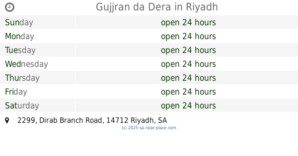
Gujjran da Dera
2299 Dirab Branch Road, 7625, Riyadh
Lodging
read more
2.681 km
The Wadi Namar
Al Warad, Riyadh
Lodging
read more
2.756 km
Nova Hotel
4351 Southern Ring Road, 7983, Riyadh
Lodging
read more
2.86 km
ناصر الربيع
6472 محمد السدوسي، الشفا الرياض 14713
Lodging
read more
2.872 km
HOME VIP
Riyadh
Lodging
read more
📑
all categories
Accounting
Administrative area level 1
Airport
Amusement park
Aquarium
Art gallery
Atm
Bakery
Bank
Bar
Beauty salon
Bicycle store
Book store
Bowling alley
Bus station
Cafe
Campground
Car dealer
Car rental
Car repair
Car wash
Casino
Cemetery
Church
City hall
Clothing store
Colloquial area
Convenience store
Country
Courthouse
Dentist
Department store
Doctor
Electrician
Electronics store
Embassy
Finance
Fire station
Florist
Food
Funeral home
Furniture store
Gas station
General contractor
Grocery or supermarket
Gym
Hair care
Hardware store
Health
Hindu Temple
Home goods store
Hospital
Insurance agency
Intersection
Jewelry store
Laundry
Lawyer
Library
Light rail station
Liquor store
Local government office
Locality
Locksmith
Lodging
Meal delivery
Meal takeaway
Mosque
Movie rental
Movie theater
Moving company
Museum
Natural feature
Neighborhood
Night club
Painter
Park
Parking
Pet store
Pharmacy
Physiotherapist
Place of worship
Plumber
Point of interest
Police
Political
Post office
Premise
Real estate agency
Restaurant
Roofing contractor
Route
Rv park, camping
School
Shoe store
Shopping mall
Spa
Stadium
Storage
Store
Sublocality
Subpremise
Subway station
Supermarket
Taxi stand
Train station
Transit station
Travel agency
University
Veterinary care
Zoo
sublocality level 1
↑