Lodging nearby Shada Suites - Al Hamra
Saudi Arabia
Lodging nearby Shada Suites - Al Hamra
Shada Suites - Al Hamra
Ma'ady District, Hamra'a Street, Al-Hamra'a, Jeddah 23212, Saudi Arabia
contacts phone
:
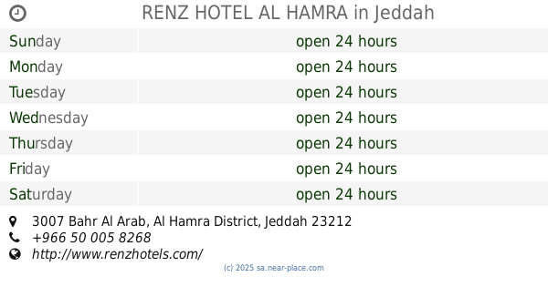
+966 12 606 0904
website:
shadasuites.com
Latitude:
21.5145465
, Longitude:
39.1619897
larger map & directions
read more
nearest Lodging
58 m
Najmat Alfakhirah
Bahr Al Arab, Jeddah
Lodging
read more
66 m
Al Hamra
Jeddah
Lodging
read more
68 m
المهيدب ريسدنس
Jeddah
Lodging
read more
74 m
RENZ HOTEL AL HAMRA
3007 Bahr Al Arab, Al Hamra District, Jeddah 23212 6969 Bahr Al Arab, Jeddah
Lodging
read more
100 m
فندق رينز حمراء
7053 Al Mukalla, Jeddah
Lodging
read more
101 m
رفال للوحدات السكنية
بحر العرب، جده، الحمراء،، جدة 23212،
Lodging
read more
128 m
Elaf Wings
Salala, Jeddah
Lodging
read more
136 m
سُبات جدة للاجنحة الفندقية
3132 المعادى، حي 6975 سبات جدة, Jeddah
Lodging
read more
171 m
Alahad Almasi
Al Uqsur, Jeddah
Lodging
read more
173 m
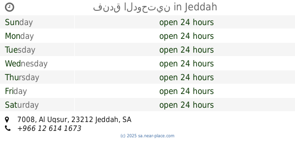
فندق الدوحتين
7008 Al Uqsur, حي الحمراء, Jeddah
Lodging
read more
173 m
Al dawhatain suites
3111 Bahr Al Arab, حي الحمراء, Jeddah
Lodging
read more
177 m
Lotus Hotel
2709, 2887, طريق الكورنيش،, Jeddah
Lodging
read more
181 m
kabab al baladi كباب البلدي
Jeddah
Lodging
read more
182 m
Lotus Hotel
Jeddah
Lodging
read more
187 m
Hala Jeddah 2 Hotel Apartment
3164 Al Maadi, Al Hamra District,, Jeddah
Lodging
read more
191 m
شقق اصالة الحمراء
Jeddah
Lodging
read more
197 m
Arab Hotel
2788 Bahr Al Arab, حي الحمراء, Jeddah
Lodging
read more
202 m
Al Farhan
Adan, Jeddah
Lodging
read more
205 m
Osan hotel
Bahr Al Arab, Jeddah
Lodging
read more
205 m
شاطىء السعادة
Jeddah
Lodging
read more
206 m
اجنحة الفرحان الحمرة جده
عدن، الحمراء،, Jeddah
Lodging
read more
213 m
Alahmad
7035 Al Uqsur, Al Hamra District, Jeddah
Lodging
read more
213 m
فندق رايق
Al Kurnaysh Road, Jeddah
Lodging
read more
216 m
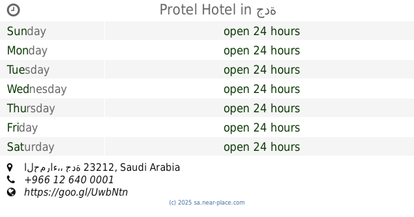
Protel Hotel
جدة
Lodging
read more
217 m
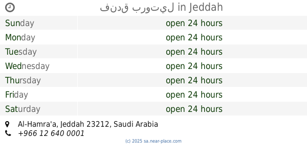
فندق بروتيل
Jeddah
Lodging
read more
📑
all categories
Accounting
Administrative area level 1
Airport
Amusement park
Aquarium
Art gallery
Atm
Bakery
Bank
Bar
Beauty salon
Bicycle store
Book store
Bowling alley
Bus station
Cafe
Campground
Car dealer
Car rental
Car repair
Car wash
Casino
Cemetery
Church
City hall
Clothing store
Colloquial area
Convenience store
Country
Courthouse
Dentist
Department store
Doctor
Electrician
Electronics store
Embassy
Finance
Fire station
Florist
Food
Funeral home
Furniture store
Gas station
General contractor
Grocery or supermarket
Gym
Hair care
Hardware store
Health
Hindu Temple
Home goods store
Hospital
Insurance agency
Intersection
Jewelry store
Laundry
Lawyer
Library
Light rail station
Liquor store
Local government office
Locality
Locksmith
Lodging
Meal delivery
Meal takeaway
Mosque
Movie rental
Movie theater
Moving company
Museum
Natural feature
Neighborhood
Night club
Painter
Park
Parking
Pet store
Pharmacy
Physiotherapist
Place of worship
Plumber
Point of interest
Police
Political
Post office
Premise
Real estate agency
Restaurant
Roofing contractor
Route
Rv park, camping
School
Shoe store
Shopping mall
Spa
Stadium
Storage
Store
Sublocality
Subpremise
Subway station
Supermarket
Taxi stand
Train station
Transit station
Travel agency
University
Veterinary care
Zoo
sublocality level 1
↑