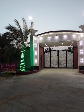
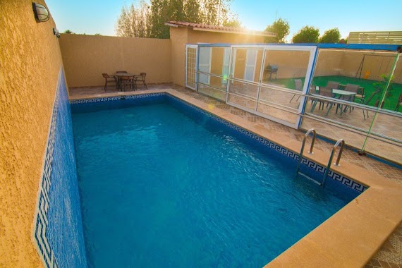
Lodging nearby شاليهات اللحيدان
Saudi Arabia
Lodging nearby شاليهات اللحيدان
شاليهات اللحيدان
الرمال،، الرياض 13434, Saudi Arabia
contacts phone
:
+966
Latitude:
24.9104414
, Longitude:
46.808293
larger map & directions
read more
nearest Lodging
139 m
Chalets 2p2
8918 Thumamah Street، الرياض
Lodging
read more
147 m
منتجعات وشاليهات المضيف
Ath Thumamah Road, Riyadh
Lodging
read more
313 m
Mirage City
Ath Thumamah Road, Riyadh
Lodging
read more
331 m
شاليهات الضيافة
الرياض
Lodging
read more
364 m
شاليهات الضيافة
Unnamed Road, مطار الملك خالد الدولي،, Riyadh
Lodging
read more
420 m
Al Mofleh Resort
2362 الكمثرى، Ar Rimal, Riyadh 13435 7780
Lodging
read more
431 m
دار الاسرة
9335 محمد بن عجلان, King Khalid Airport, Riyadh
Lodging
read more
499 m
استراحه خزامى
Unnamed Road, Riyadh
Lodging
read more
569 m
إستراحة الريان
7591 حميد الرواسي, 2502, Riyadh
Lodging
read more
742 m
Chalets Dora sand
3371, مطار الملك خالد، 8917, Riyadh
Lodging
read more
760 m
Break Abu Abdulrahman luxury
3688, مطار الملك خالد، 8336, Riyadh
Lodging
read more
771 m
منتجع الشيخ صالح الخليفة
3989, مطار الملك خالد, Riyadh
Lodging
read more
828 m
Alrasheed Farm
Riyadh
Lodging
read more
865 m
Zoom Luxury Chalets
3989, King Khalid Airport, Riyadh
Lodging
read more
908 m
Chalet N Sand
Riyadh
Lodging
read more
927 m
شاليهات الدلفين
Riyadh
Lodging
read more
933 m
شاليهات ديالا
Ar Rimal, Near مطار الملك خالد، الرياض
Lodging
read more
943 m
شاليه لنا
3989, King Khalid Airport, Riyadh
Lodging
read more
944 m
lana_chalet
3989, King Khalid Airport, Riyadh
Lodging
read more
946 m
شاليهات فريسيا - الرياض حي الرمال
Unnamed Road, Riyadh
Lodging
read more
946 m
Elkhereji Villa
Unnamed Road, Riyadh
Lodging
read more
958 m
شاليهات نخلة رمال
Thumamah Rd, Riyadh
Lodging
read more
959 m
استراحة الفرسان
Riyadh
Lodging
read more
1.012 km
منتجع الفهادية
Unnamed Road, Riyadh
Lodging
read more
1.02 km
Chalets Happy
Riyadh
Lodging
read more
📑
all categories
Accounting
Administrative area level 1
Airport
Amusement park
Aquarium
Art gallery
Atm
Bakery
Bank
Bar
Beauty salon
Bicycle store
Book store
Bowling alley
Bus station
Cafe
Campground
Car dealer
Car rental
Car repair
Car wash
Casino
Cemetery
Church
City hall
Clothing store
Colloquial area
Convenience store
Country
Courthouse
Dentist
Department store
Doctor
Electrician
Electronics store
Embassy
Finance
Fire station
Florist
Food
Funeral home
Furniture store
Gas station
General contractor
Grocery or supermarket
Gym
Hair care
Hardware store
Health
Hindu Temple
Home goods store
Hospital
Insurance agency
Intersection
Jewelry store
Laundry
Lawyer
Library
Light rail station
Liquor store
Local government office
Locality
Locksmith
Lodging
Meal delivery
Meal takeaway
Mosque
Movie rental
Movie theater
Moving company
Museum
Natural feature
Neighborhood
Night club
Painter
Park
Parking
Pet store
Pharmacy
Physiotherapist
Place of worship
Plumber
Point of interest
Police
Political
Post office
Premise
Real estate agency
Restaurant
Roofing contractor
Route
Rv park, camping
School
Shoe store
Shopping mall
Spa
Stadium
Storage
Store
Sublocality
Subpremise
Subway station
Supermarket
Taxi stand
Train station
Transit station
Travel agency
University
Veterinary care
Zoo
sublocality level 1
↑