Lodging nearby شاليهات ديم لايت
Saudi Arabia
Lodging nearby شاليهات ديم لايت
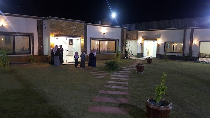
شاليهات ديم لايت
منطقة تبوك مجمع العرجان, Tabuk Saudi Arabia
contacts phone
:
+966
Latitude:
28.4681124
, Longitude:
36.6054599
read more
nearest Lodging
107 m
Chalets for Evanso
4776, منطقة الزراعية،, Tabuk
Lodging
read more
139 m
استراحات وشاليهات رهف
Saudi Arabia
Lodging
read more
139 m
استراحات وشاليهات رهف
Lodging
read more
160 m
استراحة السعودية
6812, منطقة الزراعية، 4571, Tabuk
Lodging
read more
347 m
شاليه وناسه
8919 منطقة الزراعية تبوك 47319
Lodging
read more
349 m
Break Jeriabie
Tabuk
Lodging
read more
383 m
Golden Park
9071, Cultivated Area, Tabuk
Lodging
read more
386 m
استراحة ريم الفلا
طريق الشيخ علي الشامان, Tabuk
Lodging
read more
453 m
شاليهات النزهه
8972 منطقة الزراعية، تبوك 47319
Lodging
read more
467 m
شالهات وي كند Chalets Weekend
8972, منطقة الزراعية، 3969, Tabuk
Lodging
read more
503 m
منتجعات حمدان الريفية
6765, منطقة الزراعية، 4197, Tabuk
Lodging
read more
515 m
شاليهات ليلة العمر
Unnamed Road, Tabuk
Lodging
read more
535 m
منتجع باتارا
4414, منطقة الزراعية 6491, Tabuk
Lodging
read more
630 m
شاليهات نيوبيتش
8844, Cultivated Area, Tabuk
Lodging
read more
673 m
منتجع البندقية
Saudi Arabia
Lodging
read more
673 m
منتجع البندقية
Lodging
read more
682 m
نسائم الربيع
Lodging
read more
682 m
نسائم الربيع
Saudi Arabia
Lodging
read more
703 m
Happy Knight
6679, منطقة الزراعية،, Tabuk
Lodging
read more
713 m
شاليهات المجد
6679, Cultivated Area, Tabuk
Lodging
read more
718 m
شاليهات بلاجيو
3199, منطقة الزراعية، 8604, Tabuk
Lodging
read more
737 m
استراحة و شاليه العميد
2160, منطقة الزراعية،, Tabuk
Lodging
read more
789 m
استراحه اهل تيماء بتبوك
Lodging
read more
860 m
شاليهات هبي لاند
Lodging
read more
861 m
شاليهات هولدي سويت
Saudi Arabia
Lodging
read more
📑
all categories
Accounting
Administrative area level 1
Airport
Amusement park
Aquarium
Art gallery
Atm
Bakery
Bank
Bar
Beauty salon
Bicycle store
Book store
Bowling alley
Bus station
Cafe
Campground
Car dealer
Car rental
Car repair
Car wash
Casino
Cemetery
Church
City hall
Clothing store
Colloquial area
Convenience store
Country
Courthouse
Dentist
Department store
Doctor
Electrician
Electronics store
Embassy
Finance
Fire station
Florist
Food
Funeral home
Furniture store
Gas station
General contractor
Grocery or supermarket
Gym
Hair care
Hardware store
Health
Hindu Temple
Home goods store
Hospital
Insurance agency
Intersection
Jewelry store
Laundry
Lawyer
Library
Light rail station
Liquor store
Local government office
Locality
Locksmith
Lodging
Meal delivery
Meal takeaway
Mosque
Movie rental
Movie theater
Moving company
Museum
Natural feature
Neighborhood
Night club
Painter
Park
Parking
Pet store
Pharmacy
Physiotherapist
Place of worship
Plumber
Point of interest
Police
Political
Post office
Premise
Real estate agency
Restaurant
Roofing contractor
Route
Rv park, camping
School
Shoe store
Shopping mall
Spa
Stadium
Storage
Store
Sublocality
Subpremise
Subway station
Supermarket
Taxi stand
Train station
Transit station
Travel agency
University
Veterinary care
Zoo
sublocality level 1
↑