Mosque nearby Al Noor Mosque
Saudi Arabia
Mosque nearby Al Noor Mosque
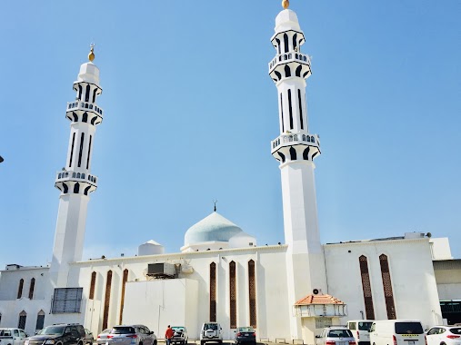
Al Noor Mosque
Bahr Al Jud, 23437, Jeddah, SA Saudi Arabia
contacts phone
:
+966 57112584
Latitude:
21.5926113
, Longitude:
39.1551399
larger map & directions
read more
nearest Mosque
200 m
مسجد التويم
Jeddah
Mosque
read more
280 m
مسجد التقوى
Manarat Bani Makhzum, Jeddah
Mosque
read more
289 m
Altaqwa Mosque
As Salamah
Mosque
read more
442 m
Al Moumneen Mosque
8230 Zahr Al Adab, Jeddah
Mosque
read more
616 m
Masjid AL Shoaybi
7193 Abdul Rahman Ibn Ahmad As Sidayri, As Salamah District, Jeddah
Mosque
read more
617 m
Masjid AL Shoaybi
7471 عبدالرحمن بن أحمد السديري, حي السلامة، جدة
Mosque
read more
624 m
Masjid Imam Bukhari
3023 Manarat Al Masa, Jeddah 23436
Mosque
read more
624 m
Mosque
3023 Manarat Al Masa, Jeddah 23436
Mosque
read more
647 m
مسجد الإمام البخاري
جدة
Mosque
read more
720 m
Hussein Mosque
Ibn Abi Sarh, Jeddah
Mosque
read more
734 m
Al-Zahra'a Mosque
Said Ibn Al Mubarak, Jeddah
Mosque
read more
740 m
Masjid e zehra Al Salama Nab al ikhlaas
2577 Nab Al Ikhlas, Jeddah
Mosque
read more
760 m
Masjid Muadh ibn Jabal (RA)
Abdul Rahman Al Mazru, Jeddah
Mosque
read more
781 m
جامع الشيخ مبارك بن عبدالعزيز الحساوي
شارع الشطنوفي، حي السلامة، جدة
Mosque
read more
782 m
Mosque
As Salamah
Mosque
read more
839 m
مسجد أهلي
جدة
Mosque
read more
855 m
Salah al-Din mosque under construction
7127 Al Barakati, حي السلامة،, Jeddah
Mosque
read more
868 m
Al Forqan Mosque
Idris Raghib, Jeddah
Mosque
read more
878 m
مسجد عباد الرحمن
7234-7280 Ghina Al Balabil, Jeddah
Mosque
read more
892 m
مسجد
As Salamah
Mosque
read more
1.076 km
مسجد عمر بن عبدالعزيز
6952 Sabil Al Ilm, حي السلامة،, Jeddah
Mosque
read more
1.079 km
مسجد عمر بن عبدالعزيز
6952 Sabil Al Ilm, As Salamah District, Jeddah
Mosque
read more
1.102 km
مصلى الريان
2396 Amir Ibn Al Harith, حي البوادي, Jeddah
Mosque
read more
1.129 km
Prince sultan ibn abdulaziz Mosque
Jeddah
Mosque
read more
1.14 km
جامع النور
Husayn Ibn Al Harith, Jeddah
Mosque
read more
📑
all categories
Accounting
Administrative area level 1
Airport
Amusement park
Aquarium
Art gallery
Atm
Bakery
Bank
Bar
Beauty salon
Bicycle store
Book store
Bowling alley
Bus station
Cafe
Campground
Car dealer
Car rental
Car repair
Car wash
Casino
Cemetery
Church
City hall
Clothing store
Colloquial area
Convenience store
Country
Courthouse
Dentist
Department store
Doctor
Electrician
Electronics store
Embassy
Finance
Fire station
Florist
Food
Funeral home
Furniture store
Gas station
General contractor
Grocery or supermarket
Gym
Hair care
Hardware store
Health
Hindu Temple
Home goods store
Hospital
Insurance agency
Intersection
Jewelry store
Laundry
Lawyer
Library
Light rail station
Liquor store
Local government office
Locality
Locksmith
Lodging
Meal delivery
Meal takeaway
Mosque
Movie rental
Movie theater
Moving company
Museum
Natural feature
Neighborhood
Night club
Painter
Park
Parking
Pet store
Pharmacy
Physiotherapist
Place of worship
Plumber
Point of interest
Police
Political
Post office
Premise
Real estate agency
Restaurant
Roofing contractor
Route
Rv park, camping
School
Shoe store
Shopping mall
Spa
Stadium
Storage
Store
Sublocality
Subpremise
Subway station
Supermarket
Taxi stand
Train station
Transit station
Travel agency
University
Veterinary care
Zoo
sublocality level 1
↑