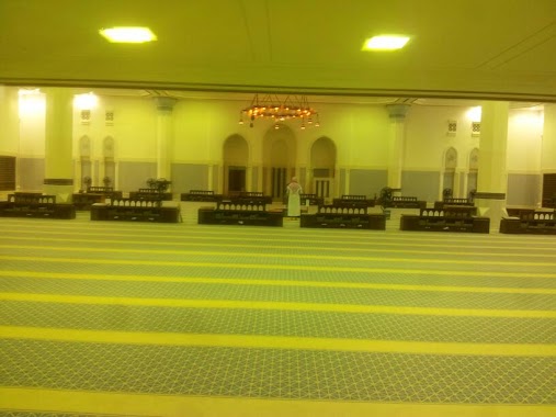
Mosque nearby Holy Mosque
Coronavirus disease (COVID-19) Situation
confirmed cases
841469
deaths
9646
Saudi Arabia
Mosque nearby Holy Mosque
Holy Mosque
شارع الأمير سلطان بن عبدالعزيز, 72341, Sakakah, SA Saudi Arabia
contacts phone
:
+966
Latitude:
29.9606013
, Longitude:
40.2147447
larger map & directions
read more
nearest Mosque
455 m
مسجد
King Fahd Ibn Abdulaziz Road, Sakaka
Mosque
read more
478 m
مسجد الفضيل بن عياض
7131 طريق الملك عبدالله بن عبدالعزيز، مخطط الصناعية، سكاكا 72341
Mosque
read more
508 m
جامع عمر بن الخطاب, Omar Bin Al Khattab Mosque
Sakaka
Mosque
read more
552 m
مسجد البيالي
مخطط الصناعية،, Sakaka
Mosque
read more
684 m
مسجد مصعب بن عمير
8296, Sakaka
Mosque
read more
807 m
مسجد الزهراء
4127، المحمدية د، سكاكا 72341
Mosque
read more
820 m
مسجد السعد
7875 شارع التسامح،, 3795, Sakaka
Mosque
read more
841 m
Ihsan Mosque
المحمدية د, Sakaka
Mosque
read more
885 m
Nasser Mosque
4732, Sakaka
Mosque
read more
916 m
مسجد محمد ابن سيرين
7005، المحمدية د، سكاكا 72341
Mosque
read more
963 m
مسجد الحمدان
4002، الشلهوب، سكاكا 72341
Mosque
read more
979 m
مسجد البازعى
3904، الشلهوب، سكاكا 72341
Mosque
read more
1.008 km
Saleh mosque
4276 الملك فيصل, Sakaka
Mosque
read more
1.05 km
مسجد ذي البجادين
6849، المحمدية د، سكاكا 72341
Mosque
read more
1.054 km
مسجد
3593 Yaaqub Ibn Aus Ath Thaqafi, المحمدية ا, Sakaka
Mosque
read more
1.085 km
مسجد عبد الله السلامة الدخيل الله
4571, المحمدية د،, Sakaka
Mosque
read more
1.092 km
Sweilem Ibrahim Mosque Daraan
4018 جبه, المحمدية د،, Sakaka
Mosque
read more
1.1 km
Al Rahmaniyah Mosque
سكاكا
Mosque
read more
1.112 km
مسجد الشراطين
3677، المحمدية ا، سكاكا 72341
Mosque
read more
1.112 km
مسجد الأحسان
3677، المحمدية ا، سكاكا 72341
Mosque
read more
1.114 km
مسجد زيد بن الخطاب
4211، المحمدية د، سكاكا 72341
Mosque
read more
1.145 km
مسجد أسيد بن الحضير
Sakaka
Mosque
read more
1.157 km
مسجد
2174, مخطط الصديق, Sakaka
Mosque
read more
1.161 km
مسجد المطرود
3779، الشلهوب، سكاكا 72341
Mosque
read more
1.243 km
مسجد قيس بن سعد
3824، المحمدية د، سكاكا 72341
Mosque
read more
📑
all categories
Accounting
Administrative area level 1
Airport
Amusement park
Aquarium
Art gallery
Atm
Bakery
Bank
Bar
Beauty salon
Bicycle store
Book store
Bowling alley
Bus station
Cafe
Campground
Car dealer
Car rental
Car repair
Car wash
Casino
Cemetery
Church
City hall
Clothing store
Colloquial area
Convenience store
Country
Courthouse
Dentist
Department store
Doctor
Electrician
Electronics store
Embassy
Finance
Fire station
Florist
Food
Funeral home
Furniture store
Gas station
General contractor
Grocery or supermarket
Gym
Hair care
Hardware store
Health
Hindu Temple
Home goods store
Hospital
Insurance agency
Intersection
Jewelry store
Laundry
Lawyer
Library
Light rail station
Liquor store
Local government office
Locality
Locksmith
Lodging
Meal delivery
Meal takeaway
Mosque
Movie rental
Movie theater
Moving company
Museum
Natural feature
Neighborhood
Night club
Painter
Park
Parking
Pet store
Pharmacy
Physiotherapist
Place of worship
Plumber
Point of interest
Police
Political
Post office
Premise
Real estate agency
Restaurant
Roofing contractor
Route
Rv park, camping
School
Shoe store
Shopping mall
Spa
Stadium
Storage
Store
Sublocality
Subpremise
Subway station
Supermarket
Taxi stand
Train station
Transit station
Travel agency
University
Veterinary care
Zoo
sublocality level 1
↑