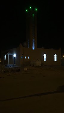
Mosque nearby جامع ابن عقل
Saudi Arabia
Mosque nearby جامع ابن عقل
جامع ابن عقل
9247, Qara, Sakaka 72344, Arabia Saudyjska
contacts phone
:
+966 55 056 2268
Latitude:
29.8793202
, Longitude:
40.2219528
larger map & directions
read more
nearest Mosque
256 m
مسجد عبد العزيز الضميرى
7224، مخطط الامل، سكاكا 72347
Mosque
read more
295 m
مسجد
7082 King Khalid Rd, مخطط الامل, Sakaka
Mosque
read more
726 m
مسجد العبدلي
سكاكا
Mosque
read more
732 m
مسجد مرضي عنان
قارا،, حي الامل،, Sakaka
Mosque
read more
746 m
مسجد الحسن
6669، جنوب غرب قارا، سكاكا 72347
Mosque
read more
753 m
مسجد الشافعي
حي الامل، قارا،, Sakaka
Mosque
read more
824 m
مسجد الأمام الشافعي
7786، مخطط الامل، سكاكا 72347
Mosque
read more
865 m
مسجد كعب بن زهير
قارا،, حي الامل،, Sakaka
Mosque
read more
882 m
مسجد الوليد بن عتبة
5143، جنوب غرب قارا، سكاكا 72347
Mosque
read more
917 m
مسجد الحسيان
Mosque
read more
929 m
Sheikh Shaalan famous mosque
5383, 6547, Sakaka
Mosque
read more
940 m
مسجد حامد الفرحان
3430, Sakaka
Mosque
read more
981 m
مسجد المياح
سكاكا
Mosque
read more
982 m
مسجد النماء
8709، قارا، سكاكا 72344
Mosque
read more
1.006 km
مسجد خلف الهيلم
4277، قارا، سكاكا 72343
Mosque
read more
1.023 km
مسجد مطارد
8093، مخطط الامل، سكاكا 72347
Mosque
read more
1.11 km
Abdullah bin Rawahah Mosque
8089, مخطط المنح الخاصة،, Sakaka
Mosque
read more
1.141 km
مسجد يحي بن حكيم
سكاكا
Mosque
read more
1.169 km
مسجد محمد بن سلمة
4060، قارا، سكاكا 72344
Mosque
read more
1.182 km
مسجد زارع الزوين الرويلي
حي الامل، قارا، سكاكا 72347،
Mosque
read more
1.205 km
مسجد بجاد الرويشد
6152، جنوب غرب قارا، سكاكا 72347
Mosque
read more
1.259 km
مسجد السعران
5216، جنوب غرب قارا، سكاكا 72347
Mosque
read more
1.284 km
مسجد أبن ماجه
سكاكا
Mosque
read more
1.298 km
مسجد أباالوكل
Sakaka
Mosque
read more
1.299 km
مسجد ابن القيم
Sakaka
Mosque
read more
📑
all categories
Accounting
Administrative area level 1
Airport
Amusement park
Aquarium
Art gallery
Atm
Bakery
Bank
Bar
Beauty salon
Bicycle store
Book store
Bowling alley
Bus station
Cafe
Campground
Car dealer
Car rental
Car repair
Car wash
Casino
Cemetery
Church
City hall
Clothing store
Colloquial area
Convenience store
Country
Courthouse
Dentist
Department store
Doctor
Electrician
Electronics store
Embassy
Finance
Fire station
Florist
Food
Funeral home
Furniture store
Gas station
General contractor
Grocery or supermarket
Gym
Hair care
Hardware store
Health
Hindu Temple
Home goods store
Hospital
Insurance agency
Intersection
Jewelry store
Laundry
Lawyer
Library
Light rail station
Liquor store
Local government office
Locality
Locksmith
Lodging
Meal delivery
Meal takeaway
Mosque
Movie rental
Movie theater
Moving company
Museum
Natural feature
Neighborhood
Night club
Painter
Park
Parking
Pet store
Pharmacy
Physiotherapist
Place of worship
Plumber
Point of interest
Police
Political
Post office
Premise
Real estate agency
Restaurant
Roofing contractor
Route
Rv park, camping
School
Shoe store
Shopping mall
Spa
Stadium
Storage
Store
Sublocality
Subpremise
Subway station
Supermarket
Taxi stand
Train station
Transit station
Travel agency
University
Veterinary care
Zoo
sublocality level 1
↑