Mosque nearby جامع الفوزان
Coronavirus disease (COVID-19) Situation
confirmed cases
841469
deaths
9646
Saudi Arabia
Mosque nearby جامع الفوزان
جامع الفوزان
Arar 73312, Arabia Saudita
contacts phone
:
+966
Latitude:
30.9836951
, Longitude:
41.0016434
larger map & directions
read more
nearest Mosque
315 m
Mehdi mosque Shamlani
طريق الأمير أحمد بن عبد العزيز, Arar
Mosque
read more
344 m
shukhayr bin farraj al-farraj Mosque
Arar
Mosque
read more
360 m
duhayah al-matrafi Mosque
Arar
Mosque
read more
421 m
Aswia Al Jagawi Mosque
Arar
Mosque
read more
476 m
Asma Bint Abu Bakr Mosque
Arar
Mosque
read more
576 m
مسجد النور
حي المطار القديم،, Arar
Mosque
read more
669 m
Mousa Bin Nusair Mosque
Arar
Mosque
read more
671 m
مسجد الحمد
Tariq Ibn Ziyad Street, Arar
Mosque
read more
684 m
Al Shobaikan Mosque
Arar
Mosque
read more
744 m
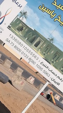
جامع الشيخ محمد ياسين الخياط
حي المطار القديم، عرعر، 73312،
Mosque
read more
753 m
مسجد عباد بن بشر
حي المطار القديم، عرعر، 73312،
Mosque
read more
756 m
ِِِAl Falah Mosque
Arar
Mosque
read more
845 m
Farhan Al Daraan Mosque
Almosaediah
Mosque
read more
914 m
Prince Abdulaziz bin musaed Mosque
Almosaediah
Mosque
read more
965 m
Mad Allah Albaig Mosque
Arar
Mosque
read more
972 m
مسجد جنوب المساعدية
Arar
Mosque
read more
1.007 km
Al Qarawi Mosque
Arar
Mosque
read more
1.03 km
Musab bin Omair Mosque
Arar
Mosque
read more
1.047 km
Al Fozan Mosque
Arar
Mosque
read more
1.061 km
Al Faleh mosque
Arar
Mosque
read more
1.077 km
جامع ياسين
Abdulrahman Bin Abdulaziz Street, Arar
Mosque
read more
1.079 km
Ali Al Melhem Mosque
Almosaediah
Mosque
read more
1.095 km
Anas bin Maaz Mosque
Arar
Mosque
read more
1.133 km
Al Aqeed Mosque
Almosaediah
Mosque
read more
1.146 km
Hussein bin Ali Mosque
Arar
Mosque
read more
📑
all categories
Accounting
Administrative area level 1
Airport
Amusement park
Aquarium
Art gallery
Atm
Bakery
Bank
Bar
Beauty salon
Bicycle store
Book store
Bowling alley
Bus station
Cafe
Campground
Car dealer
Car rental
Car repair
Car wash
Casino
Cemetery
Church
City hall
Clothing store
Colloquial area
Convenience store
Country
Courthouse
Dentist
Department store
Doctor
Electrician
Electronics store
Embassy
Finance
Fire station
Florist
Food
Funeral home
Furniture store
Gas station
General contractor
Grocery or supermarket
Gym
Hair care
Hardware store
Health
Hindu Temple
Home goods store
Hospital
Insurance agency
Intersection
Jewelry store
Laundry
Lawyer
Library
Light rail station
Liquor store
Local government office
Locality
Locksmith
Lodging
Meal delivery
Meal takeaway
Mosque
Movie rental
Movie theater
Moving company
Museum
Natural feature
Neighborhood
Night club
Painter
Park
Parking
Pet store
Pharmacy
Physiotherapist
Place of worship
Plumber
Point of interest
Police
Political
Post office
Premise
Real estate agency
Restaurant
Roofing contractor
Route
Rv park, camping
School
Shoe store
Shopping mall
Spa
Stadium
Storage
Store
Sublocality
Subpremise
Subway station
Supermarket
Taxi stand
Train station
Transit station
Travel agency
University
Veterinary care
Zoo
sublocality level 1
↑