Mosque nearby جامع السويدي
Saudi Arabia
Mosque nearby جامع السويدي
جامع السويدي
6981 السر، السويدي الرياض 12788 3630, As Sirr, 12788, Riyadh, SA Saudi Arabia
contacts phone
:
+966
Latitude:
24.590193
, Longitude:
46.6597556
larger map & directions
read more
nearest Mosque
327 m
مسجد التعاون
7246 Iyad Al Yahsabi, Riyadh
Mosque
read more
396 m
مسجد
كعب بن زهير، السويدي، الرياض
Mosque
read more
441 m
مسجد
6722 Al Fustat, Riyadh
Mosque
read more
488 m
جامع الشيخ عبدالرحمن السعدي
7299 Sakhr Ibn Umar, Riyadh
Mosque
read more
495 m
مسجد عمر بن الخطاب
Kaab Ibn Zuhair, Riyadh
Mosque
read more
513 m
Zahra mosque
6525 Ibn Al Manfaluti, Riyadh
Mosque
read more
519 m
Mosque of migration
Ibn Hilal Al Muqaddisi, Riyadh
Mosque
read more
548 m
مسجد الخراشي
النباء،، الرياض
Mosque
read more
560 m
مسجد السماعيل
7465 Abdullah Ibn Talhah, Riyadh
Mosque
read more
564 m
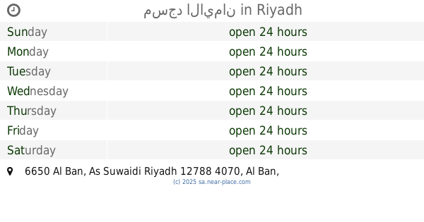
مسجد الايمان
6650 Al Ban, As Suwaidi Riyadh 12788 4070 Al Ban, Riyadh
Mosque
read more
635 m
مسجد البجادي
6755 Bab Ash Sham, Riyadh
Mosque
read more
673 m
مسجد الماجد
7487 Al Hasan Al Andalusi, Riyadh
Mosque
read more
678 m
مسجد المغيصيب
4232 البلد الامين، السويدي الرياض 12787
Mosque
read more
705 m
مسجد المحطة
سعد بن عتيق، السويدي، الرياض
Mosque
read more
729 m
Khunain Mosque
3451 عبدالرحمن الحجي، ظهرة البديعة، الرياض 12783 7692 Abdul Rahman Al Haji, Riyadh
Mosque
read more
732 m
جامع الحصيني
6253 Al Fustat, Riyadh
Mosque
read more
734 m
Eid Musalla
Aishah Bint Abi Bakr, Riyadh
Mosque
read more
774 m
مسجد محطة الدريس
Ash Shaikh Muhammad Ibn Muhaizi, Riyadh
Mosque
read more
804 m
Hamidi Mosque
Ibn Al Kaki, Riyadh
Mosque
read more
837 m
Al Sanea Mosque
As Suwaidi Al Am, Riyadh
Mosque
read more
848 m
Prince Nayef bin Abdul Aziz Mosque
As Sirr, Riyadh
Mosque
read more
878 m
مسجد البر والإحسان
السويدي العام، السويدي، الرياض
Mosque
read more
917 m
مسجد المحميد
7714 Al Balkhi As Suwaidi Riyadh 12787 4185 Al Balkhi, Riyadh
Mosque
read more
920 m
حلقات القدس لتحفيظ القرآن الكريم
شارع عمران منصور، حي السويدي، الرياض
Mosque
read more
943 m
Collector syncope
Al Wafra, Riyadh
Mosque
read more
📑
all categories
Accounting
Administrative area level 1
Airport
Amusement park
Aquarium
Art gallery
Atm
Bakery
Bank
Bar
Beauty salon
Bicycle store
Book store
Bowling alley
Bus station
Cafe
Campground
Car dealer
Car rental
Car repair
Car wash
Casino
Cemetery
Church
City hall
Clothing store
Colloquial area
Convenience store
Country
Courthouse
Dentist
Department store
Doctor
Electrician
Electronics store
Embassy
Finance
Fire station
Florist
Food
Funeral home
Furniture store
Gas station
General contractor
Grocery or supermarket
Gym
Hair care
Hardware store
Health
Hindu Temple
Home goods store
Hospital
Insurance agency
Intersection
Jewelry store
Laundry
Lawyer
Library
Light rail station
Liquor store
Local government office
Locality
Locksmith
Lodging
Meal delivery
Meal takeaway
Mosque
Movie rental
Movie theater
Moving company
Museum
Natural feature
Neighborhood
Night club
Painter
Park
Parking
Pet store
Pharmacy
Physiotherapist
Place of worship
Plumber
Point of interest
Police
Political
Post office
Premise
Real estate agency
Restaurant
Roofing contractor
Route
Rv park, camping
School
Shoe store
Shopping mall
Spa
Stadium
Storage
Store
Sublocality
Subpremise
Subway station
Supermarket
Taxi stand
Train station
Transit station
Travel agency
University
Veterinary care
Zoo
sublocality level 1
↑