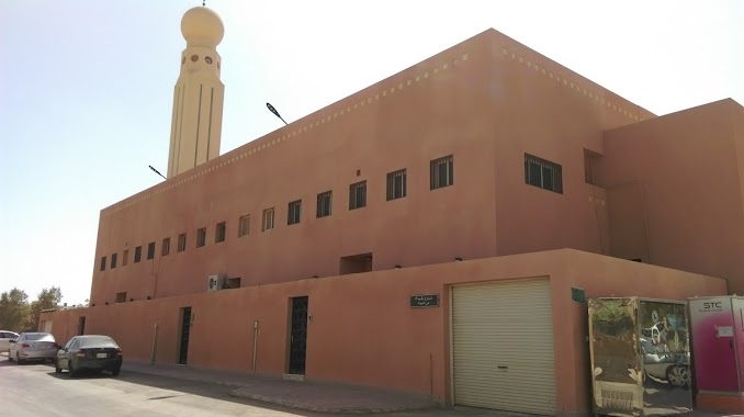
Mosque nearby جامع سعيد السيد
Saudi Arabia
Mosque nearby جامع سعيد السيد
جامع سعيد السيد
6747, حمود عايض فهد الحربي, 13241, Riyadh, SA Saudi Arabia
contacts phone
:
+966
Latitude:
24.783357
, Longitude:
46.7338969
larger map & directions
read more
nearest Mosque
4 m
Cedi Mosque
6811 حمود عايض فهد الحربي, 3175, Riyadh
Mosque
read more
357 m
مسجد الصحابة
3469 Al Qarn al Abyad, Riyadh
Mosque
read more
528 m
جامع حسين بن ابراهيم ابوسليمان
6704 طلال عبدالرحمن محمد المانع, Riyadh
Mosque
read more
528 m
مسجد ال سليمان
6704 طلال عبدالرحمن محمد المانع, Riyadh
Mosque
read more
628 m
مسجد هياء آل حسين رحمها الله
Riyadh
Mosque
read more
721 m
جامع الشيخ عبد الله بن علي الفاضل
شارع ساير بن فرحان النومسي، حي الشهداء، الرياض
Mosque
read more
725 m
مسجد الفاضل
Riyadh
Mosque
read more
761 m
مسجد خبيب بن عدي رضي الله عنه
2813 Imam Abdullah Ibn Saud Ibn Abdulaziz Branch Road, Riyadh
Mosque
read more
763 m
مسجد
7007 Ali Al Maruzi, Riyadh
Mosque
read more
781 m
Dar al-Hijrah mosque
Eastern Ring Road, Riyadh
Mosque
read more
872 m
مسجد سيد الشهداء
Adh Dhahrah, Riyadh
Mosque
read more
878 m
مسجد سيد الشهداء
شارع مفلح بن سعد الرشيدي، حي الشهداء، الرياض
Mosque
read more
909 m
مسجد المحسين
8208 At Taj, Al Hamra Riyadh 13216
Mosque
read more
1.015 km
مسجد مدارس الرواد الأهلية
Riyadh
Mosque
read more
1.015 km
مسجد العياف
Al Fara, Riyadh
Mosque
read more
1.089 km
Prince Bader's Mother Mosque
Tarif, Riyadh
Mosque
read more
1.106 km
مسجد عبدالرحمن الصرامي
Riyadh
Mosque
read more
1.107 km
جامع يحي بن معين
2607 الجود, Riyadh
Mosque
read more
1.109 km
جامع الحمراء الغربية
2607 الجود, Riyadh
Mosque
read more
1.111 km
Thunayyan mosque
7489 الجبال, Riyadh
Mosque
read more
1.132 km
Ghaith mosque
البيان, Riyadh
Mosque
read more
1.154 km
Sheikh Tariq Mosque
3801 الحنكة، الازدهار، الرياض 12488 7874 Al Hanakah, Riyadh
Mosque
read more
1.159 km
جامع غرناطة
شارع محمد غازي المطيري، حي الشهداء، الرياض
Mosque
read more
1.168 km
Mosque of Granada
Nahr Umm Ar Rabi, Riyadh
Mosque
read more
1.192 km
مسجد أم مطلق رحمها الله
شارع عبد الرحمن بن عزاز، حي الشهداء، الرياض
Mosque
read more
📑
all categories
Accounting
Administrative area level 1
Airport
Amusement park
Aquarium
Art gallery
Atm
Bakery
Bank
Bar
Beauty salon
Bicycle store
Book store
Bowling alley
Bus station
Cafe
Campground
Car dealer
Car rental
Car repair
Car wash
Casino
Cemetery
Church
City hall
Clothing store
Colloquial area
Convenience store
Country
Courthouse
Dentist
Department store
Doctor
Electrician
Electronics store
Embassy
Finance
Fire station
Florist
Food
Funeral home
Furniture store
Gas station
General contractor
Grocery or supermarket
Gym
Hair care
Hardware store
Health
Hindu Temple
Home goods store
Hospital
Insurance agency
Intersection
Jewelry store
Laundry
Lawyer
Library
Light rail station
Liquor store
Local government office
Locality
Locksmith
Lodging
Meal delivery
Meal takeaway
Mosque
Movie rental
Movie theater
Moving company
Museum
Natural feature
Neighborhood
Night club
Painter
Park
Parking
Pet store
Pharmacy
Physiotherapist
Place of worship
Plumber
Point of interest
Police
Political
Post office
Premise
Real estate agency
Restaurant
Roofing contractor
Route
Rv park, camping
School
Shoe store
Shopping mall
Spa
Stadium
Storage
Store
Sublocality
Subpremise
Subway station
Supermarket
Taxi stand
Train station
Transit station
Travel agency
University
Veterinary care
Zoo
sublocality level 1
↑