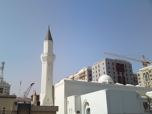
Mosque nearby Masjid Al Ghamamah
Saudi Arabia
Mosque nearby Masjid Al Ghamamah
Masjid Al Ghamamah
Al Haram, Medina 42311, Saudi Arabia
contacts phone
:
+966
Latitude:
24.4658305
, Longitude:
39.6070141
larger map & directions
read more
nearest Mosque
72 m
Masjid Abu Bakr Siddeeq RA
Medina
Mosque
read more
143 m
Imam Ali Mosque
As Salam Road, Medina
Mosque
read more
163 m
Masjid Ali ibn Abi Talib
Medina
Mosque
read more
175 m
Masjid Umar bin Khattab
طريق 4, Al Jubayl
Mosque
read more
175 m
Mosque of Omar bin Khattab
6154 أبو أيوب الأنصاري، بني خدرة، المدينة المنورة 42311 2479 Abu Ayyub Al-Ansari, Medina
Mosque
read more
178 m
Masjid Umer
6412 As Salam Rd Al Manakhah Medina 42311 2461 As Salam Road, Medina
Mosque
read more
339 m
Mosque...
2738 طريق الملك فيصل - الدائري الاول الفرعي، Bani Khidrah Medina 42311 6054
Mosque
read more
349 m
Zu Al Nourain Mosque
Al Haram
Mosque
read more
353 m
Hz Osman Cami
Medina
Mosque
read more
353 m
HZ. EBUBEKİR CAMİİ
حفصة بنت عمر, Medina
Mosque
read more
413 m
الحرم النبوي الشريف باب السلام
Medina
Mosque
read more
413 m
Haram al-Sharif door of peace
Medina
Mosque
read more
444 m
Al Masjid an Nabawi
Medina
Mosque
read more
462 m
Al Salam Road toward Porphet Masjid
2104 As Salam Road, Medina
Mosque
read more
469 m
محراب عثمان بن عفان رضي الله عنه
Medina
Mosque
read more
472 m
The Messenger of Allah Mosque
Medina
Mosque
read more
472 m
The Masjid of the Messenger of Allah
Medina
Mosque
read more
472 m
The Mosque of the Messenger of Allah
Medina
Mosque
read more
479 m
Riyadhul Jannah, Masjid-e-Nabawi
2851, Medina
Mosque
read more
479 m
Riyadhul Jannah, Masjidun Nabawi
2851, Medina
Mosque
read more
559 m
Masjid Rosulullah Nabawi
Medina
Mosque
read more
667 m
مسجد الترك
السقيا،
Mosque
read more
680 m
مسجد الآغا
Qiba Road, Medina
Mosque
read more
685 m
Bilal Ibn Rabah Mosque
8359 Abdul Muhsin Ibn Abdul Aziz, Medina
Mosque
read more
712 m
المسجد التركي
Medina
Mosque
read more
📑
all categories
Accounting
Administrative area level 1
Airport
Amusement park
Aquarium
Art gallery
Atm
Bakery
Bank
Bar
Beauty salon
Bicycle store
Book store
Bowling alley
Bus station
Cafe
Campground
Car dealer
Car rental
Car repair
Car wash
Casino
Cemetery
Church
City hall
Clothing store
Colloquial area
Convenience store
Country
Courthouse
Dentist
Department store
Doctor
Electrician
Electronics store
Embassy
Finance
Fire station
Florist
Food
Funeral home
Furniture store
Gas station
General contractor
Grocery or supermarket
Gym
Hair care
Hardware store
Health
Hindu Temple
Home goods store
Hospital
Insurance agency
Intersection
Jewelry store
Laundry
Lawyer
Library
Light rail station
Liquor store
Local government office
Locality
Locksmith
Lodging
Meal delivery
Meal takeaway
Mosque
Movie rental
Movie theater
Moving company
Museum
Natural feature
Neighborhood
Night club
Painter
Park
Parking
Pet store
Pharmacy
Physiotherapist
Place of worship
Plumber
Point of interest
Police
Political
Post office
Premise
Real estate agency
Restaurant
Roofing contractor
Route
Rv park, camping
School
Shoe store
Shopping mall
Spa
Stadium
Storage
Store
Sublocality
Subpremise
Subway station
Supermarket
Taxi stand
Train station
Transit station
Travel agency
University
Veterinary care
Zoo
sublocality level 1
↑