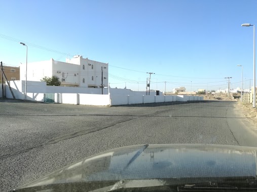
Mosque nearby Mosque Almtoklh girl Massoud
Saudi Arabia
Mosque nearby Mosque Almtoklh girl Massoud
Mosque Almtoklh girl Massoud
2847, Khamis Mushait Saudi Arabia
contacts phone
:
+966
Latitude:
18.2717677
, Longitude:
42.7404508
read more
nearest Mosque
340 m
مسجد ابن مشيط
15, Khamis Mushait
Mosque
read more
340 m
مسجد
15, Khamis Mushait
Mosque
read more
533 m
Khamis Mosque General Hospital
8022 South to Ahad Rufaiydah Northern to Khamis Mushayt, Khamis Mushait
Mosque
read more
736 m
مسجد حي ذهبان
6756, Khamis Mushait
Mosque
read more
742 m
مسجد آل مريط
Khamis Mushait
Mosque
read more
767 m
جامع الغنيم
حي الصفق، خميس مشيط
Mosque
read more
1.006 km
مسجد بلال ابن رباح
8070, Khamis Mushait
Mosque
read more
1.105 km
مسجد أم محمد بن زحيفة
طريق المدينة العسكرية- حي ذهبان، خميس مشيط
Mosque
read more
1.128 km
Ansar Mosque
4668, Khamis Mushait
Mosque
read more
1.151 km
مسجد
7734, 2367, Khamis Mushait
Mosque
read more
1.153 km
Mosque decantation East Mosque Al-Ghoneim
7734, Khamis Mushait
Mosque
read more
1.256 km
مسجد ابن زحيفة
حي ذهبان، خميس مشيط
Mosque
read more
1.272 km
Collector healing neighborhood
Prince Sultan Road, Khamis Mushait
Mosque
read more
1.412 km
مسجد الوالدين
Khamis Mushait
Mosque
read more
1.442 km
مسجد ابن زحيفة
Khamis Mushait
Mosque
read more
1.511 km
Eid prayer neighborhood Dhahban
7214, Khamis Mushait
Mosque
read more
1.546 km
جامع ابن مسلط بحي شكر
8207, Khamis Mushait
Mosque
read more
1.576 km
جامع حي الريان
Khamis Mushait
Mosque
read more
1.667 km
مسجد ابن دواس
Khamis Mushait
Mosque
read more
1.695 km
مسجد عبدالله بن ظافر
Khamis Mushait
Mosque
read more
1.765 km
مسجد الشيخ إبراهيم السنيدي
طريق الملك خالد، حي ضمك، خميس مشيط
Mosque
read more
1.785 km
مسجد
مخطط بن مشيط، خميس مشيط
Mosque
read more
1.829 km
مسجد ابو بكر الصديق
3281, Khamis Mushait
Mosque
read more
1.849 km
Collector Alkhalsh
طريق الأمير سلطان, Khamis Mushait
Mosque
read more
1.871 km
جامع هادي بن دواس
Khamis Mushait
Mosque
read more
📑
all categories
Accounting
Administrative area level 1
Airport
Amusement park
Aquarium
Art gallery
Atm
Bakery
Bank
Bar
Beauty salon
Bicycle store
Book store
Bowling alley
Bus station
Cafe
Campground
Car dealer
Car rental
Car repair
Car wash
Casino
Cemetery
Church
City hall
Clothing store
Colloquial area
Convenience store
Country
Courthouse
Dentist
Department store
Doctor
Electrician
Electronics store
Embassy
Finance
Fire station
Florist
Food
Funeral home
Furniture store
Gas station
General contractor
Grocery or supermarket
Gym
Hair care
Hardware store
Health
Hindu Temple
Home goods store
Hospital
Insurance agency
Intersection
Jewelry store
Laundry
Lawyer
Library
Light rail station
Liquor store
Local government office
Locality
Locksmith
Lodging
Meal delivery
Meal takeaway
Mosque
Movie rental
Movie theater
Moving company
Museum
Natural feature
Neighborhood
Night club
Painter
Park
Parking
Pet store
Pharmacy
Physiotherapist
Place of worship
Plumber
Point of interest
Police
Political
Post office
Premise
Real estate agency
Restaurant
Roofing contractor
Route
Rv park, camping
School
Shoe store
Shopping mall
Spa
Stadium
Storage
Store
Sublocality
Subpremise
Subway station
Supermarket
Taxi stand
Train station
Transit station
Travel agency
University
Veterinary care
Zoo
sublocality level 1
↑