Mosque nearby Mosque of Mohammad Majali
Saudi Arabia
Mosque nearby Mosque of Mohammad Majali
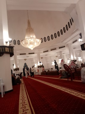
Mosque of Mohammad Majali
4 Street, 82716, Jazan, SA Saudi Arabia
contacts phone
:
+966
Latitude:
16.8940956
, Longitude:
42.5428432
larger map & directions
read more
nearest Mosque
288 m
Mahdi mosque
King Fahd Road, Jazan
Mosque
read more
338 m
King Saud Mosque
K Faisal Rd, Jazan
Mosque
read more
344 m
مسجد سعد بن أبي وقاص رضي الله عنه
3991 الملك عبدالعزيز، جازان 82714
Mosque
read more
394 m
جامع الميدان
King Faisal, Jazan
Mosque
read more
463 m
King Abdulaziz Mosque
King Faisal, Jazan
Mosque
read more
487 m
مسجد محمد عباس
4049 طريق الملك فهد، جازان 82716
Mosque
read more
598 m
مسجد سوق السمك
4008 طريق الرياض جازان 82716
Mosque
read more
619 m
مصلى العيد
King Faisal, Jazan
Mosque
read more
740 m
مسجد الدويري
Jazan
Mosque
read more
777 m
مسجد الجمعية التعاونية
Unnamed Road, Jazan
Mosque
read more
966 m
جامع الشاكرين
Jazan
Mosque
read more
987 m
جامع الشاگرينالغامديسابقا
6589 المطلع, Jazan
Mosque
read more
1.2 km
Princess Setah Mosque
King Fahd Road, Jazan
Mosque
read more
1.218 km
مسجد الاميرة صيتة
2988 King Fahd Road, Jazan
Mosque
read more
1.272 km
مسجد ناصر مصطفى
6710, 3145, Jazan
Mosque
read more
1.457 km
مسجد السوق
Jazan
Mosque
read more
1.478 km
Amana Mosque
3666 King Fahd Road, Jazan
Mosque
read more
1.524 km
Down Town Mosque
Jazan
Mosque
read more
1.597 km
Masjid Taqwa
Jazan
Mosque
read more
1.79 km
Dubayan mosque
Prince Sultan Bin Abdul Aziz, Jazan
Mosque
read more
1.791 km
مسجد الفتح
7479، جازان 82722
Mosque
read more
1.811 km
جامع أبو عبيدة عامر بن الجراح
2164, 7130, Jazan
Mosque
read more
1.819 km
مسجد وردة الغامدي
6215، جازان 82723
Mosque
read more
1.875 km
Abu Bakr Mosque
Jazan
Mosque
read more
1.888 km
جامع عمر بن عبد العزيز
7417, 2356, Jazan
Mosque
read more
📑
all categories
Accounting
Administrative area level 1
Airport
Amusement park
Aquarium
Art gallery
Atm
Bakery
Bank
Bar
Beauty salon
Bicycle store
Book store
Bowling alley
Bus station
Cafe
Campground
Car dealer
Car rental
Car repair
Car wash
Casino
Cemetery
Church
City hall
Clothing store
Colloquial area
Convenience store
Country
Courthouse
Dentist
Department store
Doctor
Electrician
Electronics store
Embassy
Finance
Fire station
Florist
Food
Funeral home
Furniture store
Gas station
General contractor
Grocery or supermarket
Gym
Hair care
Hardware store
Health
Hindu Temple
Home goods store
Hospital
Insurance agency
Intersection
Jewelry store
Laundry
Lawyer
Library
Light rail station
Liquor store
Local government office
Locality
Locksmith
Lodging
Meal delivery
Meal takeaway
Mosque
Movie rental
Movie theater
Moving company
Museum
Natural feature
Neighborhood
Night club
Painter
Park
Parking
Pet store
Pharmacy
Physiotherapist
Place of worship
Plumber
Point of interest
Police
Political
Post office
Premise
Real estate agency
Restaurant
Roofing contractor
Route
Rv park, camping
School
Shoe store
Shopping mall
Spa
Stadium
Storage
Store
Sublocality
Subpremise
Subway station
Supermarket
Taxi stand
Train station
Transit station
Travel agency
University
Veterinary care
Zoo
sublocality level 1
↑