Mosque nearby Mosque of repentance
Saudi Arabia
Mosque nearby Mosque of repentance
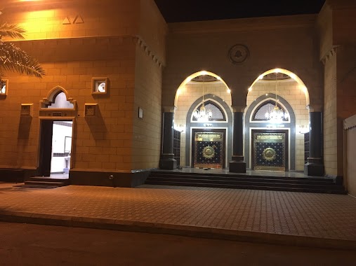
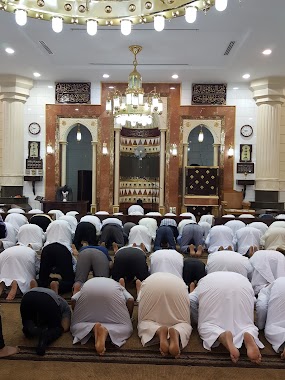
Mosque of repentance
Ad Difa, Medina 42374, Saudi Arabia
contacts phone
:
+966
Latitude:
24.4558028
, Longitude:
39.5396876
larger map & directions
read more
nearest Mosque
123 m
مسجد محلي
4393 الرازي ابو بكر، الدفاع، المدينة المنورة 42374
Mosque
read more
288 m
جامع أمير المؤمنين عثمان بن عفان رضي الله عنه
Ad Difa
Mosque
read more
301 m
جامع الشهيد عثمان بن عفان رضي الله عنه
العزيزية، المدينة المنورة
Mosque
read more
361 m
Salah Mosque Rehaily
Medina
Mosque
read more
460 m
مسجد النملة
الدفاع،
Mosque
read more
538 m
مسجد علياء السويدي
الامير نايف بن عبدالعزيز, Medina
Mosque
read more
538 m
مسجد علياء السويدي
Prince Naif Ibn Abdulaziz, Medina
Mosque
read more
538 m
مسجد علياء السويدي
Prince Naif bin Abdulaziz, Medina
Mosque
read more
541 m
King Abdul Aziz bin Abdul Rahman Al Saud Mosque
Medina
Mosque
read more
680 m
مسجد عبد الله ابن ام مكتوم
Medina
Mosque
read more
801 m
مسجد قرطلي
As Salam
Mosque
read more
816 m
مسجد عودة مرزوق الحربي
Ad Difa
Mosque
read more
822 m
جامع عوده مرزوق الحربي
4315 مقاتل بن حيان, Medina
Mosque
read more
914 m
Neighborhood mosque
3898 مكرم بن أحمد, Medina
Mosque
read more
957 m
مسجد صالح صقر الردادي
Medina
Mosque
read more
958 m
مسجد المحتسب
Medina
Mosque
read more
1.009 km
Budeiri Mosque
Medina
Mosque
read more
1.141 km
Ibn Taymiyyah mosque
Medina
Mosque
read more
1.222 km
جامع الحديقة
Medina
Mosque
read more
1.281 km
جامع لويفي بن فيصل الحبيشي
Al Imam Muslim, Medina
Mosque
read more
1.321 km
مسجد الجبولي
6802 عبيدالله الزهرى, Medina
Mosque
read more
1.326 km
مسجد الجهني العزيزيه
6859 Abdallah Bin An Numan, Medina
Mosque
read more
1.328 km
مسجد الامام محمد بن عبد الوهاب
6366 خذام بن وديعة، الدفاع، المدينة المنورة 42374 3205 خذام بن وديعة, Medina
Mosque
read more
1.328 km
جامع الإمام محمد بن عبدالوهاب
Alaaziziyah
Mosque
read more
1.331 km
Farouk Mosque
محمد بن محمد البلدي, Medina
Mosque
read more
📑
all categories
Accounting
Administrative area level 1
Airport
Amusement park
Aquarium
Art gallery
Atm
Bakery
Bank
Bar
Beauty salon
Bicycle store
Book store
Bowling alley
Bus station
Cafe
Campground
Car dealer
Car rental
Car repair
Car wash
Casino
Cemetery
Church
City hall
Clothing store
Colloquial area
Convenience store
Country
Courthouse
Dentist
Department store
Doctor
Electrician
Electronics store
Embassy
Finance
Fire station
Florist
Food
Funeral home
Furniture store
Gas station
General contractor
Grocery or supermarket
Gym
Hair care
Hardware store
Health
Hindu Temple
Home goods store
Hospital
Insurance agency
Intersection
Jewelry store
Laundry
Lawyer
Library
Light rail station
Liquor store
Local government office
Locality
Locksmith
Lodging
Meal delivery
Meal takeaway
Mosque
Movie rental
Movie theater
Moving company
Museum
Natural feature
Neighborhood
Night club
Painter
Park
Parking
Pet store
Pharmacy
Physiotherapist
Place of worship
Plumber
Point of interest
Police
Political
Post office
Premise
Real estate agency
Restaurant
Roofing contractor
Route
Rv park, camping
School
Shoe store
Shopping mall
Spa
Stadium
Storage
Store
Sublocality
Subpremise
Subway station
Supermarket
Taxi stand
Train station
Transit station
Travel agency
University
Veterinary care
Zoo
sublocality level 1
↑